Severe storms fire up in Saskatchewan, prompting tornado warnings
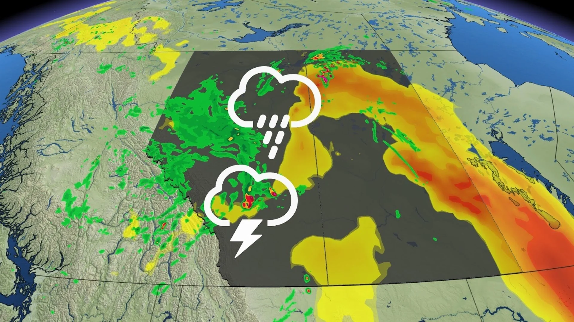
A severe thunderstorm capable of producing a tornado has been detected in Saskatchewan. Residents in the affected regions should be in their shelters.
Tornado warnings have been issued in Saskatchewan Environment and Climate Change Canada (ECCC) meteorologists are tracking a thunderstorm that is possibly producing a tornado.
In addition to potentially producing a tornado and intense winds, large hail and locally intense rainfall are possible. See below for the details.
Current tornado warnings
R.M. of Fertile Valley including Conquest Macrorie and Bounty
R.M. of Montrose including Donovan and Swanson
At 4:52 PM CST: Environment Canada meteorologists are tracking a severe thunderstorm that is possibly producing a tornado. Damaging winds, large hail and locally intense rainfall are also possible.
Location: North of Outlook, moving east at 30 km/h.
Hazards: Tornado, 90 km/h winds, quarter- to toonie-size hail.
This is a dangerous and potentially life-threatening situation.

Take cover immediately, if threatening weather approaches. If you hear a roaring sound or see a funnel cloud, swirling debris near the ground, flying debris, or any threatening weather approaching, take shelter immediately.
Go indoors to a room on the lowest floor, away from outside walls and windows, such as a basement, bathroom, stairwell or interior closet. Leave mobile homes, vehicles, tents, trailers and other temporary or free-standing shelter, and move to a strong building if you can. As a last resort, lie in a low spot and protect your head from flying debris.
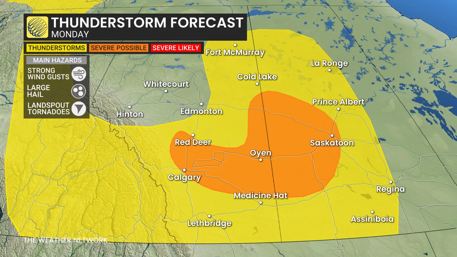
Severe storm, landspout tornado risk on Monday
A low-pressure system will track into Saskatchewan Monday, triggering severe storms with possible landspout tornadoes. That has prompted ECCC to issue a tornado watch for several regions.
Those types of tornadoes are usually weak and short-lived. Severe storms are also possible in southern Alberta along the cold front, stretching from Calgary to Red Deer, and locales east of there.
DON'T MISS: The Weather Network's new Fire & Smoke map helps you plan ahead and stay safe
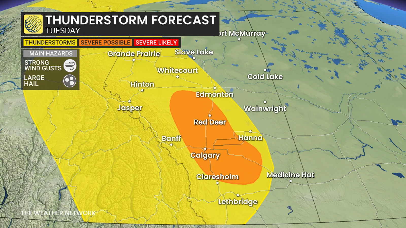
Another day of storms are possible on Tuesday as the system moves east into Winnipeg, Man., as well as in the Rockies.
Severe thunderstorms will be possible, expected to develop along the Alberta foothills and track east by the late-afternoon period.
Instead of loonie-size hail, however, we're looking at up to toonie-size hail with Tuesday's storms, along with strong winds, as the extra energy could give the storm a stronger updraft to keep the hailstones aloft.
Temperatures on the Prairies are expected to trend on the warmer side of normal throughout the week, before a shot of cooler air moves in to end the month.
Enjoy the rainy and stormy weather while it's here, though, because July is forecast to kick off on a hot and dry note across the Prairies, which will once again raise concerns about wildfires.
Stay with The Weather Network for more information and updates on your weather across the Prairies.