Tornado watches issued in Saskatchewan amid funnel cloud potential
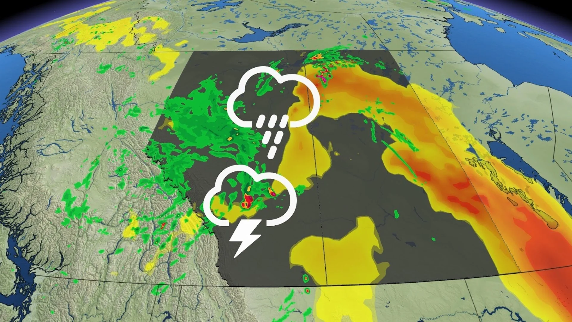
Residents across parts of Saskatchewan are advised to monitor the forecast closely as severe weather, including the potential for a landspout tornado, is expected to continue through Monday evening. Check back regularly for updates.
After a weekend of soaking rains across the western Prairies, some change is coming to kick off the final week of June.
While the upcoming forecast still features some damp weather, it does have a booming twist.
SEE ALSO: The science behind spectacular Canada Day firework displays
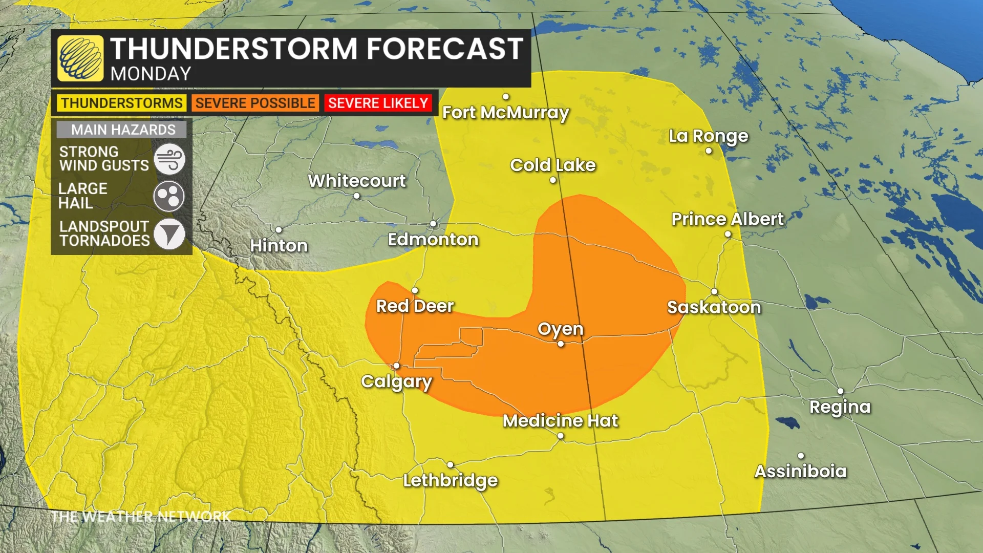
Thunderstorms are forecast to develop along a passing cold front in southern Alberta on Monday. While the majority of the storms are forecast to be non-severe, there is a small swath of area between Calgary, Red Deer, and the Saskatchewan border where we could see some storms reach severe criteria.
The main threat from Monday's storms will be large hail up to the size of a loonie, and landspout tornadoes in parts of Alberta and Saskatchewan on Monday afternoon and evening.
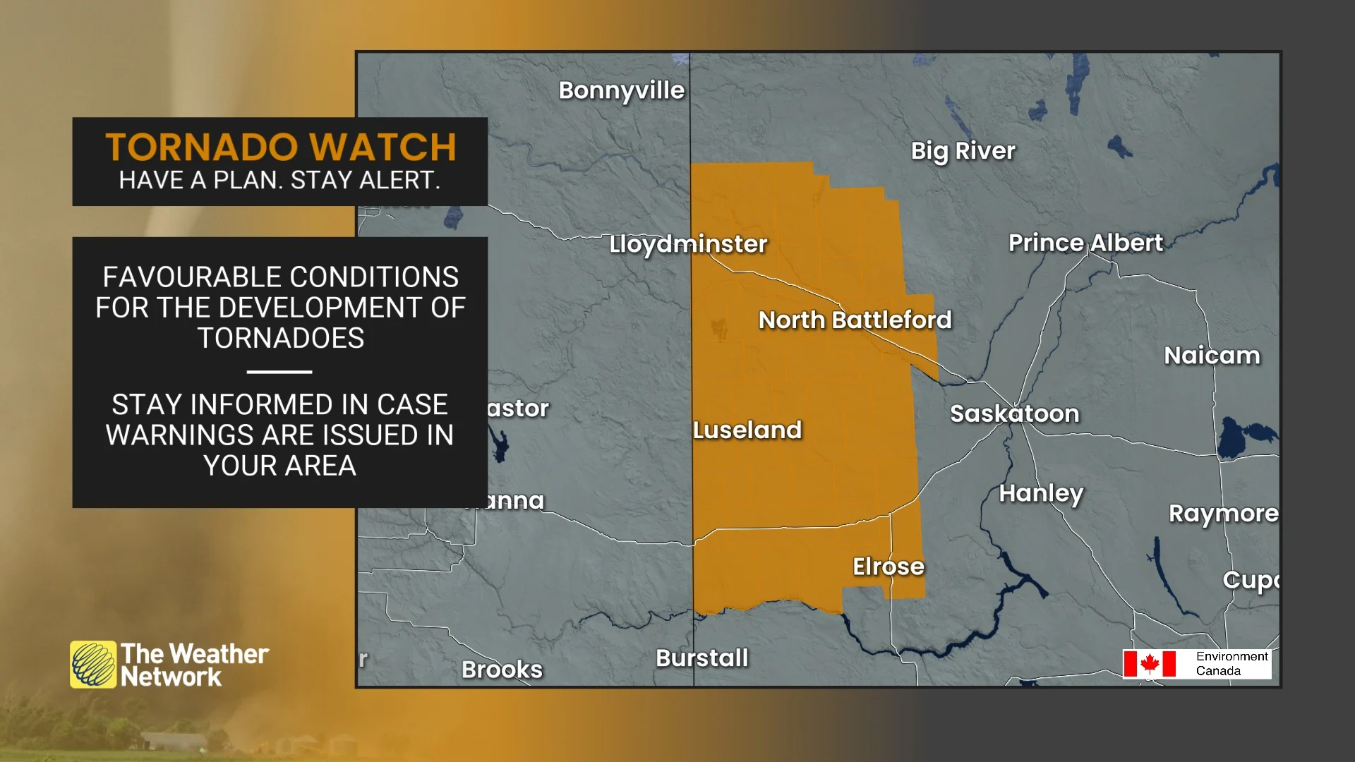
Tornado watches have been issued in the latter province.
Conditions are favourable for the development of funnel clouds and possibly brief, weak tornadoes, Environment and Climate Change Canada (ECCC) warned. Strong winds, large hail and heavy rain are also possible.
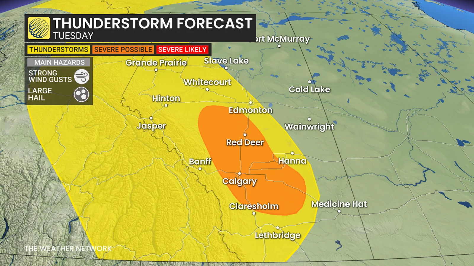
The thundery weather doesn't end there, however. Tuesday will feature another risk for thunderstorms to develop—this time along the Alberta foothills.
Severe storm, landspout tornado risk on Monday
The foothills will provide a bit more energy for the developing storms, so we will see another risk for severe weather to bubble up. There is also the risk of landspout tornadoes on Monday afternoon and evening, prompting ECCC to issue a tornado watch for several regions.
DON'T MISS: The Weather Network's new Fire & Smoke map helps you plan ahead and stay safe
Instead of loonie-size hail, however, we're looking at up to toonie-size hail with Tuesday's storms, as the extra energy could give the storm a stronger updraft to keep the hailstones aloft.
Temperatures on the Prairies are expected to trend on the warmer side of normal throughout the week, before a shot of cooler air moves in to end the month.
Enjoy the rainy and stormy weather while it's here, though, because July is forecast to kick off on a hot and dry note across the Prairies, which will once again raise concerns about wildfires.
Stay with The Weather Network for more information and updates on your weather across the Prairies.