
Atlantic Canada sees heaviest rain in months, followed by a significant cooldown
Additional rain and powerful winds kick off this final weekend of September in parts of Atlantic Canada
Some much-needed rainfall has spread into Atlantic Canada, with some areas experiencing the wettest conditions in months.
Fredericton, N.B. saw 35–40 mm fall overnight Thursday, marking its heaviest rainfall since July 25, two months ago.
DON'T MISS: What’s the wettest month in your corner of Canada?
While Friday’s rainfall won’t fully end the ongoing drought, it will provide the first significant impact to the region in quite some time.

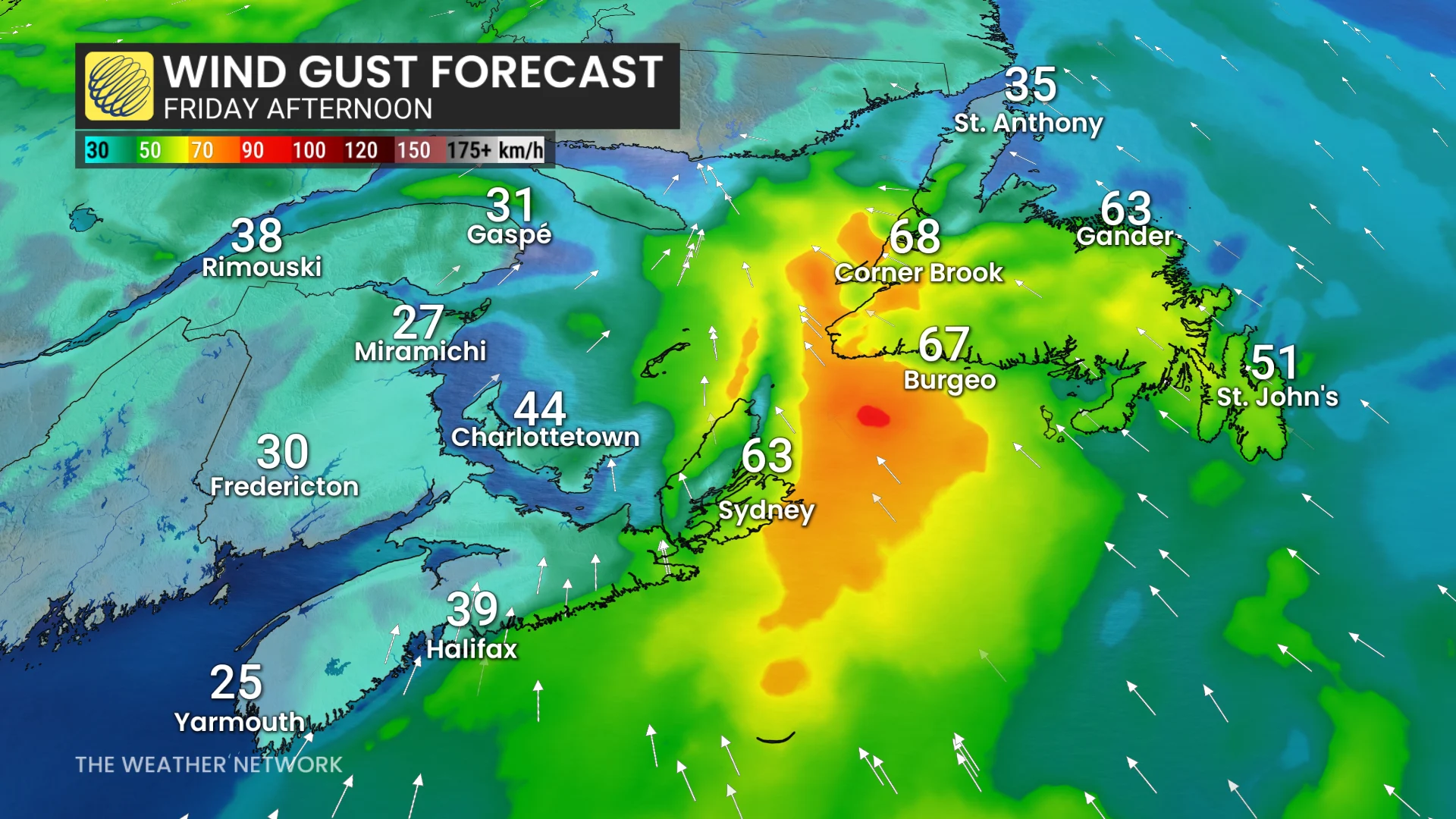
Rain spreads into Newfoundland Friday
The south coast of Newfoundland will see the heaviest rainfall Friday, with 10–20 mm expected for the Avalon Peninsula.

Wind warnings were issued for the Wreckhouse and Les Suêtes areas, where gusts could reach 100 km/h into Friday afternoon.
Sunshine will return for the weekend, but cooler air is on the way.
Visit our Complete Guide to Fall 2025 for an in depth look at the Fall Forecast, tips to plan for it and much more!
Next Wednesday, St. John’s may see its first single-digit daytime high in over four months after a record-breaking summer.
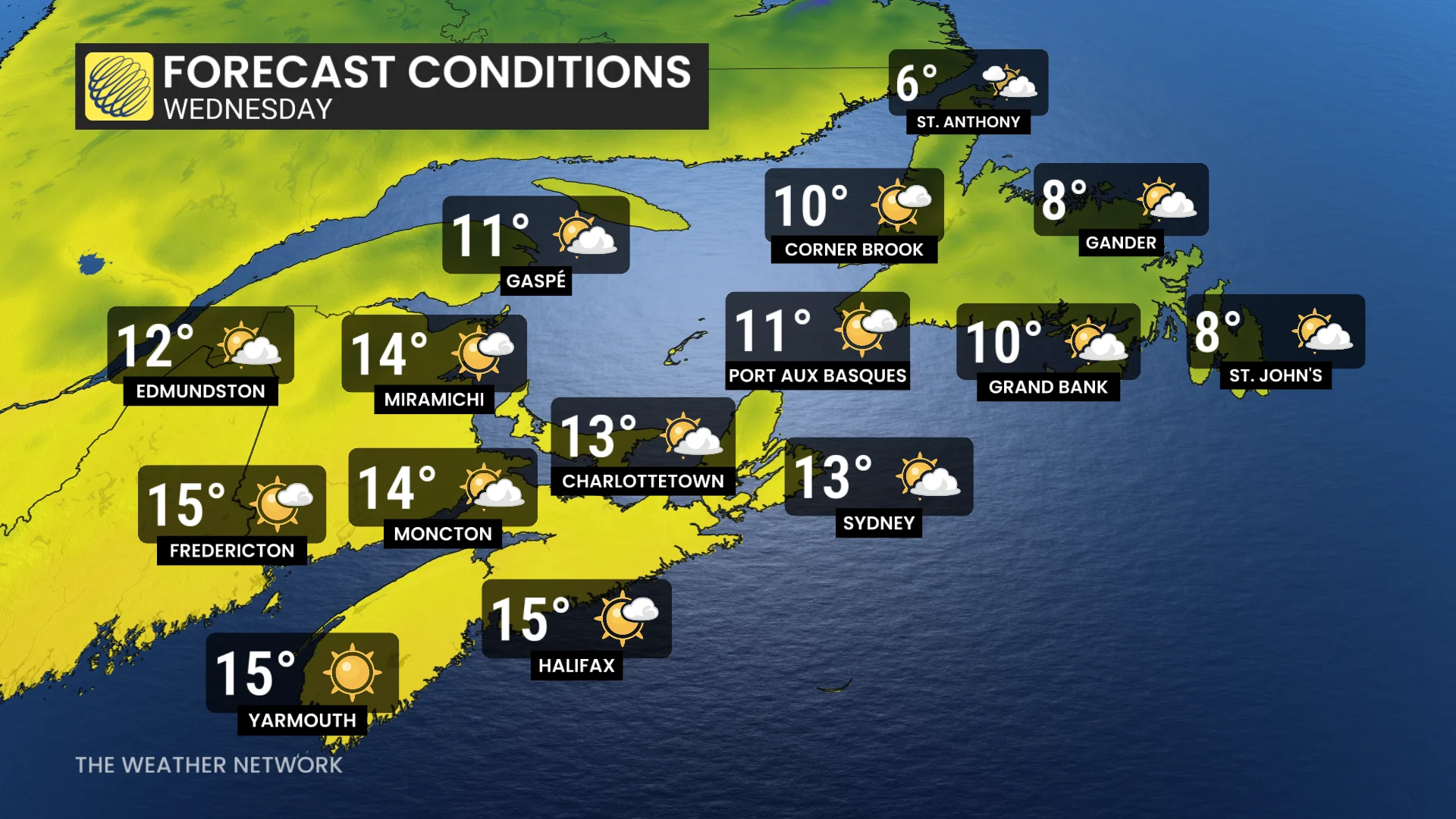
Warmer conditions are forecast to return late in the week or into next weekend, though Newfoundland is expected to remain cooler for a longer period.
Keeping a close eye on the Atlantic hurricane season for early October
A much drier weather pattern is anticipated to develop in early October, however, attention will turn to the increasingly active tropics.
SEE ALSO: Autumn can still produce intense hurricanes across the Atlantic
While current projections suggest storms will remain offshore, any shift to a more northerly track could alter the outlook.
WATCH: What's the best month for rainboots in your town?
Be sure to check back for the latest weather updates across Atlantic Canada