Moisture-heavy system soaks the East Coast, keeps flood threat elevated
Active weather stalls over Atlantic Canada with soggy conditions continuing across the eastern Maritimes and Newfoundland through the day on Sunday--keeping the flooding threat elevated
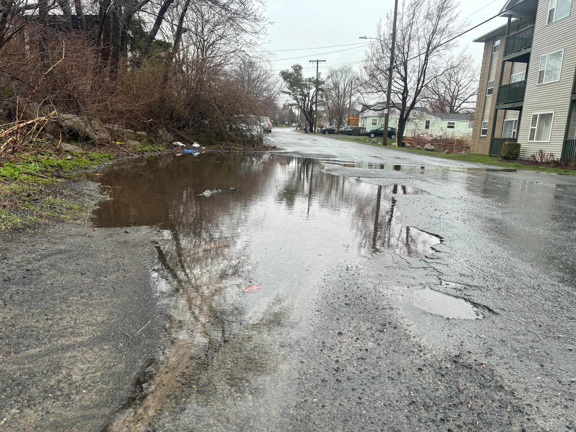
The last weekend of April brought very soggy conditions across parts of Atlantic Canada as a moisture-laden system hit Sunday, increasing the chances of localized flooding.
The highest rainfall reports across Nova Scotia have been documented across the Cape Breton area, where some weather stations are reporting more than 70 mm of rainfall, including 66 mm for Sydney.
DON'T MISS: Summer sneak peek: Canada's warm season goes on cruise control
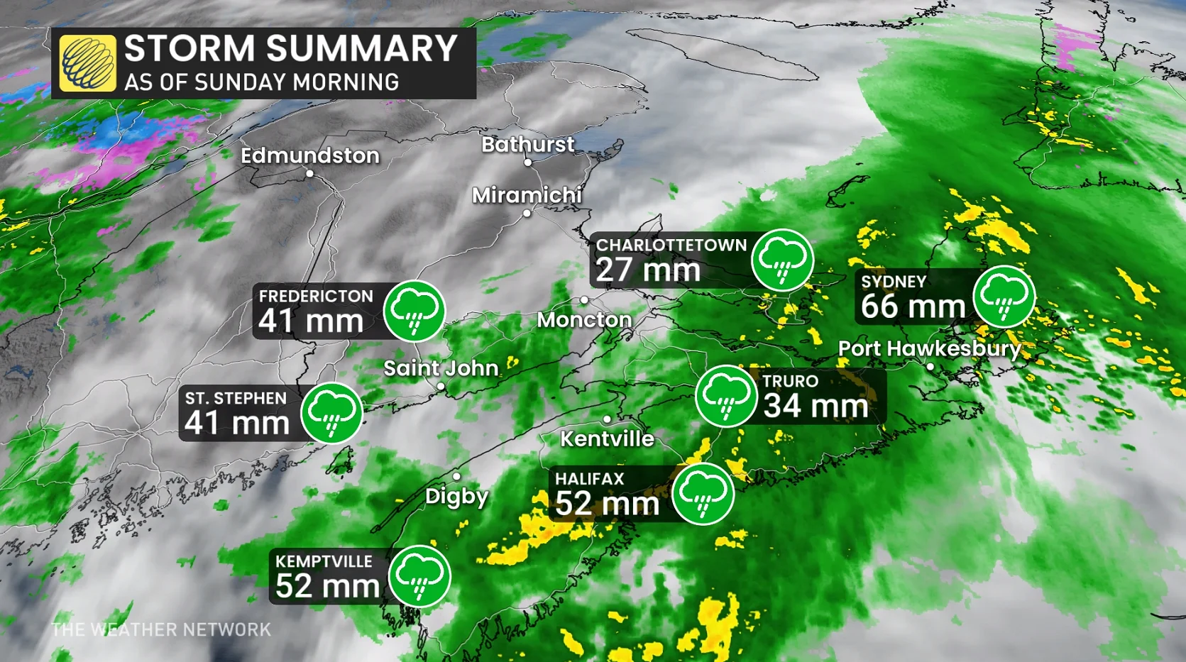
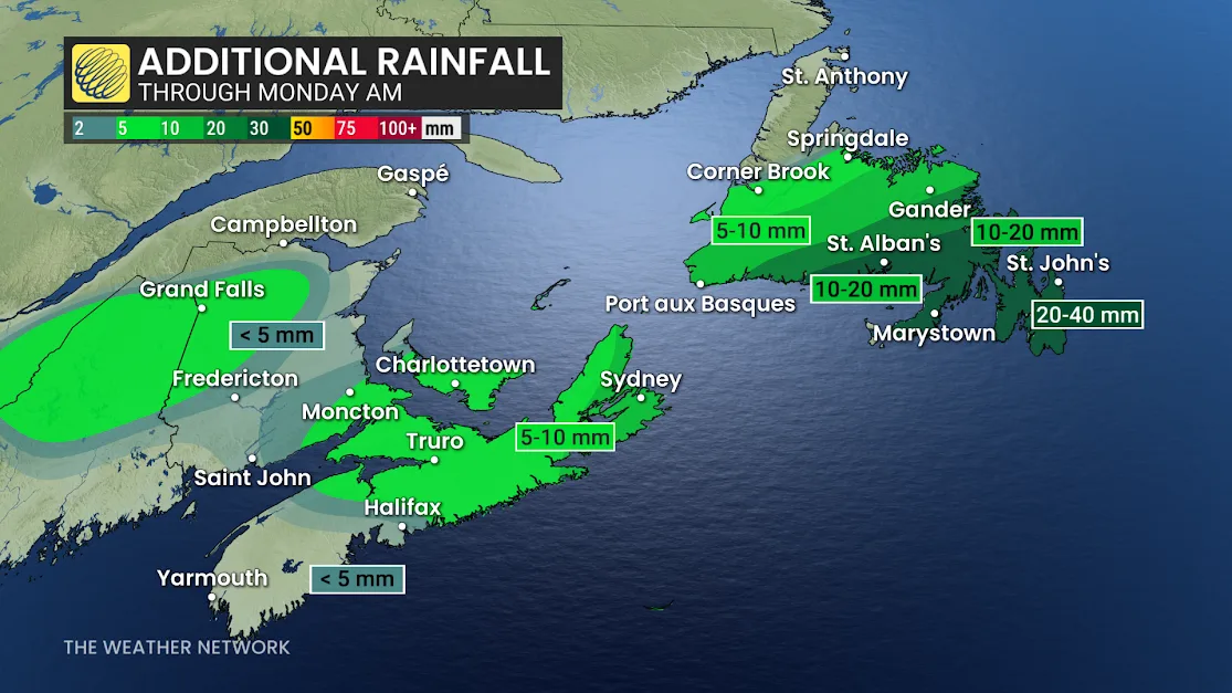
The heaviest rainfall is quickly shifting gears to aim at Newfoundland, where more than 50 mm of rainfall is still forecast to fall across southern sections of the province
Rainy weather stalls over Atlantic Canada into Monday
Showers will continue into Monday afternoon for the Avalon Peninsula, pushing St. John’s close to the 50 mm mark for a storm total.
DON'T MISS: A rain barrel can up your gardening game. Here's how
Localized flooding is likely with the heavier rain amounts, so you'll want to keep a close eye on any additional weather watches and warnings in your area as the rain continues. Heavy rainfall amounts like this could lead to water pooling on roadways.
The last time Halifax Stanfield International Airport saw heavy rain was on Dec. 5, 2024, when it documented 34.3 mm of precipitation.
After a brief break, another system is expected to track across the region by midweek and another system is expected next weekend. Temperatures will be changeable, but overall near seasonal or slightly above seasonal as we get deeper into May.
Be sure to check back for the latest weather updates across Atlantic Canada.