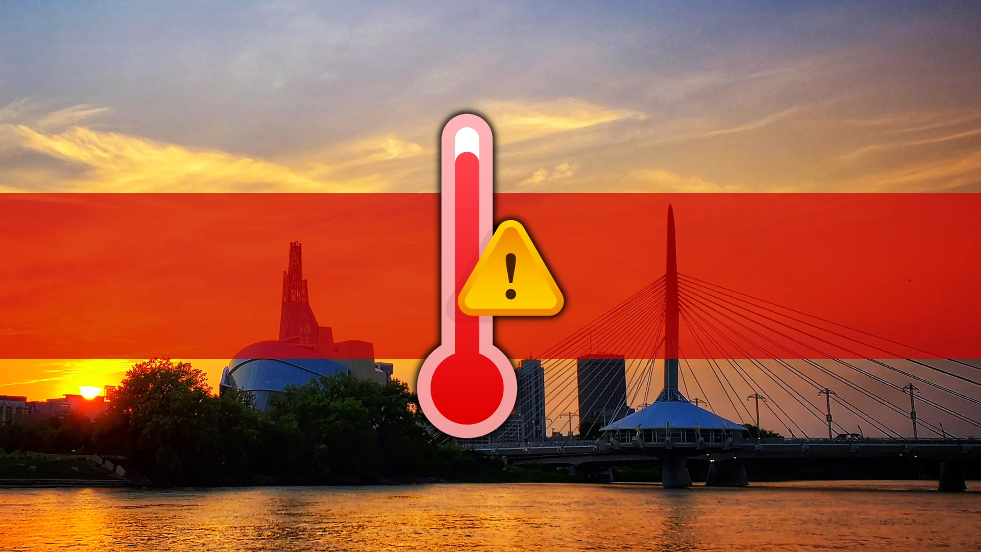
Mid-30s expected as Manitoba's early heat wave builds
Winnipeg could soon grow hotter than they’ve ever been this early in May. Heat warnings are in effect
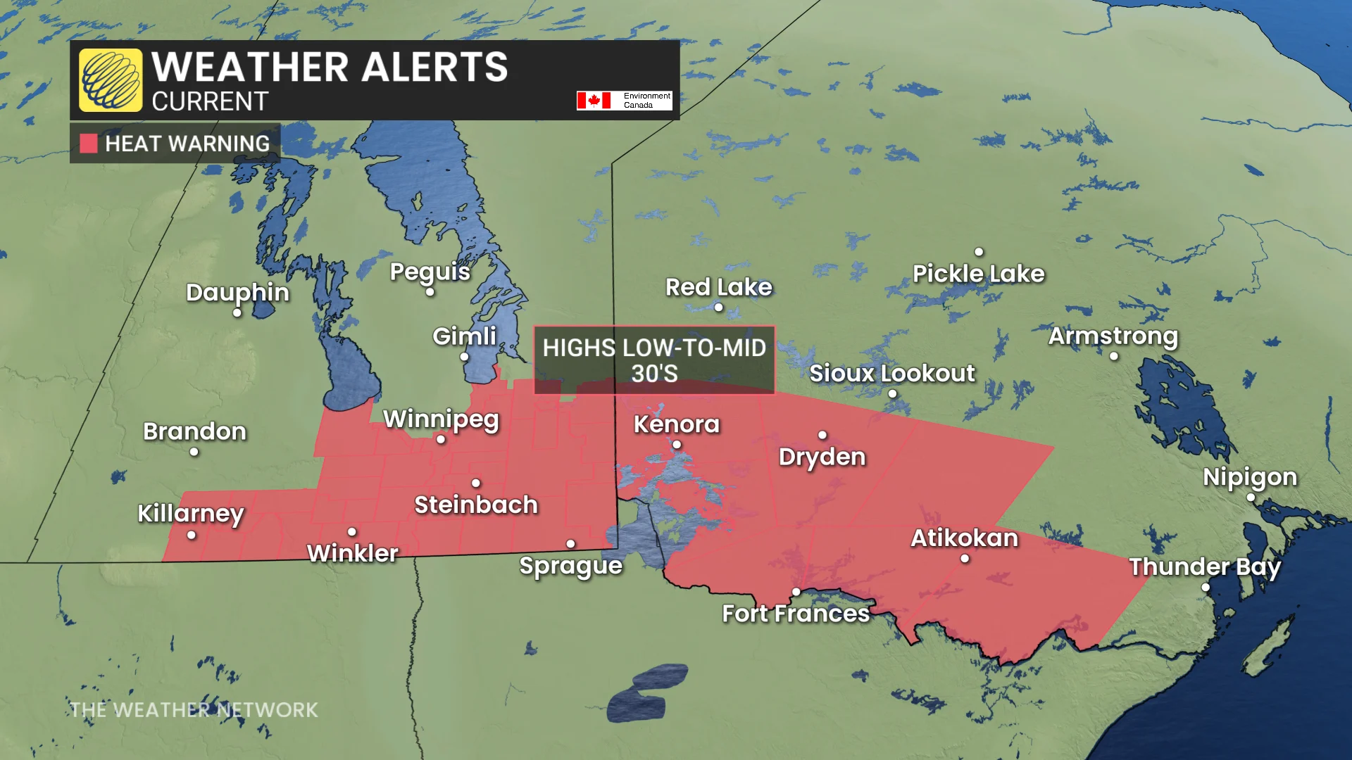
Heat warnings are in effect on the eastern Prairies as temperatures across the region soar into the 30s. Winnipeg’s forecast high temperature on Monday will challenge the all-time record high for the month of May.
A formidable ridge on the Prairies will keep the heat cranking through Wednesday, adding to the tally of communities joining the 30-degree club across Canada this year.
RELATED: The quest for 30 degrees: When will Eastern Canada feel the heat?
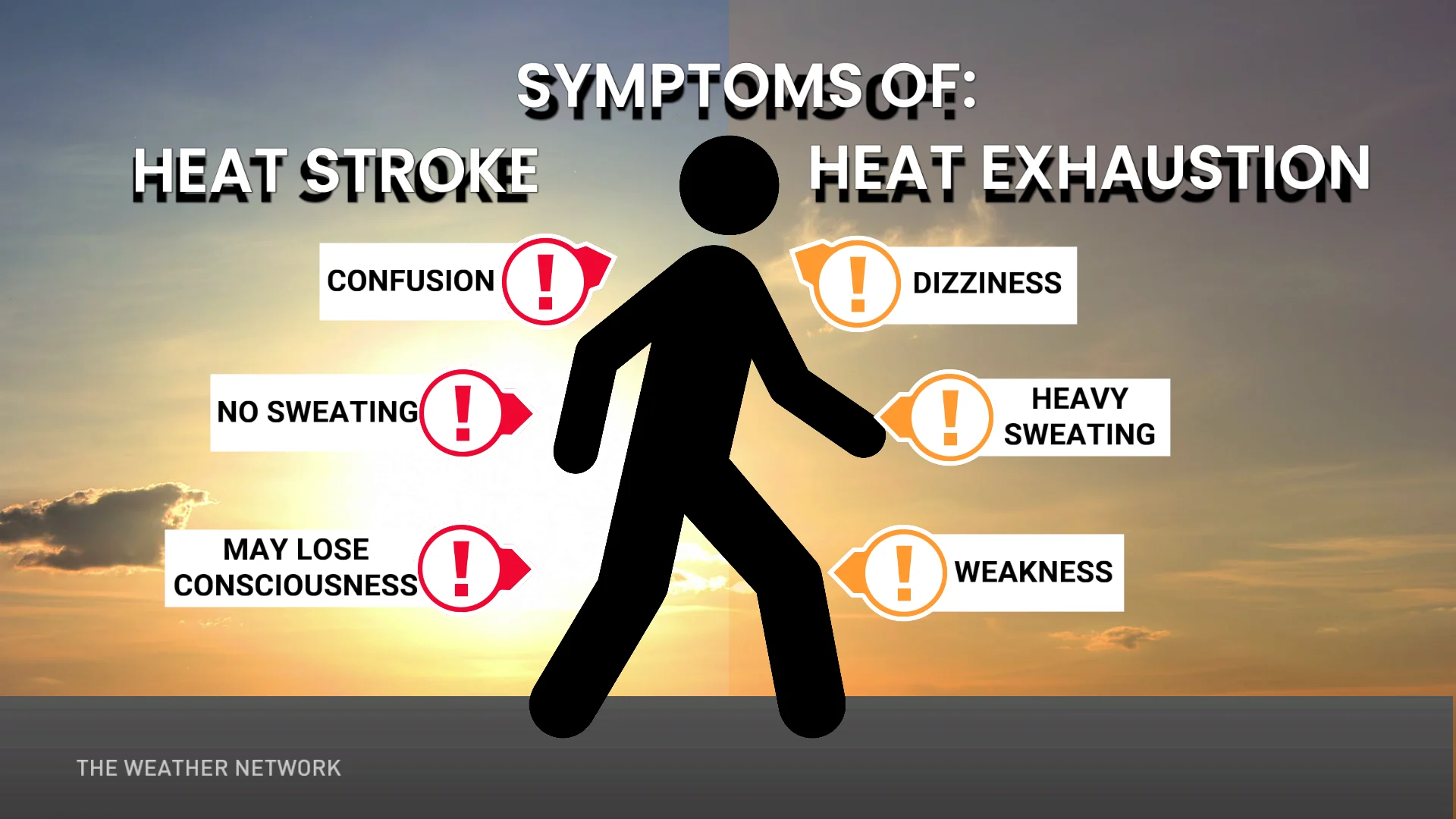
These summer-like temperatures could threaten the health and safety of folks throughout the region, particularly those who are susceptible to hot temperatures.
“Watch for the early signs of heat exhaustion in yourself and others,” Environment and Climate Change Canada (ECCC) advised in its heat warning.
CANADA'S WILDFIRES: Visit The Weather Network's wildfire hub to keep up with the latest on the active start to wildfire season across Canada.
Limit time outdoors and make sure you stay hydrated. Those looking for relief at night won't get much help—overnight lows will remain in the upper teens or even low 20s.
Canada sees first heat warnings of the season
A ridge of high pressure building over the Prairies will favour a warm, southwesterly flow across Saskatchewan and Manitoba. The heat is expected to persist until Wednesday when an upper-level trough finally arrives to flush out the anomalous warmth.
DON'T MISS: Sprawling 3,500+ km 'weather-free zone' to emerge over Canada
Heat waves are unusual by their nature, but sometimes they’re downright unprecedented. Which is this? The timing of this heat wave tips the event toward the unprecedented side of the spectrum.
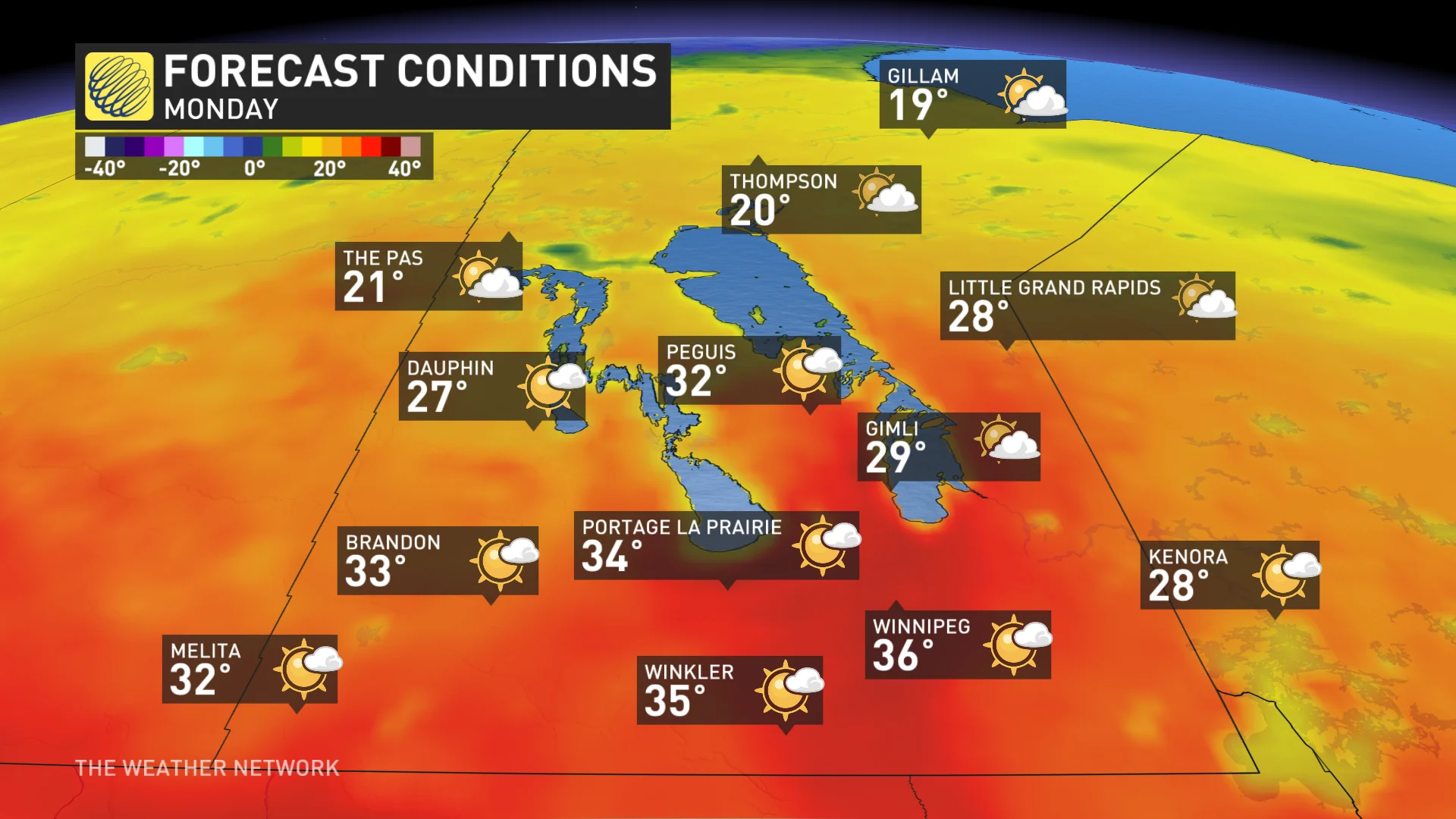
Weather data at the Winnipeg Airport goes back to 1938, and this will be easily the earliest stretch of consecutive days above 33°C on record. On Monday, Winnipeg has the opportunity to reach 36°C—one of the earliest instances of hitting that value on record for the city.
The earliest occurrence of 36 degrees on record happened most recently on May 21, 1980. It’s unlikely, however, that the city will beat its all-time record for the hottest May temperature, which stands at 37.8°C on May 30, 1934.
The only comparable heat wave in the month of May occurred on May 21–22, 1980, when temperatures reached 36.5°C and 37.0°C, respectively. This building heat event will stand on its own more than a week-and-a-half earlier than that event 45 years ago.
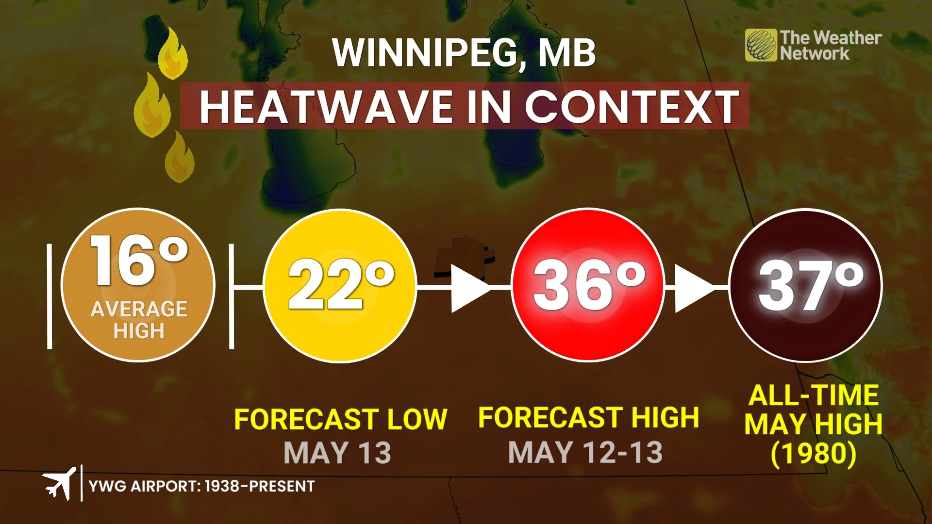
Keep in mind that the average high this time of year is in the mid-to-upper teens.
Remarkably warm overnight temperatures are anticipated throughout the heat event––temperatures remaining above 20°C for locations like Winnipeg.
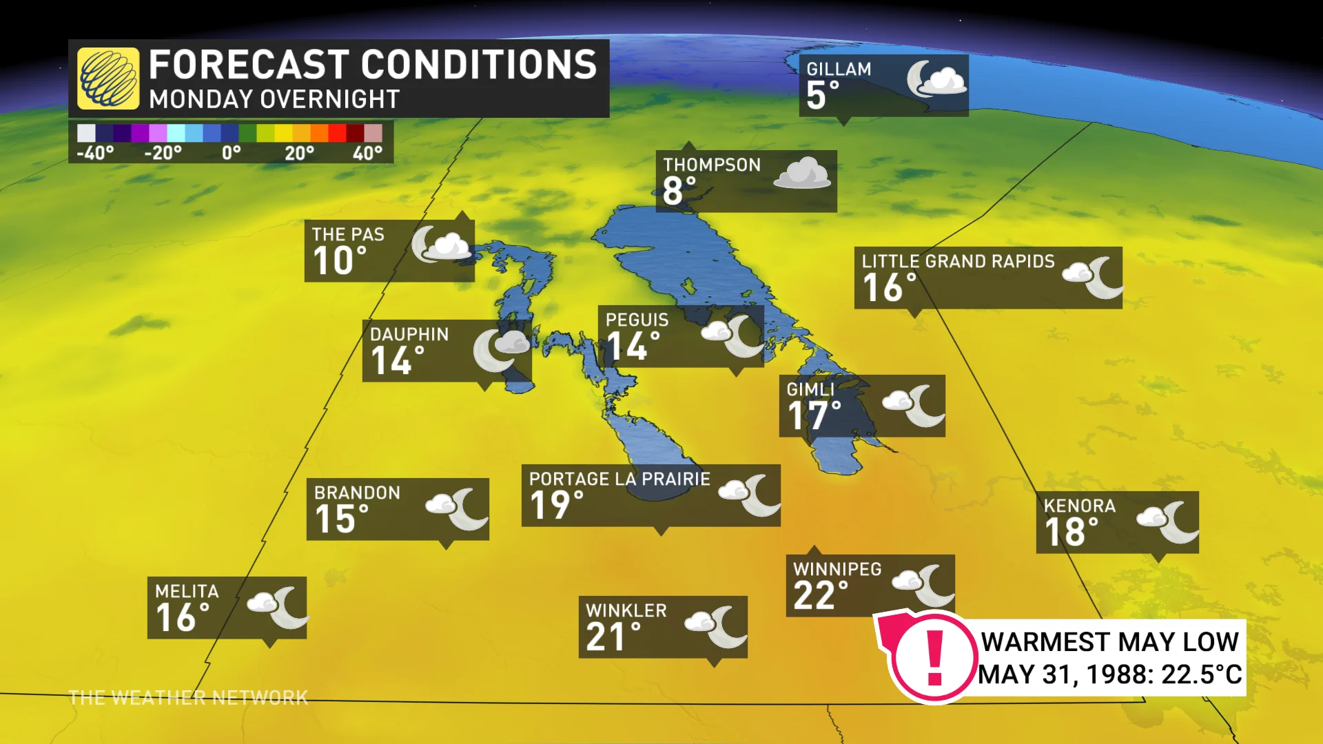
Winnipeg’s warmest overnight low recorded during the month of May was a balmy 22.5°C reading on May 31, 1988—and we might hit that threshold 2.5 weeks earlier! A minimum temperature above 20 degrees has never been recorded during the first half of May in the history of the Winnipeg airport station.
Meanwhile, some much-needed rain is coming to the Prairies this week. Some areas will miss out while others will see excessive amounts, but overall, that is very good news for agriculture and for the wildfire danger.
A low will develop over the Dakotas and track into southern Manitoba on Wednesday or Thursday with widespread rain, locally heavy, and thunderstorms.
Stay with The Weather Network for all the latest on this heat event across Manitoba.
Header image created using graphics and imagery from Canva.