Messy snow, rain to disrupt Atlantic Canada's New Year's Day
Another round of messy winter weather is forecast to bring disruptive snow and mixed precipitation to Atlantic Canada to kick off the New Year.
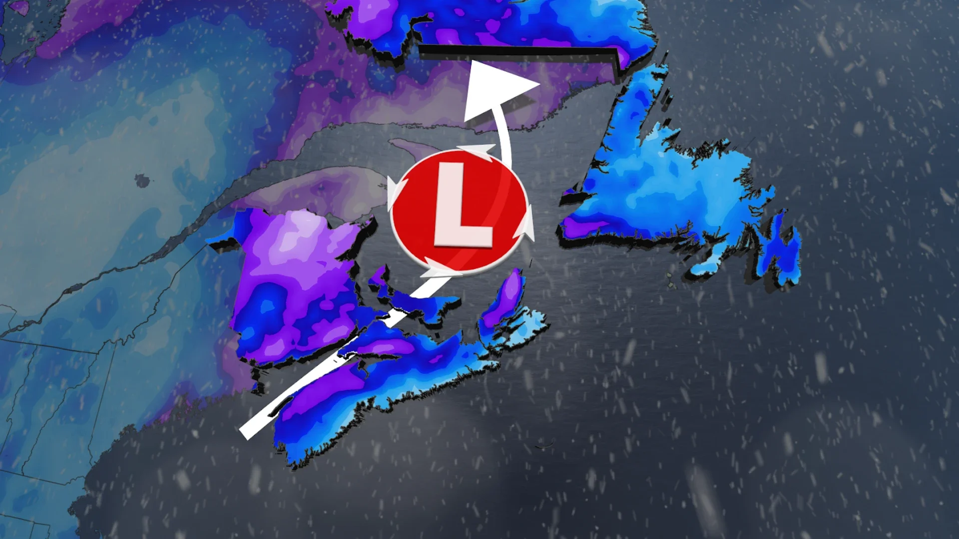
Atlantic Canada won't be catching much of a break between messy systems as we ring in 2026 with yet another round of messy snow and rain across Atlantic Canada.
A low-pressure system moving over the Great Lake and into the Bay of Fundy will gain strength over Atlantic Canada. A strong area of high pressure over Greenland, however, will block the system from moving into the Atlantic. Instead, the system will be pushed north and then backward over Labrador, resulting in a messy mix of heavy snowfall and rain across Atlantic Canada.
Higher terrains are likely to only see heavy snowfall, while coastal areas are likely to see a changeover to rain.
DON'T MISS: Coldest New Year's Day in over a decade expected in parts of Canada
Newfoundland's forecast will be a little more messy as we see freezing rain added to the mix on Friday.
Keep an eye on local weather alerts if you plan on travelling anywhere after their New Year celebrations, as the heavy snow and rain could impact road conditions.
Up to 30 cm snow possible in the Maritimes New Year's Day
Snowfall will begin across the Maritimes on Thursday afternoon as cold air remains in place over the provinces. As the system continues to gain strength over the day, however, we will see snowfall rates begin to pick up.
Western New Brunswick is forecast to see the heaviest snowfall, with 20-30 cm possible. Fredericton, Moncton, and Sackville are forecast to see a little less snow at 10-20 cm.

Prince Edward Island and Nova Scotia are also forecast to see a widespread 10-20 cm of snowfall through Thursday and Friday morning, although Nova Scotia's exact snow totals will be terrain dependent over the Annapolis Valley and North Shore.
The snow should ease substantially into Friday morning, leaving folks with light, blowing snow as the system moves north into Newfoundland and Labrador.
Nova Scotia's south coast will separate itself from the rest of the region in the afternoon, though, as we begin to see the snow change over to rain. This could create slippery road conditions for folks as the earlier snow mixes with the rain.

Newfoundland to see a messy mix Friday
Heavy snow is forecast to begin over central Newfoundland Thursday morning, while the Avalon Peninsula sees rainfall. Parts of western Newfoundland, where elevations are higher, could see 10-20 cm of snow.
SEE ALSO: Tragic floods, historic twisters struck around the world in 2025
The snowy and rainy conditions are forecast to ease by the evening, giving folks a short break before the strengthening system over the Maritimes makes its way north into the province on Friday morning.

By Friday morning, rain is forecast to move into the south and east coasts of Newfoundland, while central regions of the province get a round of freezing rain.
About 2-5+ mm of ice accretion is possible from the freezing rain, which will give snowy surfaces a hard shell. Roads may also become slick and difficult to travel on, so drivers are urged to be cautious.
The rain and freezing rain are forecast to ease throughout the day on Friday, changing to light rain in the afternoon.
Stay with The Weather Network for more information and updates on your weather across Atlantic Canada.