Melissa's threat to Jamaica grows as monster hurricane hits Category 4
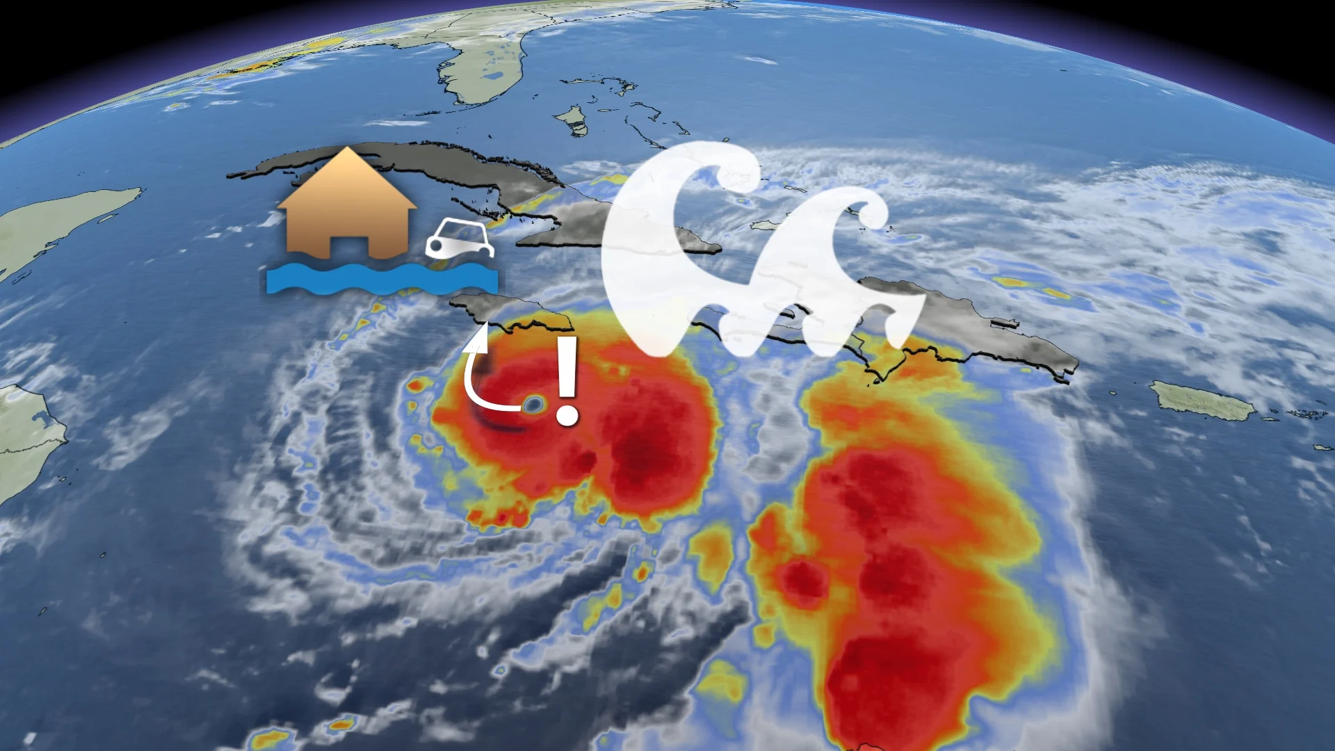
Jamaica and southern Hispaniola are expected to see life-endangering and catastrophic flash flooding soon as the sluggish, behemoth Hurricane Melissa hit a dangerous Category 4 status on Sunday morning
Weather Highlights:
Hurricane Melissa strengthened into a Category 4 hurricane on Sunday morning
The system will continue to intensify through Sunday, with fluctuations afterwards
Life-threatening and catastrophic flash flooding expected in Jamaica and southern Hispaniola
Tourists in the region are urged to heed the advice of local officials
Melissa undergoing rapid intensification; now at Category 4
Millions of residents across the Caribbean are at risk for life-threatening flash flooding and mudslides into this week as a growing storm meanders through the region.
Hurricane Melissa rapidly started the rapid intensification process this weekend, allowing the storm to quickly jump from a Category 1 to a Category 4 storm by Sunday morning. The strengthening isn't finished, either, with more expected through Sunday night, followed by fluctuations in intensity.
Rapid intensification will likely take this storm to Category 5 by Monday afternoon, followed by a drop to Category 4 status shortly before hitting Jamaica.
DON’T MISS: A stalled hurricane can produce disastrous flash flooding

According to the U.S. National Hurricane Center (NHC), Melissa currently boasts maximum, sustained winds near 220 km/h with higher gusts.
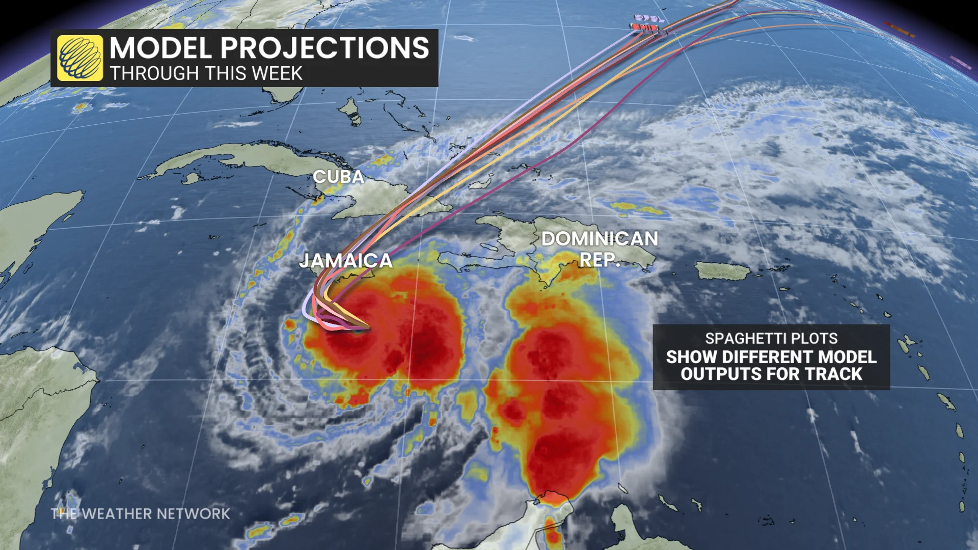
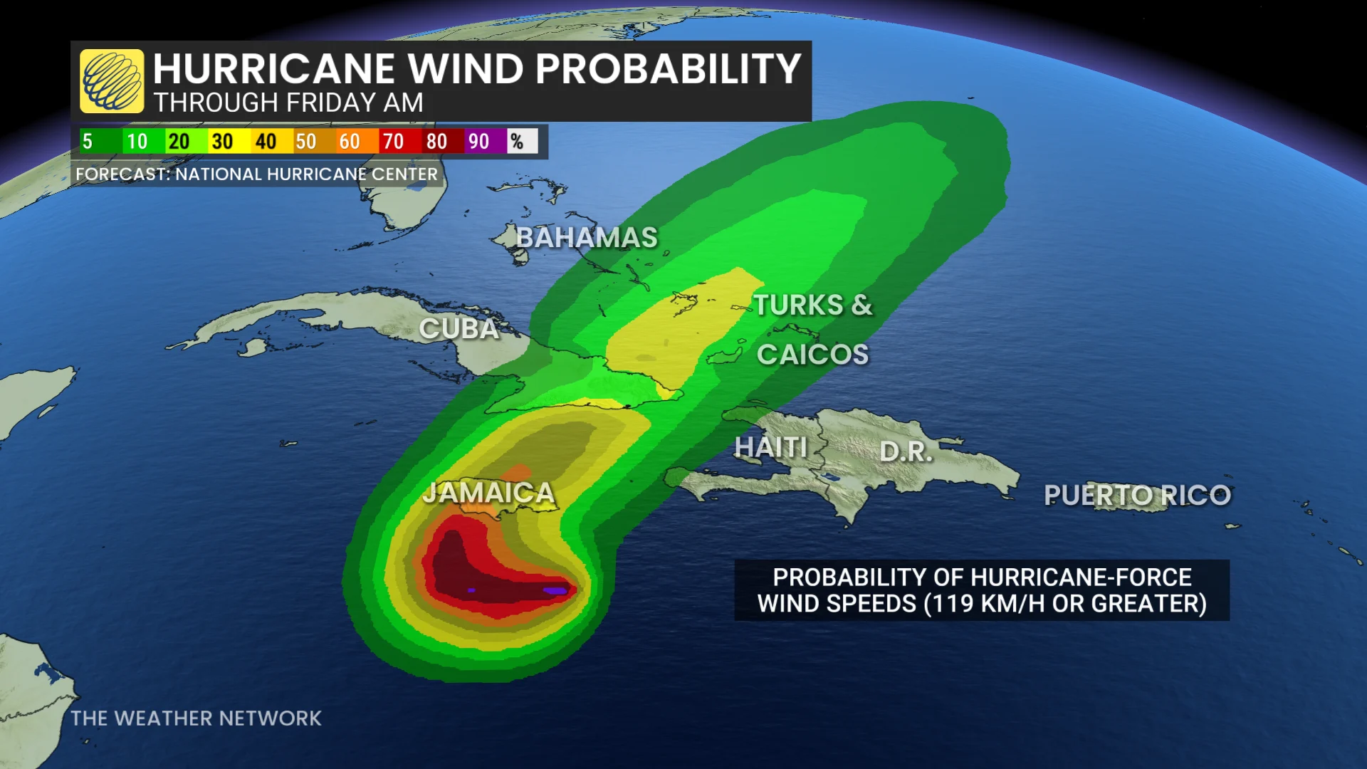
"The centre of Melissa is expected to move near or over Jamaica through Tuesday, across southeastern Cuba Tuesday night, and across the southeastern Bahamas on Wednesday," NHC said.
Melissa is expected to be a major hurricane when making landfall in Jamaica Monday night or Tuesday morning, and then southeastern Cuba on late Tuesday. The eye wall is expected to pass directly over the island, bringing the worst of the winds inland.
Forecasters expect the storm to encounter lower wind shear and some of the Western Hemisphere’s hottest water temperatures in the days ahead.
Melissa is forecast to make landfall along the southern coast of Jamaica, and track northward across the island. That puts the eastern half of the island on the receiving end of the brunt of the storm's power.
Lower elevation areas, which are more densely populated, will be at risk for flooding, coastal flooding and erosion, and storm surge. More inland areas over higher terrain will be at risk for flooding and landslides.
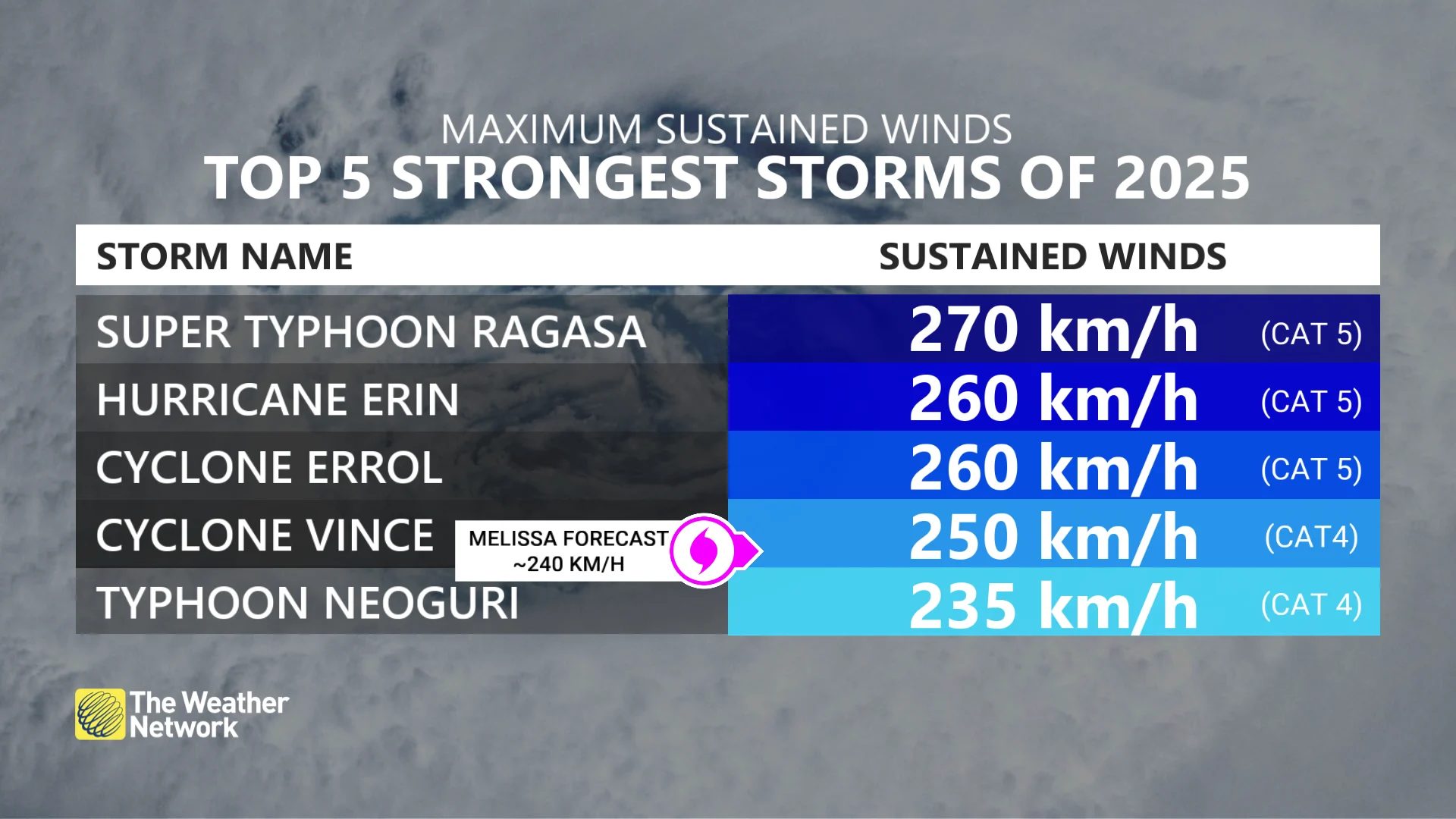
We've already had two Category 5 storms this year. If Melissa achieves this scale-topping feat, it would make history as only the second Atlantic hurricane season on record to see more than two Category 5 storms. (The leader, 2005, produced four: Emily; Katrina; Rita; and Wilma.)
Experts believe conditions remain optimal for intensification, with moderate wind shear and extraordinarily warm sea-surface temperatures fuelling the system.
A slow-moving hurricane could prove destructive
Weak steering currents around Melissa will force the storm to slowly drift west into the beginning of this week, allowing high winds and drenching rains to wash over the mountainous terrain of Jamaica and southern Hispaniola for days at a time.
RELATED: What does a hurricane’s ‘cone of uncertainty’ mean?
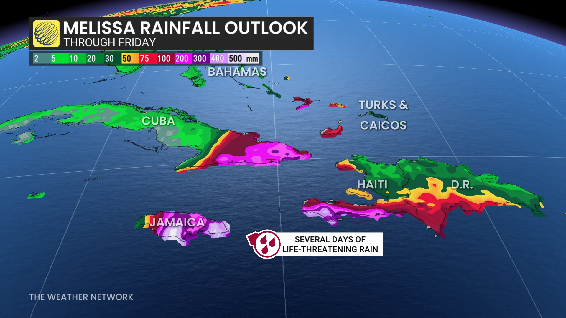
Rainfall totals of 500+ mm are possible across portions of the region, which could lead to potentially devastating flash flooding and landslides. A persistent storm surge along Jamaica’s southern coast could also lead to dangerous coastal flooding, including around the capital of Kingston.
Based on current predictions, Melissa could become one of the strongest storms on record to strike Jamaica. The island nation’s current record-holder is 1988’s Hurricane Gilbert, which struck with 200 km/h winds and rainfall totals that topped 800 mm in some locations.
Potential Canadian impacts remain uncertain
It’s likely that the storm will exit the Caribbean and begin accelerating into the western Atlantic by the middle of or by late this week.
Forecasters are watching the potential for some of Melissa’s moisture and energy to transfer to a developing centre of low pressure off the East Coast. This could fuel heavy rainfall across portions of Eastern Canada around Halloween.
Stay with The Weather Network for all the latest updates on the tropics. Header image courtesy of NOAA