Long-delayed moisture for B.C. coast finally arrives for fire relief
An atmospheric river is looming on the horizon for the B.C. coast, finally bringing relief to a region suffering through varying levels of dry conditions and an elevated wildfire threat.
With eyes on a new wildfire growing exponentially on Vancouver Island, relief is finally coming for the dry- and fire-stricken regions in B.C. this week.
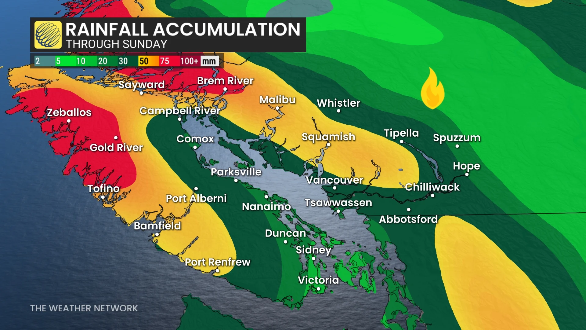
Much-needed and substantial rain is forecast for the South Coast from Thursday night through Sunday. An atmospheric river is taking shape, expected to fill in and bring periods of rain that will total 20-40+mm to much of the Lower Mainland, and 50+mm for the higher terrain.
SEE ALSO: 'Megathrust' earthquake fault line confirmed off Haida Gwaii, capable of generating large tsunamis
It will be a highly beneficial rainfall since it will be spread out over a more extended period of time. Some beneficial rain is likely for the southern and central Interior, as well.
Atmospheric river coming this week as temperatures finally drop
A fall-like low will bring an abundance of rainfall for the South Coast this week.

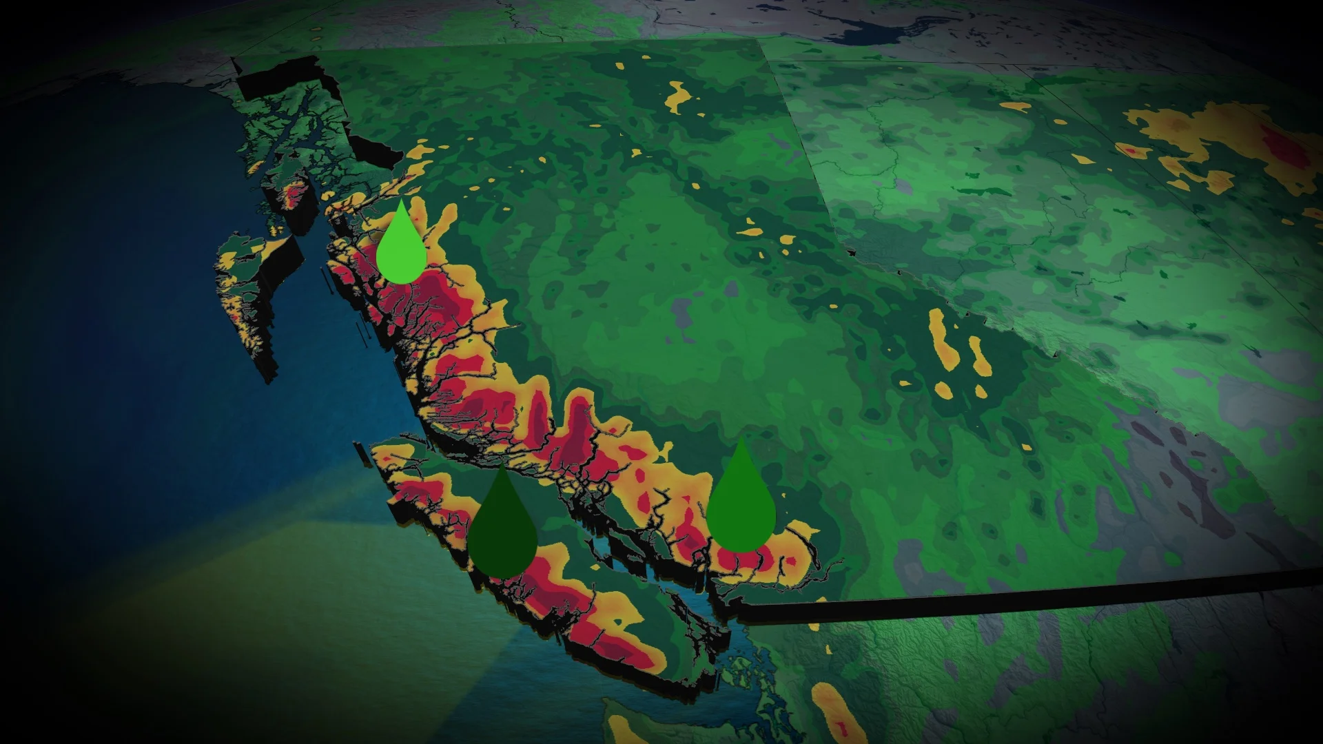
The dry conditions across the B.C. coastline has been a huge contributor for the wildfires in the area. The end of July featured a range from moderate drought to abnormally dry conditions.
But, things are shifting directions this week.
A low-pressure system from Alaska will form west of Haida Gawaii for Thursday and Friday. The associated cold front will pull ample amounts of of moisture to set up an atmospheric river for the B.C. coast.
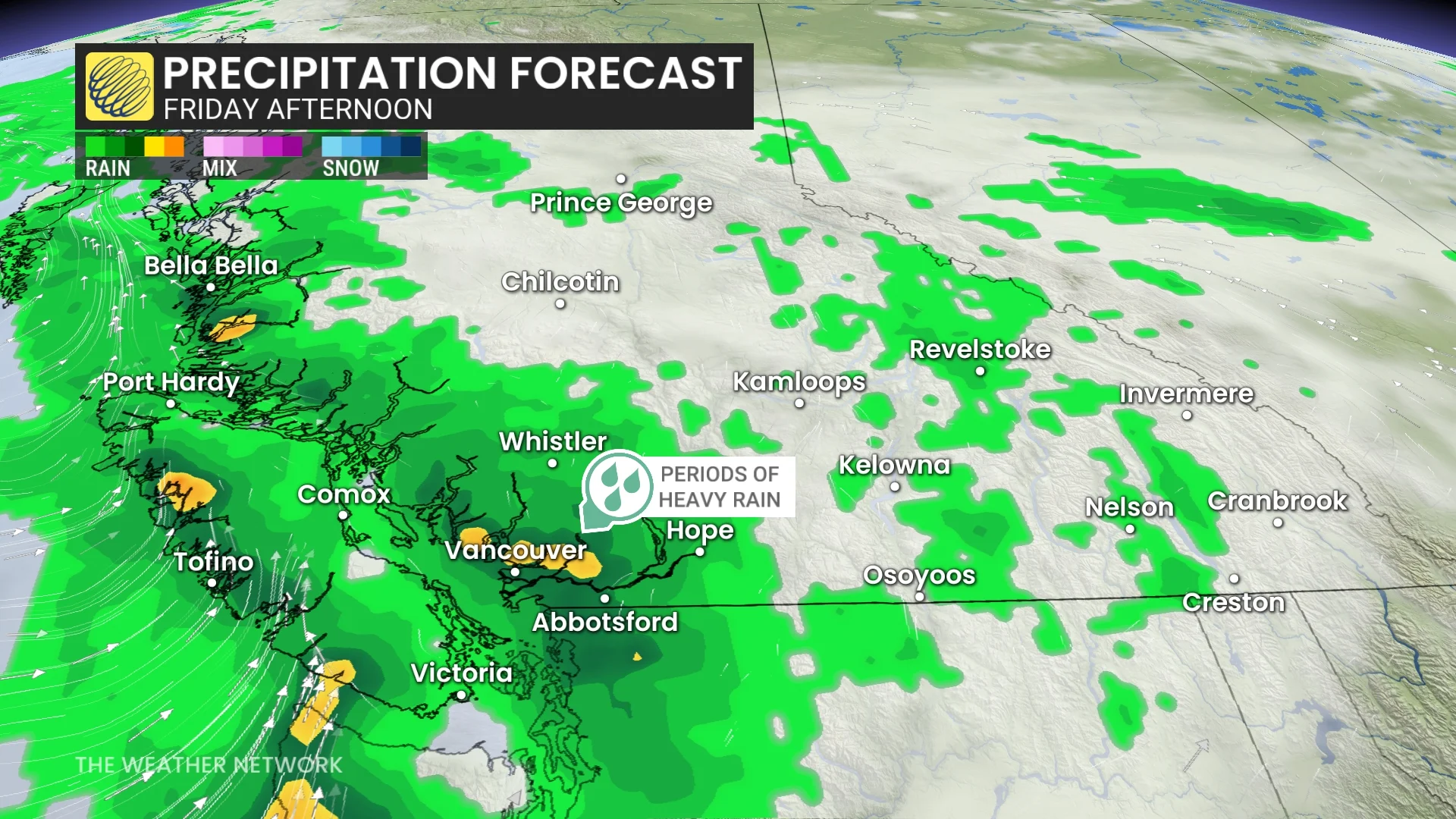
Heavy showers will move in Thursday evening over Vancouver Island.
The heaviest rainfall will be through the day Friday along the BC coast. The central B.C. coast east of Haida Gawaii will experience the greatest impact, with an AR3-level event expected. Meanwhile, southern portions of Vancouver Island will see a range of AR1 to AR2.
The rain will be extremely beneficial for the ongoing wildfires and drought conditions.
Showers are expected to stick around until Sunday.
Freezing levels, meanwhile, will drop below 3000 metres heading into Saturday, and to 2500 metres on Sunday. Because of that, some high-elevation snow can be expected on the mountain tops.
Behind the cold front, cooler-than-normal temperatures are expected to dominate late this week through early next week. Drier conditions with a warming trend are expected mid- and late next week, however, putting temperatures back to seasonal and then warmer than seasonal.
Stay with The Weather Network for more information and updates on your weather across B.C.