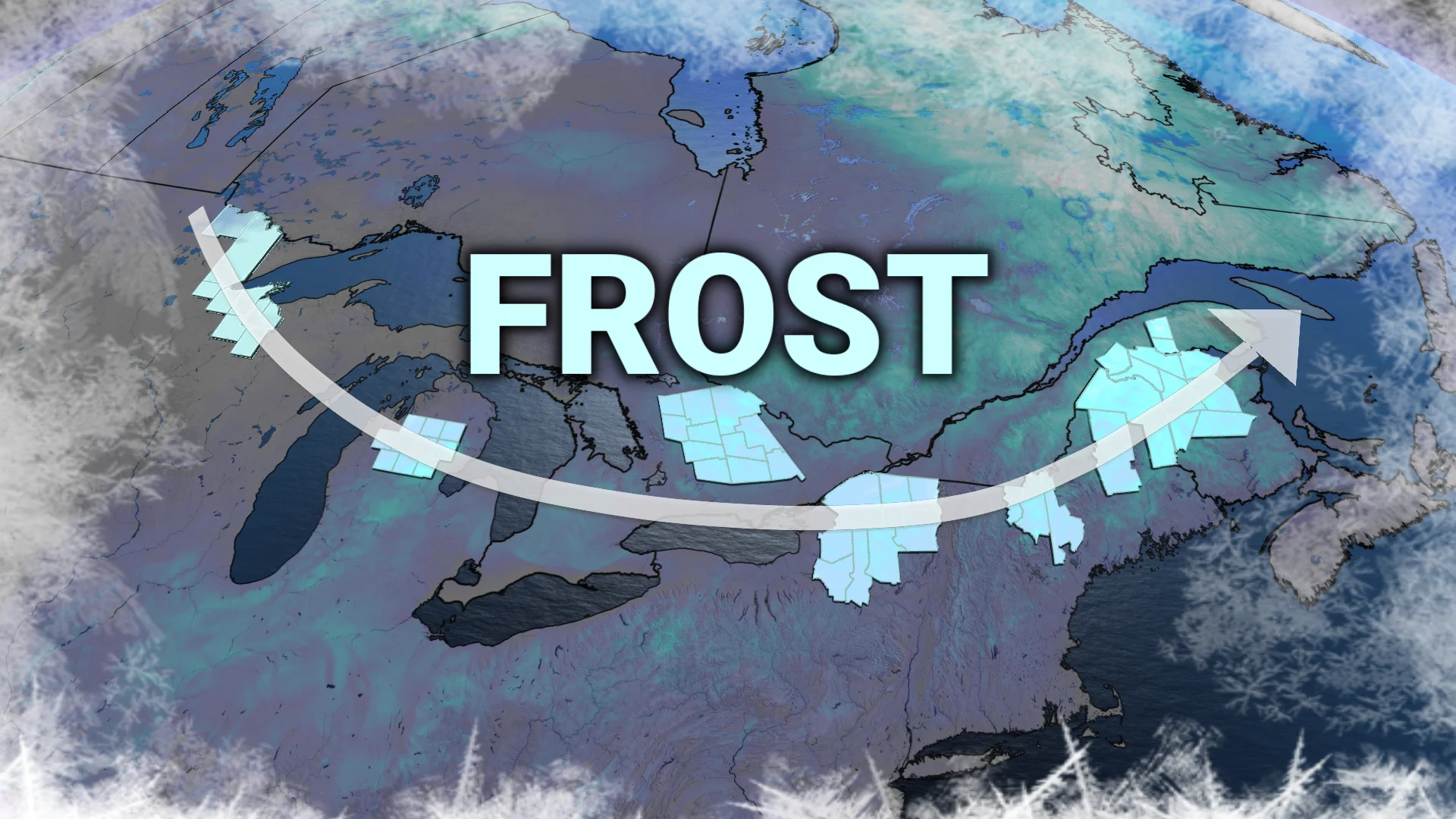
Late-summer frost advisories stretch over 2,000 km

A late-summer frost threat covers parts of Eastern Canada, but will this be a full freefall into autumn?
This week may require some extra wardrobe adjustments across Ontario as chilly overnight lows transition into mild, warming afternoons.
While some areas may even experience frost in the early mornings, this is not an indication of a full shift into cooler autumn weather just yet.
DON'T MISS: A typical September sends Canada heat, frost, hurricanes, and snow
Mornings may feel brisk, but afternoon temperatures are expected to rise to seasonal levels for many.
Frost risk for Algonquin Highlands and parts of eastern Ontario into Tuesday morning
After a brisk and chilly start to the week Monday morning, clear skies overnight will lead to heat loss from the surface, causing temperatures to drop steadily until sunrise again on Tuesday.
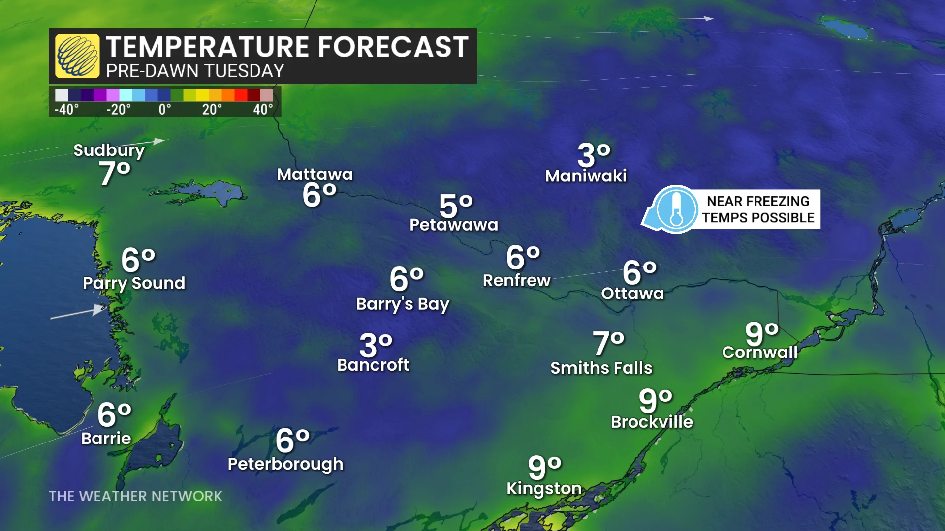
Areas away from the Great Lakes, particularly inland regions of eastern Ontario, are at the highest risk for patchy frost. Higher elevations in the Algonquin Highlands, as well as areas such as Bancroft and Petawawa, are especially vulnerable. Frost advisories are in effect.
"Cover up plants, especially those in frost-prone areas. Take preventative measures to protect frost-sensitive plants and trees," says Environment and Climate Change Canada (ECCC) in the alert.
Late-summer frost advisories stretch 2,000 km
Ontario isn't alone in this late-summer chill, either. In fact, patchy frost advisories stretch over 2,000 km from Minnesota to New Brunswick.

By Tuesday afternoon, daytime highs are expected to rebound to seasonal values.
The rest of the week is forecast to maintain stable and seasonal temperatures, as well, with some areas set to reach the low to mid-20s.