Large hail, landspout tornadoes possible with today's storms on the Prairies
A severe storm threat continues across the Prairies, with the next round expected on Wednesday. Storms that develop could bring significant impacts, including large hail, landspout tornadoes, and strong winds
The threat for severe weather continues across parts of the Prairies on Wednesday, with heavy rainfall set to engulf the region by the end of the week.
SEE ALSO: What’s the wettest month in your corner of Canada?
On Wednesday, the severe storm risk will span a broad area across Western Canada, extending from northeastern B.C. to southern Manitoba and northwestern Ontario. The primary concern will be large hail, particularly for regions near the Alberta foothills and areas stretching eastward, including cities like Regina, Sask., and Winnipeg, Man.
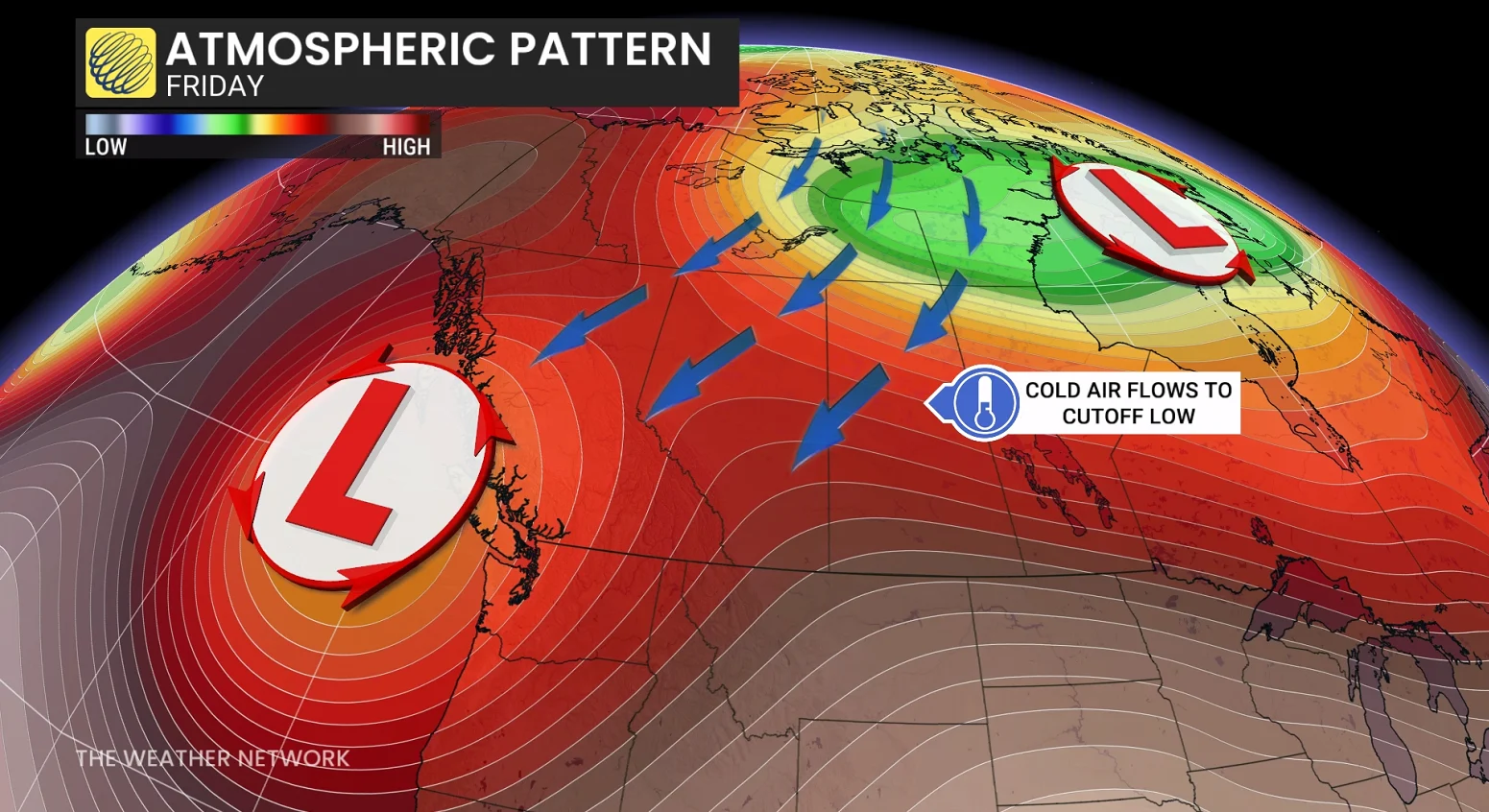
Following the storms, heavy rain and much cooler, spring-like conditions are expected to end off the week, with some areas set to sit 5-10°C below seasonal as summer officially begins. Between 50-100 mm of rain could fall in some of the harder-hit regions this weekend.
Pay close attention to watches and warnings in your area as severe thunderstorms could bubble up on Wednesday.
Large hail: Severe thunderstorm threat continues over the Prairies on Wednesday
A cold front moving southward from the Arctic will confine the storm threat to the southern regions of the Prairie provinces on Wednesday.
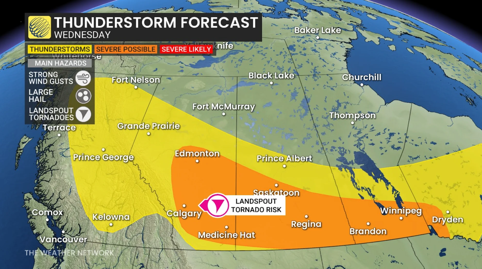
Strong to severe thunderstorms are expected to develop along the cold front, stretching from Calgary, Alta., to Winnipeg, Man.
Large hail remains a key concern, with strong wind gusts posing an added risk, particularly for storms between Regina, Sask., and Winnipeg, Man.
Additionally, there is a risk for funnel clouds east of Calgary today along the cold front, which could touch down and cause landspout tornadoes.
While a lack of moisture will limit the potential for heavy rain, slow-moving storms near the northern foothills may still generate areas of localized rainfall.
Residents are advised to stay prepared and monitor their Weather Network app for potential weather alerts.
Heavy rain and very cool temperatures kick off summer this weekend
Focus will shift from the storms to the incoming cooler conditions this weekend, with temperatures during the first few days of summer forecast to be 5-10°C below seasonal averages. This cool and unsettled weather pattern is then set to dominate the latter half of June.
Significant rainfall is also forecast for much of the agricultural regions this weekend, particularly in southern and central Alberta and Saskatchewan, where totals could reach 40-80+ mm, and 20-40+ mm closer to the U.S. border.
Southern Manitoba is also expected to receive substantial rainfall, with 20-40+ mm likely.
DON'T MISS: The Weather Network's exclusive summer 2025 forecast
Rain will begin across Alberta on Friday afternoon and evening, as a low-pressure system forms over Montana. This system will gradually bring rain and thunderstorms eastward across the Prairies throughout the weekend.

Be weather-aware
Monitor The Weather Network's app or TV channel, and pay attention to local announcements for severe weather warnings and watches.
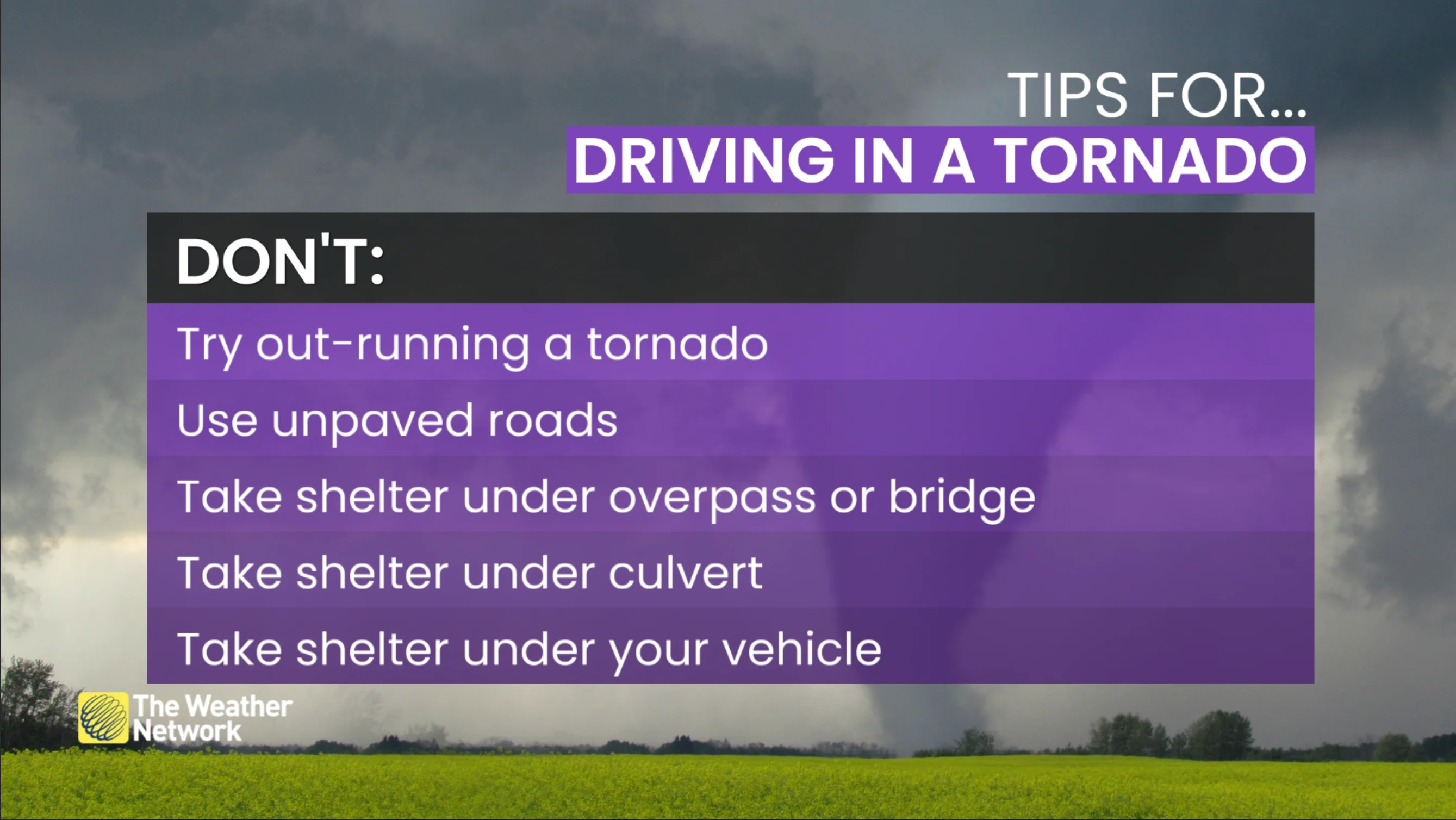
In case of a tornado warning, identify a safe place in your home where household members and pets will gather during a tornado: a basement, storm cellar or an interior room on the lowest floor with no windows.

In case of frequent lightning, even indoors, you have to take safety precautions in order to prevent receiving an electric shock from a lightning bolt. Below are some helpful tips to keep in mind:
Stay away from windows.
Unplug appliances.
Do not use the telephone.
Avoid running tap water.
Additionally, flash flooding can happen in a matter of minutes during, or shortly after, a major rain event. Do not attempt to drive through floodwaters as you as it only takes a small amount of moving water to sweep a vehicle away

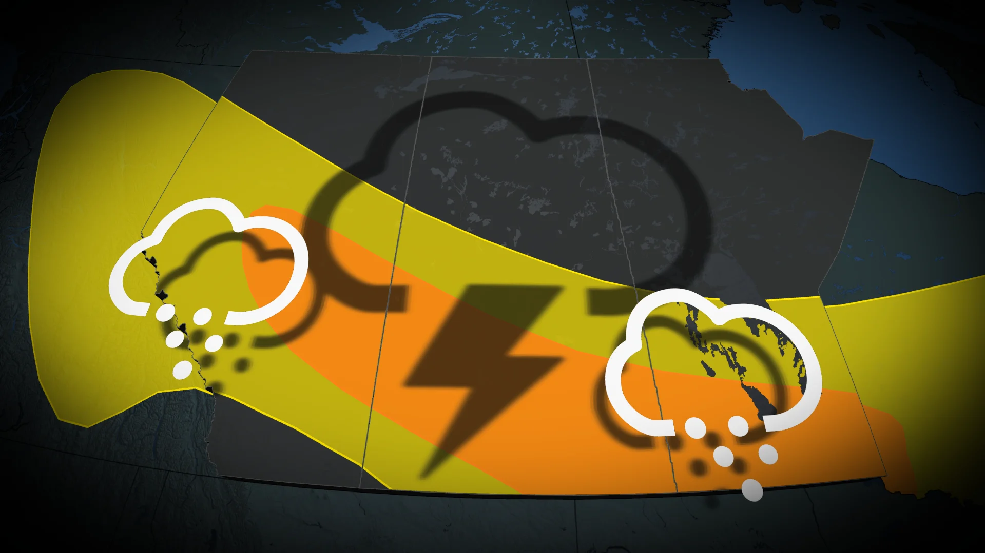
Summer snow?
In addition, snowfall is expected at higher elevations in the central and southern Rockies by Saturday, primarily above 2,000 metres. Some high-elevation hiking trails could see significant snow accumulation.
Stay with The Weather Network for all the latest on conditions across the Prairies.