
La Niña returns, but this will be the key driver of Canada’s winter
Big swings in water temperatures across the Pacific Ocean could affect our winter weather here in Canada
What's going to drive our winter weather across Canada this year?
La Niña officially arrived to kick off October, a sign that we could see the event influence our patterns heading into the start of winter.
But another unusual event much closer to home could have a greater impact on our season ahead.
La Niña returns in time for winter
This winter will begin with a weak La Niña, which is a pattern of colder-than-normal waters around the equator in the eastern Pacific Ocean.
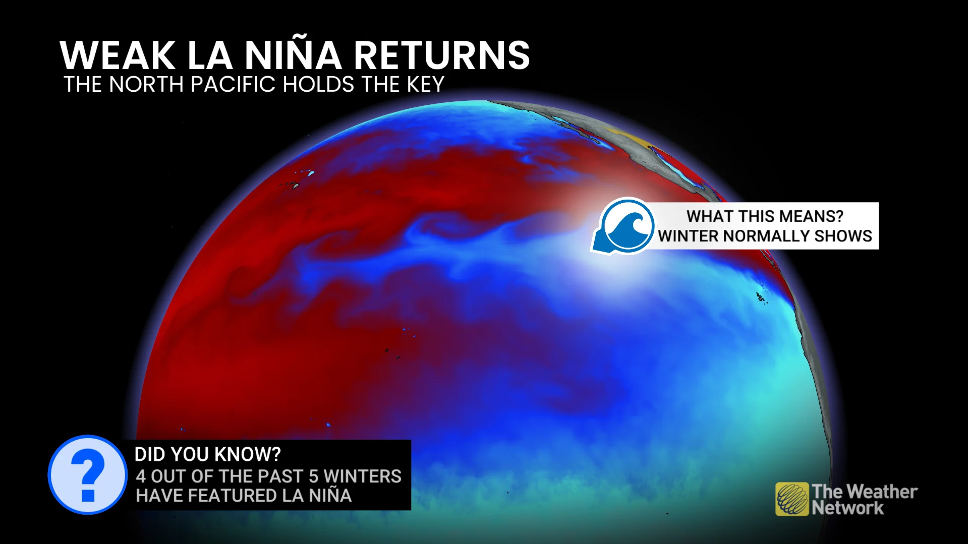
We’re no stranger to a La Niña winter. In fact, we’ve seen four La Niña events during the past five winters.
A typical La Niña would alter the jet stream to allow cooler-than-normal conditions to spill across Western Canada while an active storm track builds over the eastern half of the country. The effect is less pronounced during weak events.
But this year, it looks like La Niña may take a backseat to another driver in town.
Very warm waters across the northern Pacific in 2025
Water temperatures in the northern Pacific Ocean between Japan and British Columbia began rising above seasonal earlier this year. Readings in some areas have peaked 3-5°C higher than normal at times.
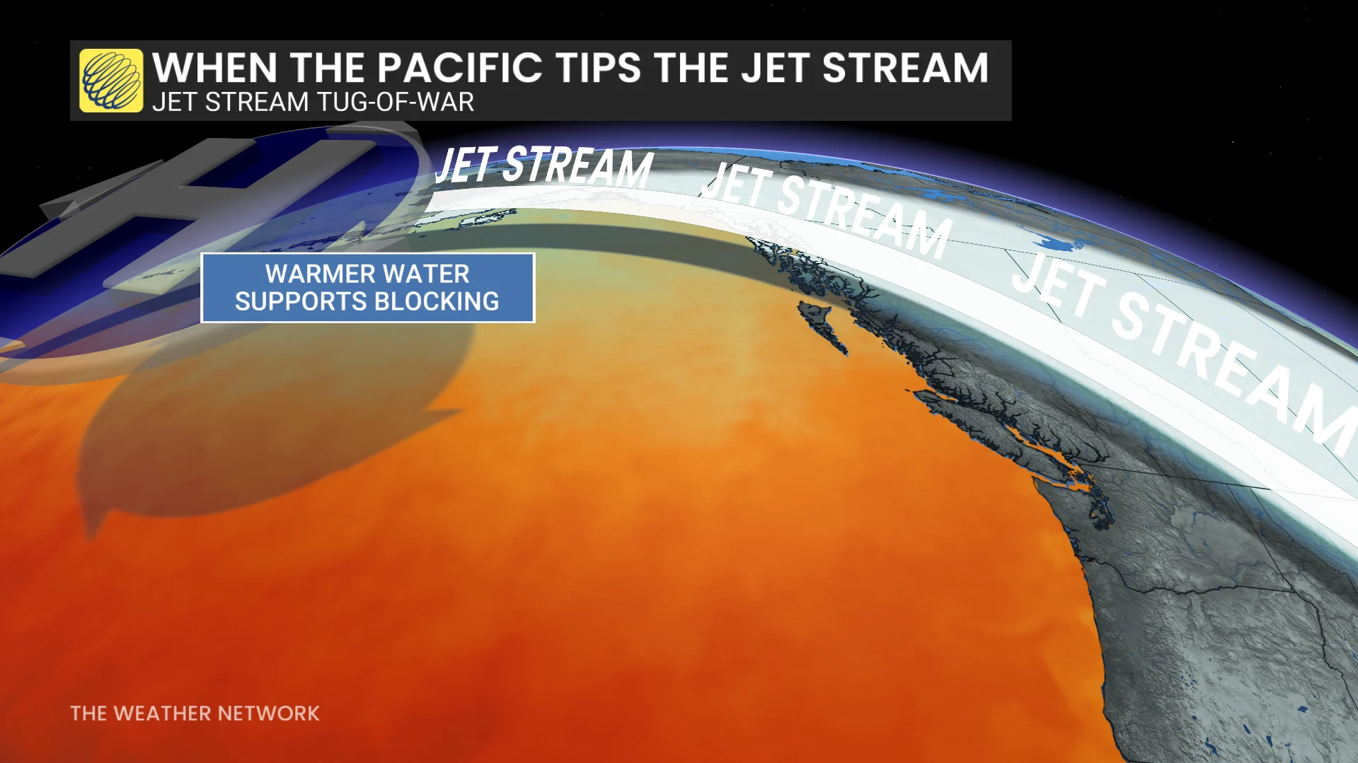
Marine heat waves enable far-reaching effects on weather patterns, including here in Canada. These unusually warm waters can exert a conflicting influence on our winter season by essentially playing tug-of-war with the jet stream.
Such an expanse of warm waters may support a blocking pattern that favours cold air diving across much of Canada from the north. These bursts of below-seasonal temperatures sometimes spread from the Prairies to Quebec.

When the blocking pattern breaks down, though, toasty ocean temperatures can help fuel mild Pacific air that spreads a thaw across the country from coast to coast.
Water temperatures have cooled in recent weeks
However, a recent trend presents a challenge in pinning down the potential pattern.
Water temperatures have noticeably cooled off the coasts of Alaska and British Columbia over the past couple of weeks. How this evolves over the next two months will determine how much the pattern influences our winter here in Canada.

If this trend in water temperatures continues into the winter months, a less-pronounced blocking pattern would pull the cold air back toward Western Canada. This altered pattern, combined with cooler waters, would also make for fewer national thaws during the heart of the season.