Snow continues sliding across Ontario amid winter’s grand return
A dramatic weekend weather shift is underway for southern Ontario after a January warmth, with significant snowfall coming for some areas alongside a temperature cooldown
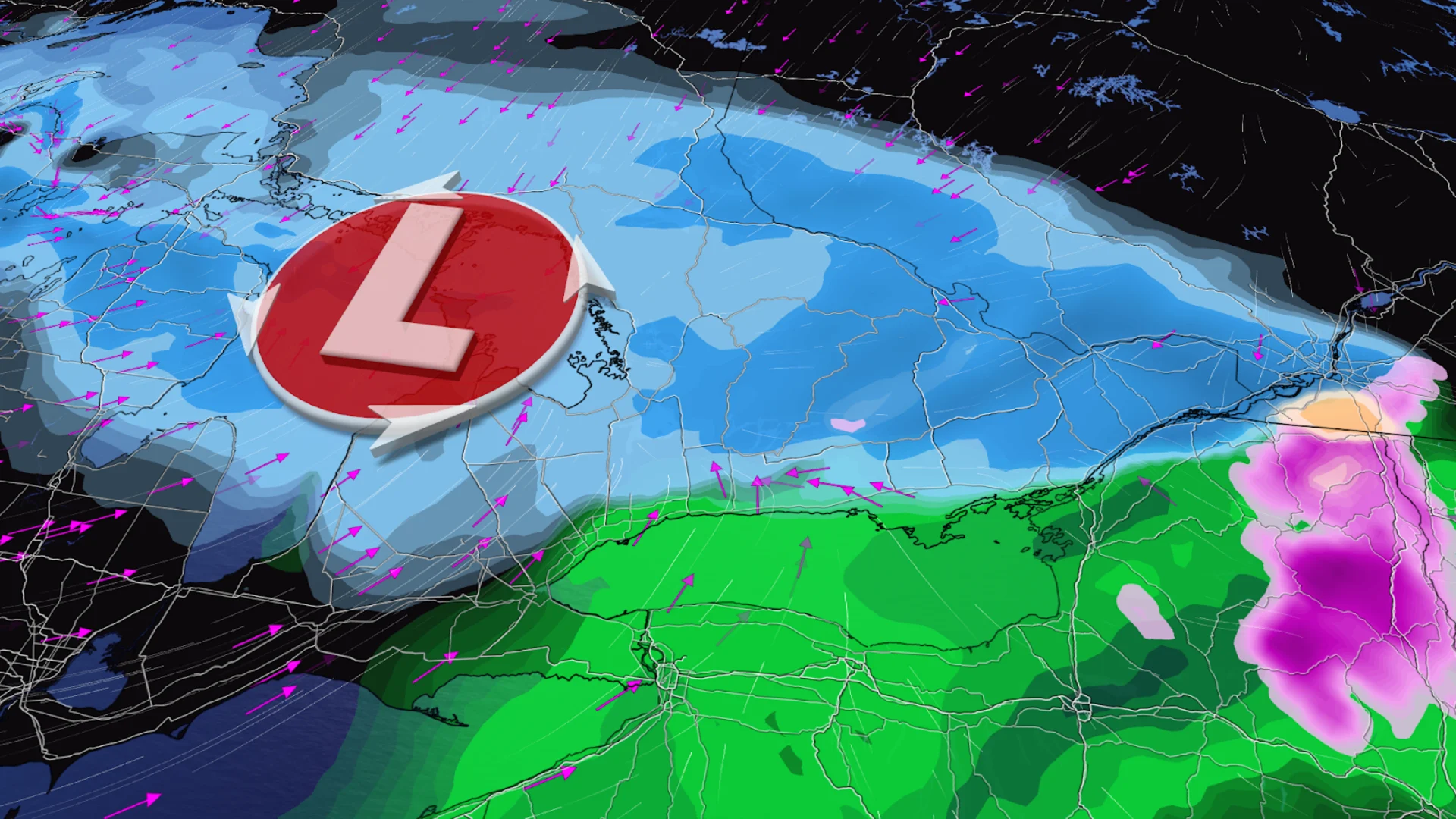
The brief thaw that spread across Ontario to end the week is a distant memory this weekend as a wintry system continues marching through the province.
Cold temperatures and ample moisture brought a blanket of snow to much of southern Ontario through the day Saturday. Expect the snow to persist in eastern Ontario during the overnight hours.
Winds behind this system will help kick up some lake-effect snow heading into Sunday.
DON’T MISS: El Niño incoming? Forecasters see signs of big changes ahead
Brief pause ends with weekend system
Unseasonably warm air spread over southern Ontario to end the week. Friday’s highs made it up to 16.0°C in Sarnia and 15.2°C at Pearson International Airport.
Saturday saw an abrupt end to the warmth as a system tracking through the Great Lakes helped drag chilly air back over the region.

Snow that pushed across southwestern Ontario through the day Saturday will continue across eastern Ontario during the evening and overnight hours, with snowfall totals coming in around 10-15 cm by Sunday morning.
Cold winds behind our departing system will create favourable conditions for lake-effect snow to build downwind of Lake Huron and Georgian Bay on Sunday. Beware potentially hazardous driving conditions in and around any bands of snow that develop.
Stay with The Weather Network for all the latest on conditions across Ontario.