Ingredients in play for northwestern Ontario severe storms on Tuesday
Folks across northwestern Ontario should pay close attention to the weather on Tuesday as severe thunderstorms will be possible
With Ontario getting a break from the heat to start the week, but will return soon, northwestern sections of the province will be getting into the severe weather risk on Tuesday.
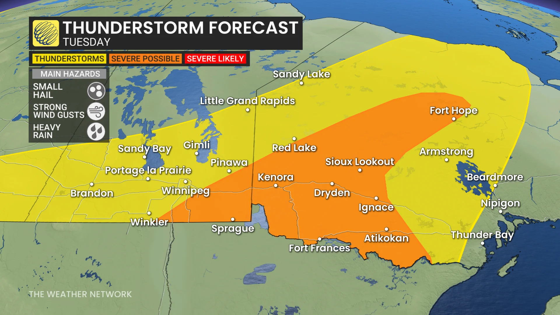
In fact, multiple days of thunderstorms are expected in northern Ontario as a boundary stalls over the region. Tuesday could bring multiple rounds of thunderstorms into the region, with a severe chance for some areas. Folks can expect strong winds, heavy downpours and hail with any severe storm that forms.
DON’T MISS: U.S heat will soon spill into Eastern Canada, bringing back 30 C weather
Tuesday's storm risk also extends back into southern Manitoba, with a severe chance in southeastern sections.
Make sure you keep an eye on the radar––especially if you have outdoor plans––and stay aware of any severe weather watches or warnings issued in your area.
Tuesday and Wednesday: Multiple storm opportunities
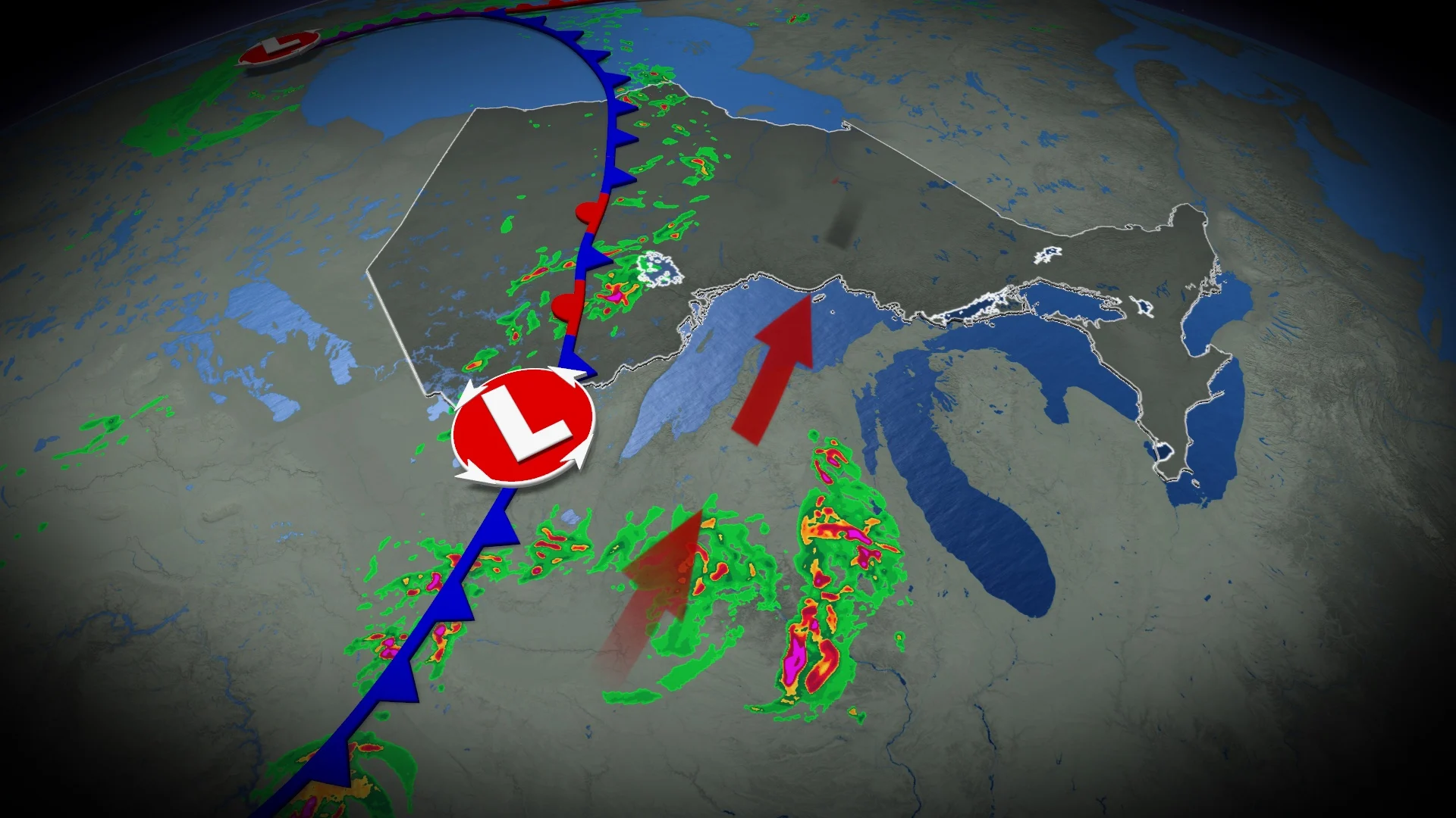
An active weather boundary will move into northern Ontario on Tuesday, and stall over the coming days--bringing several opportunities for severe weather.

SEE ALSO: Wildfire smoke, other extreme weather affecting Ontarians' vision: Poll
From Tuesday morning to the lunch hour, forecasters will be watching a complex of storms stateside that could clip the Ontario-U.S. border. Strong winds and heavy downpours are the main threats with those storms.
As the day progresses, later in the afternoon on Tuesday, storms could pop up from Dryden to Fort Hope, possibly becoming marginally severe with two-centimetre hail possible.
If you are in the region, please stay on top of severe weather alerts and know what to do and where to go in the event severe weather approaches.
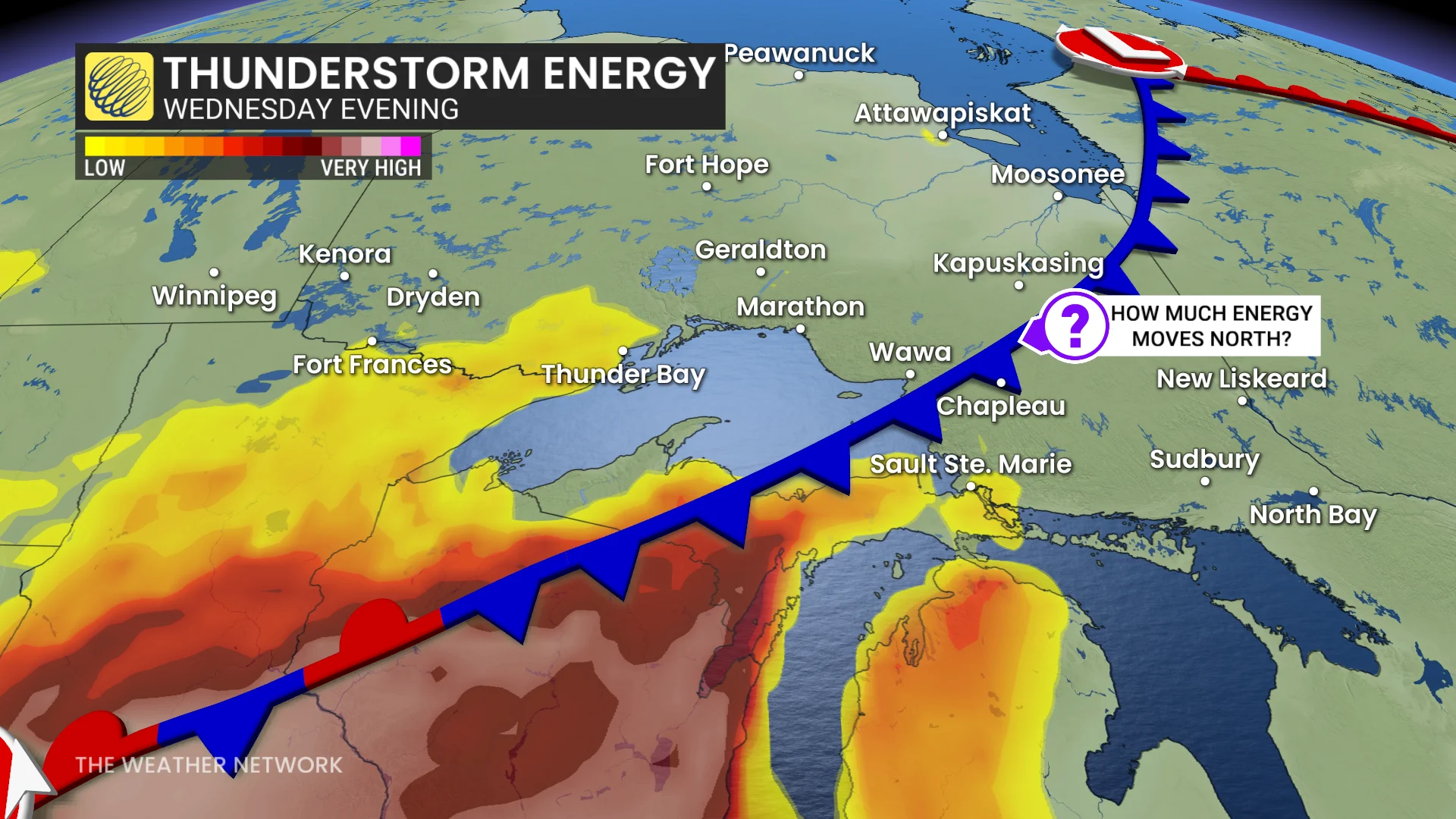
On Wednesday, forecasters will then turn their attention to the potential for another cluster of storms to develop along the Lake Superior shores.
Stretching from Marathon to Sault Ste. Marie, the risk will fall from the morning to early afternoon, then moving east of Sault Ste. Marie by the afternoon and evening time.

There is some uncertainty on how much thunderstorm energy will develop and the severe potential at this time. But heavy rainfall and frequent lightning will be the main threats.
There is still much uncertainty in the forecast Tuesday due to capping in the atmosphere and wildfire smoke, which could reduce the severe risk
There is model uncertainty and trouble handling the location and movement of the thunderstorms stateside.
Beyond, much cooler weather is expected late next week and well into the first week of August, especially in eastern areas.
WATCH: In a tornado warning? Here’s what you should do
Stay with The Weather Network for more information and updates on your weather across northwestern Ontario.