Incoming winter storm threatens Atlantic Canada with icy impacts
Another winter storm is set to impact Atlantic Canada on Monday, bringing a messy mix of ice, snow, and rain that may impact travel.
It hasn't been long since two back-to-back powerful winter storms swept toward Newfoundland on Christmas and Boxing Day, bringing blizzard conditions to the island. Now, we're already looking at the next big storm tracking into Atlantic Canada as a strengthening Colorado low meanders through Ontario and Quebec on Sunday and Monday.
A dynamic atmospheric setup combined with intense moisture to the south has resulted in a rapidly strengthening storm set to deliver a wintry mess to those in its path.
The combination of cold surface air over Atlantic Canada and moist air aloft will help to fuel an environment for ice, rain, and snow on Monday.
RELATED: Freezing rain and ice pellets are dangerous winter hazards

Prolonged freezing rain sets stage for dangerous travel, outages
Folks across Atlantic Canada can all expect to see some freezing rain with this event.
While Newfoundland won't be directly impacted by this powerful Colorado low, a second low over the Atlantic will help to pull in some freezing rain during the overnight Sunday and into early Monday.
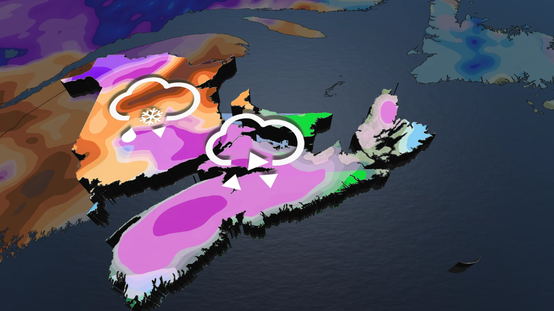
The Maritimes, however, will be bearing the brunt of the winter storm, with prolonged freezing rain on tap throughout the day Monday.

In Nova Scotia, folks can expect to initially see 5-10 hours of freezing rain on Monday, which should result in about 4-8 mm of ice accretion. This will be enough to make sidewalks and roadways quite slippery, so take caution if heading outside.
The freezing rain will then transition into heavy rainfall through the overnight hours as the system departs into the Atlantic and pulls in warmer air.
On the back end of the storm, though, we could see some snow squalls developing as gusty 60+ km/h winds persist, especially around the Bay of Fundy coast.
SEE ALSO: A winter storm's track can make or break your forecast
New Brunswick's stormy forecast is a little more complex than Nova Scotia's, with more of a wintry mix setting up over the province.
Northern regions of the province, including the Gaspe Peninsula, should see mainly snowfall, but we could see some ice pellets mixed in too. Strong winds will also make blowing snow a hazard for travellers to keep an eye out for.

The rest of the province, however, should see up to 10+ hours of freezing rain mixed with the snow throughout Monday and into Tuesday morning before transitioning to rain.
The combination of icy weather and strong winds across Atlantic Canada will raise the risk for isolated power outages from damaged tree limbs and power lines.
The exact precipitation timing may also vary depending on how much warm air is pushed aloft by the system, although forecasters are feeling confident in the types of precipitation we will see.
Stay with The Weather Network for more information and updates on your weather across Atlantic Canada.