Wind, waves, and heavy rain: Pacific storm parade batters B.C. coast
Heavy rain to soak B.C.'s coastline through Friday as strong winds and waves threaten power outages and ferry disruptions
B.C. braces for another stormy setup as multiple systems bring heavy rain to the coast this week. Strong winds and high waves are expected to remain a concern.
DON'T MISS: What’s the difference between hurricanes, typhoons, and cyclones?
A wetter pattern is expected for the rest of the month, as well, as a strong Pacific jet stream drives a series of low-pressure systems across the region.
Above-normal precipitation is expected into late October and early November, and temperatures will range near seasonal or slightly below average.
Active storm parade continues across B.C. this week
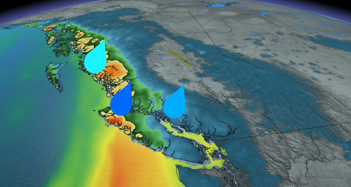
After a turbulent weekend of strong winds, high waves, and heavy rainfall, the South Coast is gearing up for more unsettled weather as a series of Pacific storm systems move in.
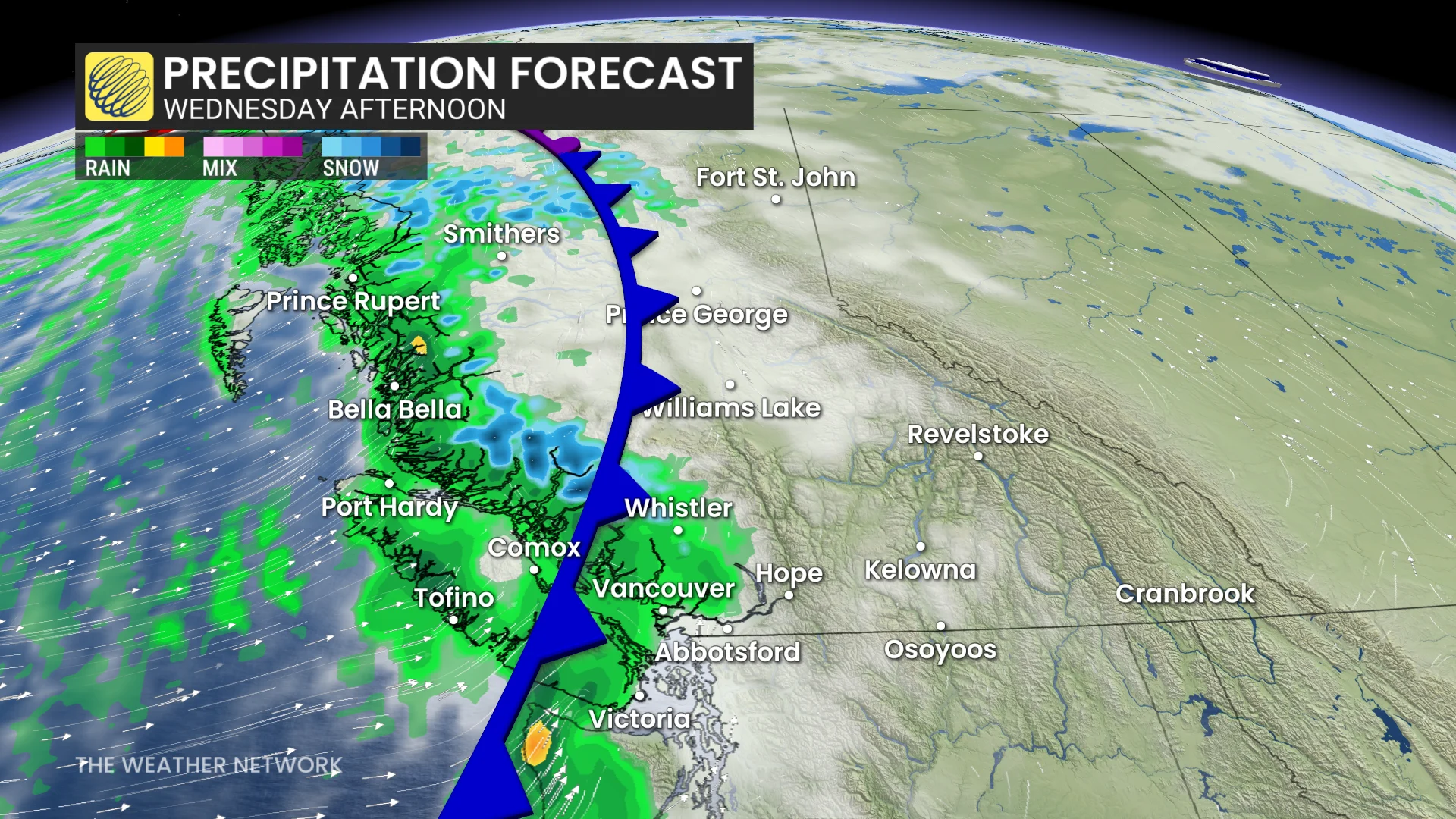
Fronts are expected to arrive Monday night, Wednesday, and Friday, with Friday delivering the most intense round of atmospheric moisture.
Rainfall totals are projected to reach 40-60 mm across the Lower Mainland by Friday, while Victoria may see 10-20 mm.
DON'T MISS: More dangerous than snow: Why driving in the rain can be a bigger hazard
Heavier amounts up to 100 mm are likely for areas such as West Vancouver Island and parts of the North Coast.
There is also a chance for alpine snow beginning Wednesday.

Strong winds will accompany these systems, with gusts of 40-80+ km/h potentially sweeping through the South Coast by Thursday. These could disrupt power services and ferry schedules.
Waves between 5-6 m will contribute to rough water conditions, as well.
RELATED: Staying safe during a power outage
While these systems bring some much-needed rainfall, several areas still remain well below monthly norms. Vancouver has recorded just 55 mm of rain as of Oct. 19—45 per cent of the monthly average.
Kelowna has only seen 10 mm, or 35 per cent of its October norm.
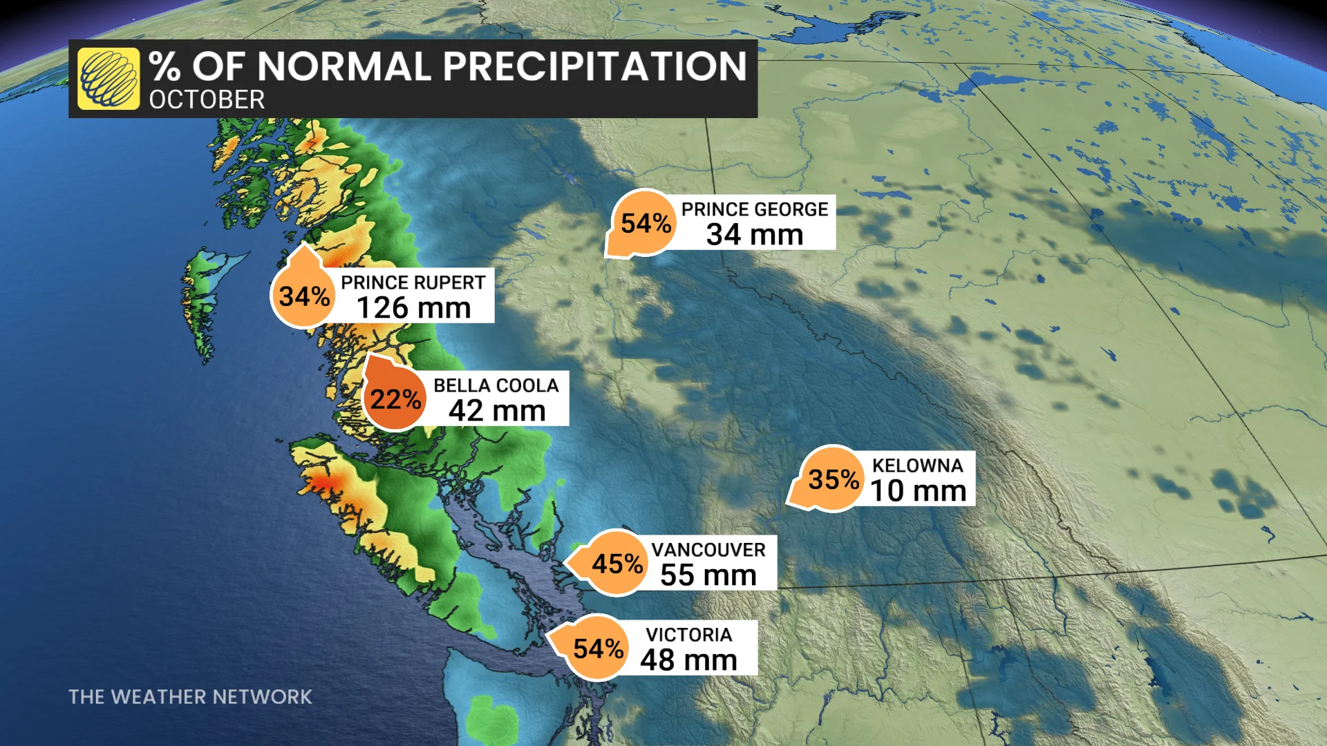
Even with this wet week ahead, the monthly averages may be difficult to achieve.
Temperatures across most of the province are forecast to remain cooler-than-seasonal normals through the end of the month, with daytime highs more typical of early November.