
Ontario welcomes first day of spring with burst of snow and ice
Spring arrives in Ontario with freezing rain, snow, and several weekend clipper systems
Expect delays on the roads Friday, as a round of wintry precipitation moves through southern Ontario.
Freezing rain will lead to some icy surfaces north of the 401, while a fresh blanket of snow falls across portions of eastern Ontario.
Rush hour traffic could be affected as accumulating snow or ice pellets make roads and walkways challenging to navigate.
DON'T MISS: Did the groundhogs get it right? Grading this year’s furry forecasters
Another system arriving this weekend will bring a renewed chance for wintry weather during the first full weekend of spring.
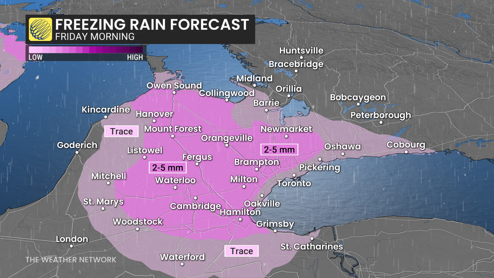
Risk of freezing rain and ice pellets Friday
A swath of snow, freezing rain, and regular old rain will spread into southern Ontario through Friday morning as a clipper system moves in from the Prairies.
RELATED: Friday's Vernal Equinox ushers in astronomical spring for 2026
Light freezing rain is expected from the Bruce Peninsula across the Dundalk Highlands and Oak Ridges Moraine east toward Prince Edward County and Kingston.
These areas could see a few millimetres of ice accretion through the morning, which could create some slick surfaces north of Highway 401.
We’ll see precipitation transition to rain across the Greater Toronto Area (GTA) and to the southwest.
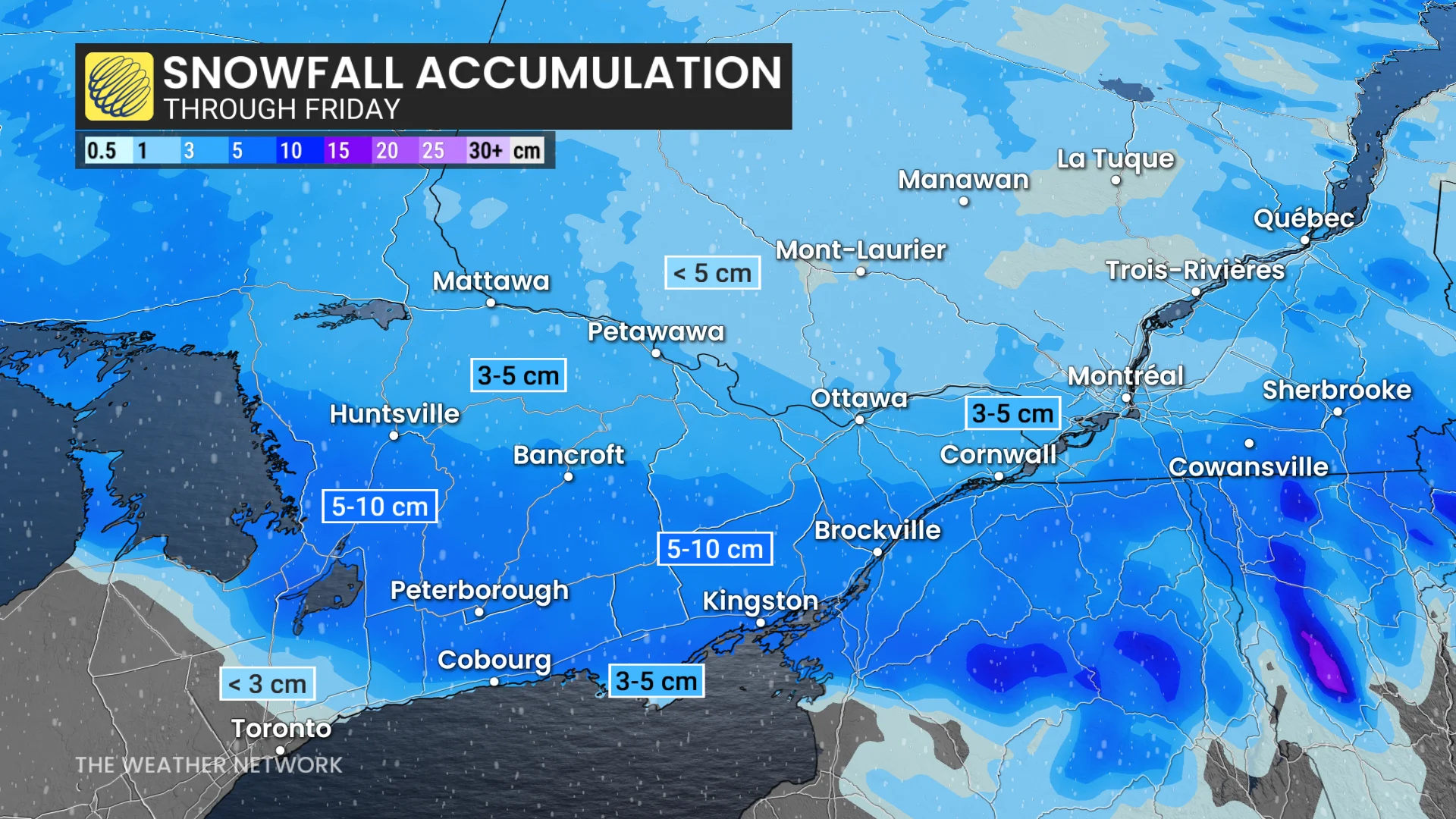
Meanwhile, a round of snow will bring 5-10 cm of accumulation to parts of eastern Ontario, including Bancroft and Brockville.
Breezy southerly winds will accompany this system as it moves through the region, with gusts of 30-60 km/h possible during the day Friday.
Folks in southwestern Ontario won’t have to worry about the wintry precipitation, as temperatures here could climb into the lower to mid-teens for some areas.
DON'T MISS: A potentially strong El Niño will develop by this summer
More wintry weather for the first weekend of spring
Looking ahead, we’ll see a pleasant start to the weekend before another system spreads across Ontario late Saturday and early Sunday.
This system could bring a mixture of snow, ice, and rain to the region as a boundary sets up over the region. Mild temperatures to the south of the boundary will contrast with conditions that are near or below the freezing mark to the north.
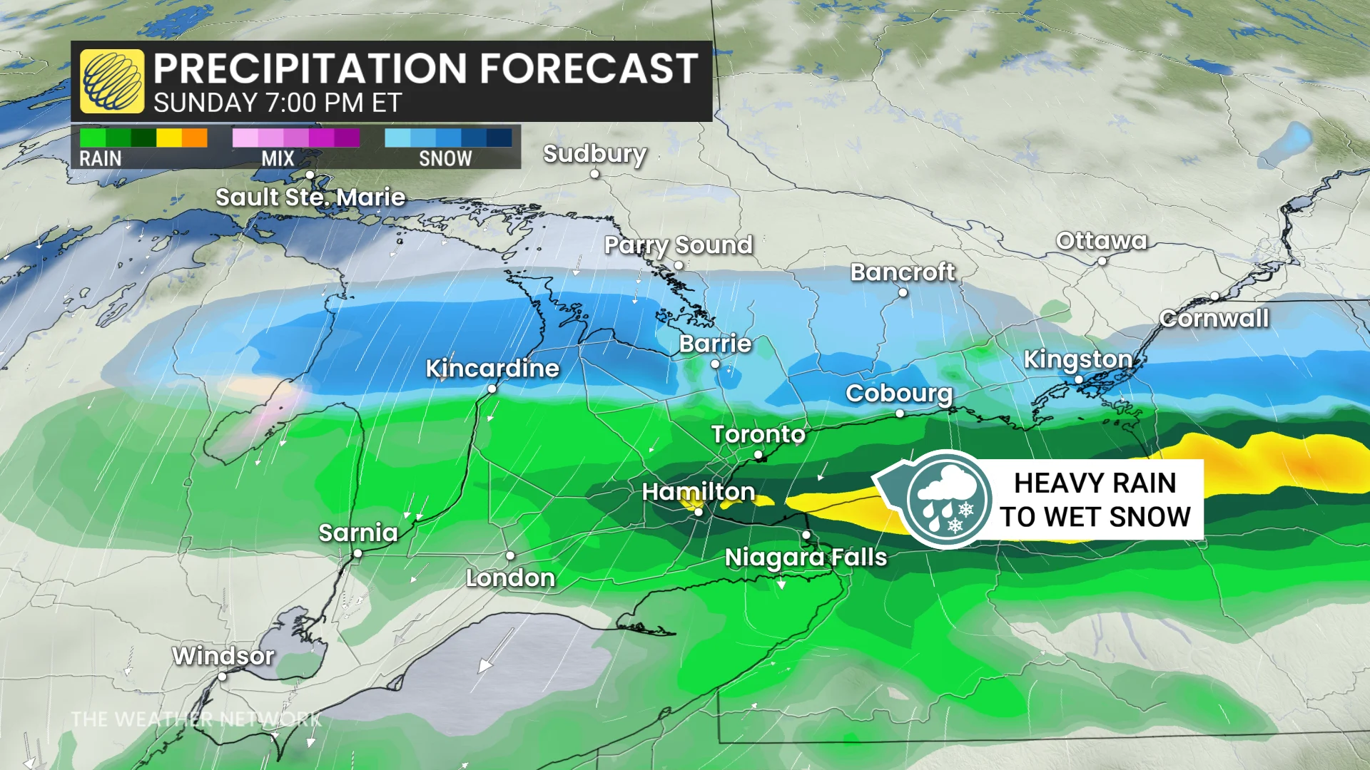
Yet another clipper will spread across the GTA and southern Ontario Sunday afternoon, with rounds of heavy rain, changing to snow by the evening.
Stay with The Weather Network for all the latest on conditions across Ontario.