Ice jam threat looms for southern Ontario amid mid-week rainfall

Rising temperatures and an approaching storm could lead to favourable conditions for ice jams throughout portions of southern Ontario
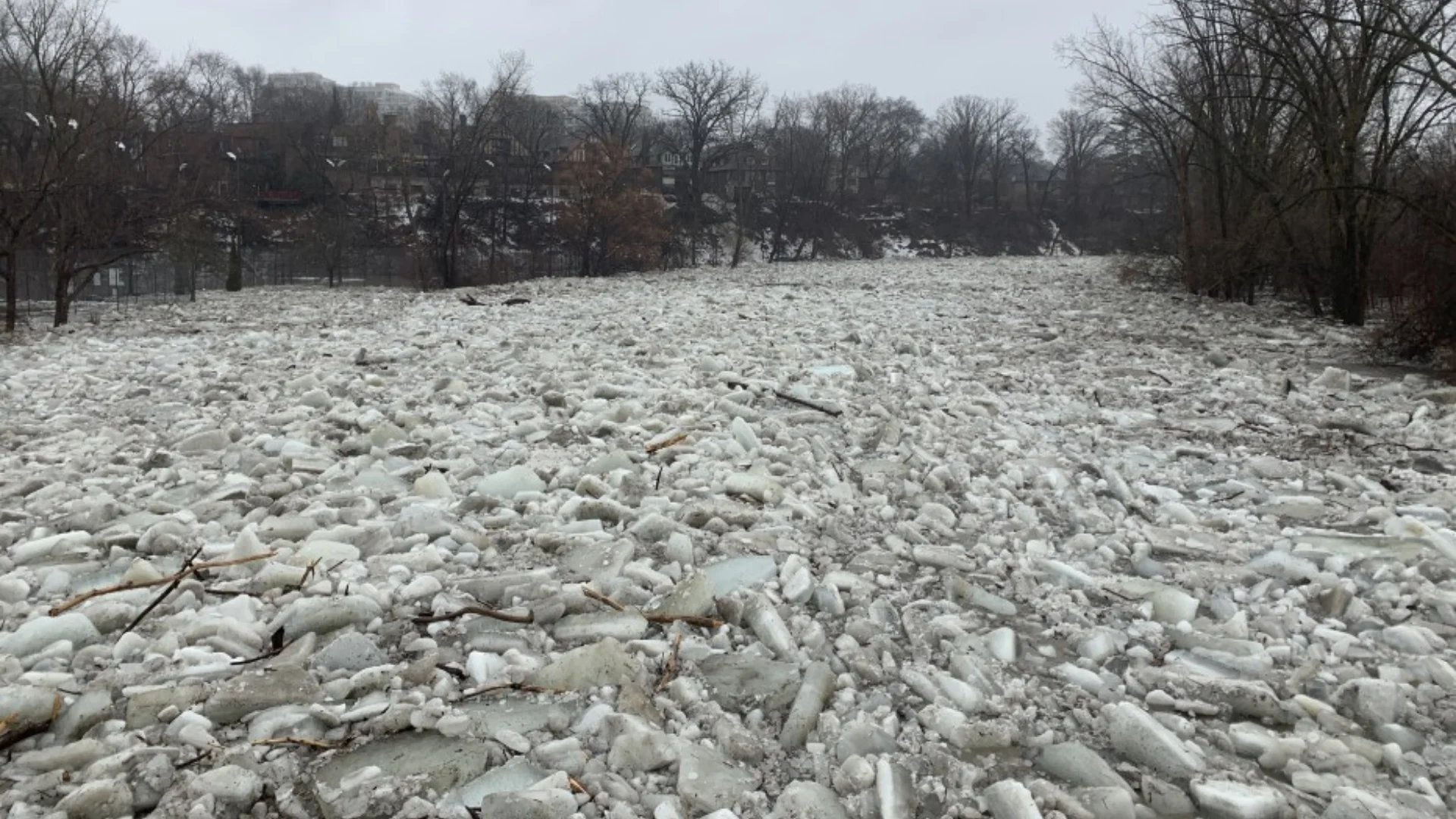
A significant temperature swing and an incoming Colorado low could set the stage for ice jams along the Humber River this week, echoing past events in 2019 and 2022.
With days of snowmelt, heavy rain, and then falling temperatures on Thursday, conditions align for potential flooding risks in flood-prone areas like Old Mill in Toronto.
GET THE LATEST: Colorado low to bring Ontario a buffet of wintry and spring hazards
Deep freeze sets the stage before the storm
Despite a gradual thaw the past week or so–with highs in the 4-6°C range softening river ice–the past 24 hours have seen some of the coldest temperatures of the entire season, plunging below -15°C.

This sudden deep freeze will harden the snowpack and river ice, which could break apart quickly when the next warm-up arrives.
The concern is that instead of a slow, gradual breakup, we could see an abrupt release of ice into the Humber River, a scenario that has contributed to past ice jams.

On Tuesday and Wednesday, a Colorado low will bring some steadier rainfall, totaling up to 10-20 mm, along with temperatures climbing to over 6°C. This will melt more snow and weaken river ice, potentially sending ice chunks downstream.
Similarities to February 2019 & 2022 ice jams
Both Feb. 8-9, 2019, and Feb. 17, 2022, events saw significant ice jams on the Humber River following this general setup:
Fluctuating temperatures (freeze, thaw, freeze)
A significant rainfall (10-20+ mm) driving runoff
A sharp drop back below freezing, forcing ice to stall and pile up
Grand River Threat
The Grand River Conservation Authority (GRCA) has flagged a moderate risk for ice jams due to the combination of snowmelt and rainfall forecast
Key areas prone to ice jams along the Grand River include the following:
Brantford
Cayuga
Conestogo & Grand Valley

In 2019, Cambridge saw one of the worst Grand River ice jams in recent memory, but current conditions aren’t at that level yet. However, residents along the Grand should stay vigilant as water levels rise this week.
What to watch for:
Rapidly fluctuating water levels on Wednesday
Ice build-up at known choke points in both the Humber & Grand Rivers
Sudden water level drop upstream, signaling a downstream jam release and potential river flooding downstream
While ice jams are difficult to predict precisely, residents near the Humber and Grand River should stay alert–flooding can occur rapidly and without notice.