
Hurricane season has passed peak, but the Atlantic shows renewed life
With the sluggish first half of Atlantic hurricane season over, what can we expect for the second? The U.S. National Hurricane Center (NHC) says it isn’t unusual for hurricane season to start late with these mixed factors
The Atlantic hurricane season has been unexpectedly calm so far, despite NOAA’s initial forecast that predicted a 60 per cent likelihood of above-normal activity this year.
RELATED: The high-stakes factors that decide where a hurricane tracks
With six named storms reported so far this year, those unfamiliar with hurricane season might assume this year is shaping up to be relatively calm.

Keeping in mind that the average for hurricane season is 14.7 for named hurricanes, with three major hurricanes on average (Category 3 or higher).
NOAA’s forecast for this year predicts 13–18 named storms, 5–9 hurricanes, and 2–5 major hurricanes, leaving ample room for outcomes ranging from near-average activity to more significant developments.

Saharan dust impedes tropical development
Despite extremely warm sea surface temperatures, the season has been relatively quiet so far. Factors such as wind shear and Saharan dust have suppressed tropical cyclone development.
Throughout the summer months, dry, sandy winds from the Sahara Desert often carry massive clouds of dust across the Atlantic Ocean. These large bursts of hot, dusty air are called Saharan air layers (SAL). They can significantly disrupt hurricane formation and even lead to hazy skies and poor air quality over parts of North America.
When a substantial surge of Saharan dust spreads across the tropical Atlantic, it can create environmental conditions that hinder tropical cyclone development.
READ MORE: Hurricane Erin is huge, how does it compare to previous storms?
This prevents storms from gaining strength and reaching the Americas.

Another reason? The NHC states that "60 per cent of the season's activity occurs after the peak," as highlighted in a recent explainer shared on X.
Hurricane season continues until November, leaving ample time for conditions to shift and for activity to increase. There is still enough time for storm numbers to align with forecasts before the season concludes by Nov. 30.

Watching a tropical disturbance closely
Already, as we move past what should be the peak of the season, things are starting to pick up. The NHC is tracking an area of disturbance that has an 80 per cent probability of cyclone development in the next seven days.
The area of showers and storms along a tropical wave is expected to move into a more favourable environment.
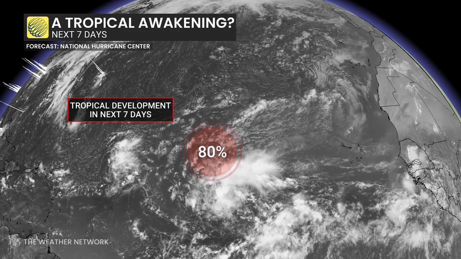
If it were to develop into a storm, it would be called Gabrielle, selected from the list of names for 2025’s hurricane season.
Environment and Climate Change Canada (ECCC) reports that Canada and its Atlantic waters face an average of six tropical storms annually, some of which intensify into hurricanes. With more than two months remaining in the Atlantic hurricane season, remaining vigilant is essential.