
Hurricane Melissa may impact Atlantic Canada this weekend. Here's what to know
Closely watching Hurricane Melissa's track and its possible impacts across parts of Atlantic Canada. Heavy rain and winds build through the weekend
Stay up-to-date with all hurricane developments on The Weather Network's tropical storm hub page.
Hurricane Melissa made its second landfall in Cuba early Wednesday, following its historic impact on Jamaica. The powerful storm previously caused significant damage in Jamaica, where it became the strongest hurricane ever recorded on the Caribbean island.
Hurricane Melissa's forecast path places its core over eastern Cuba on Wednesday, followed by a track through the southeastern or central Bahamas. The storm is projected to approach Bermuda late Thursday into Thursday night.
Melissa is expected to remain a powerful hurricane as it follows this trajectory.
DON'T MISS: How a mammoth hurricane rapidly intensifies in mere hours
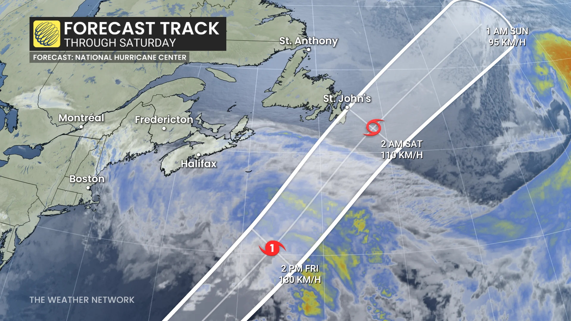
Forecasters are closely monitoring Hurricane Melissa’s track through the weekend, as well, with St. John’s, NL currently positioned within the U.S. National Hurricane Center's (NHC) forecast cone
The set up that could bring tropical impacts into Atlantic Canada this weekend
Parts of Atlantic Canada may experience impacts from Melissa and a developing low pressure system this weekend. A low advancing through Ontario and Quebec will reach the Maritimes on Friday, while Melissa remains offshore in the Atlantic, with the two systems likely to interact.
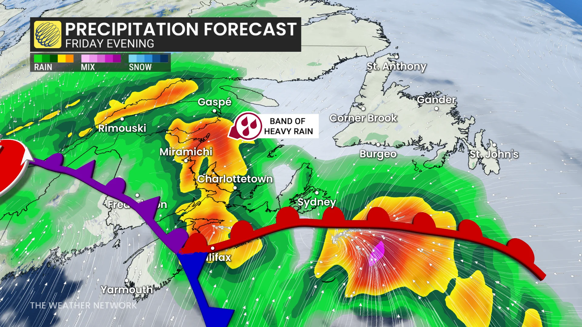
Heavy rainfall is expected as Melissa feeds tropical moisture into the low pressure system.
SEE ALSO: What does a hurricane's ‘cone of uncertainty’ mean?
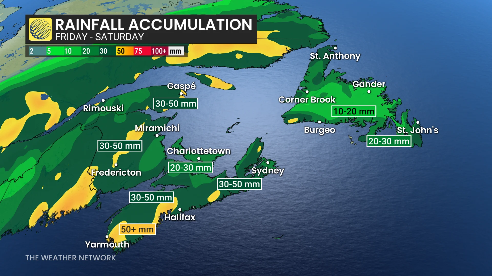
Widespread totals of 30-50+ mm are forecast across the Maritimes on Friday, with Halifax, N.S. seeing the heaviest rain by Friday afternoon. Rainfall will persist into the evening in eastern regions of the Maritimes.
Winds may strengthen, reaching 50-70+ km/h in many areas on Friday.
By Friday night into Saturday morning, Melissa’s weakening could expand its wind field, increasing the potential for gusty winds to impact Newfoundland.
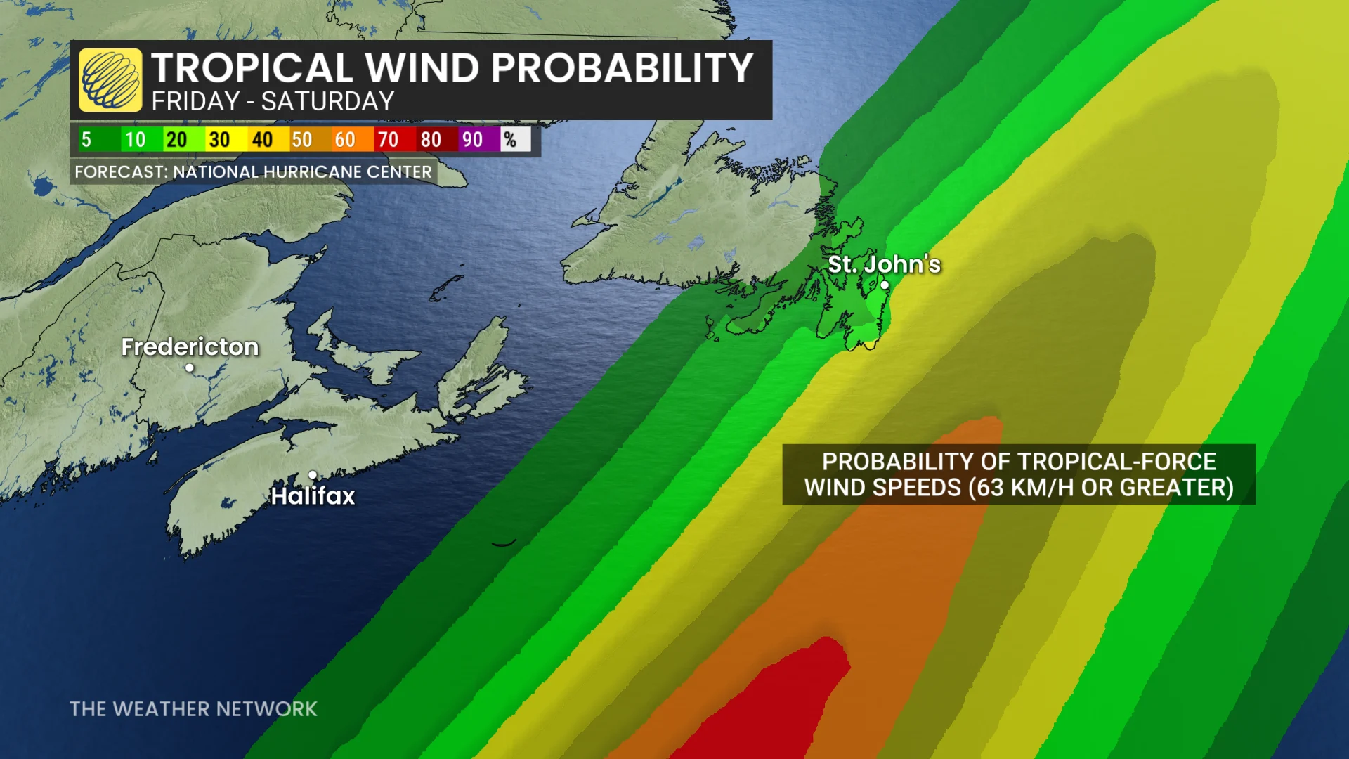
Gusts over 100 km/h are possible for parts of the Avalon Peninsula, including St. John’s, which is in the NHC forecast cone.

Forecast uncertainty remains regarding Melissa’s track and its interaction with the low pressure system. Further updates are expected as details evolve.