Hurricane Gabrielle hits Category 4, rip current risks in Atlantic Canada
Hurricane Gabrielle reaches Category 4 strength, and rip current risks persist in Atlantic Canada
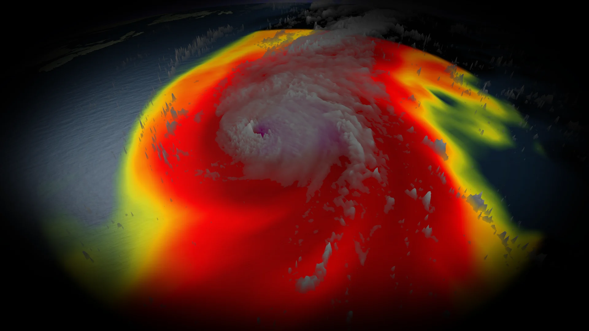
Hurricane Gabrielle formed over the open waters of the Atlantic Ocean on Sunday, making it the second hurricane of the 2025 Atlantic hurricane season.
By Monday morning, Gabrielle intensified into a major Category 3 hurricane, later reaching Category 4 status. As of early Tuesday, it sustained maximum winds of 220 km/h.

The U.S. National Hurricane Center (NHC) reports Gabrielle is moving northeast into the open central Atlantic, and residents in the Azores should monitor its progress.
DON’T MISS: Study urges forecasters to adopt new hurricane intensity scale
On the forecast track, the storm's centre will continue to move away from Bermuda on Tuesday, with gradual weakening anticipated over the next few days.
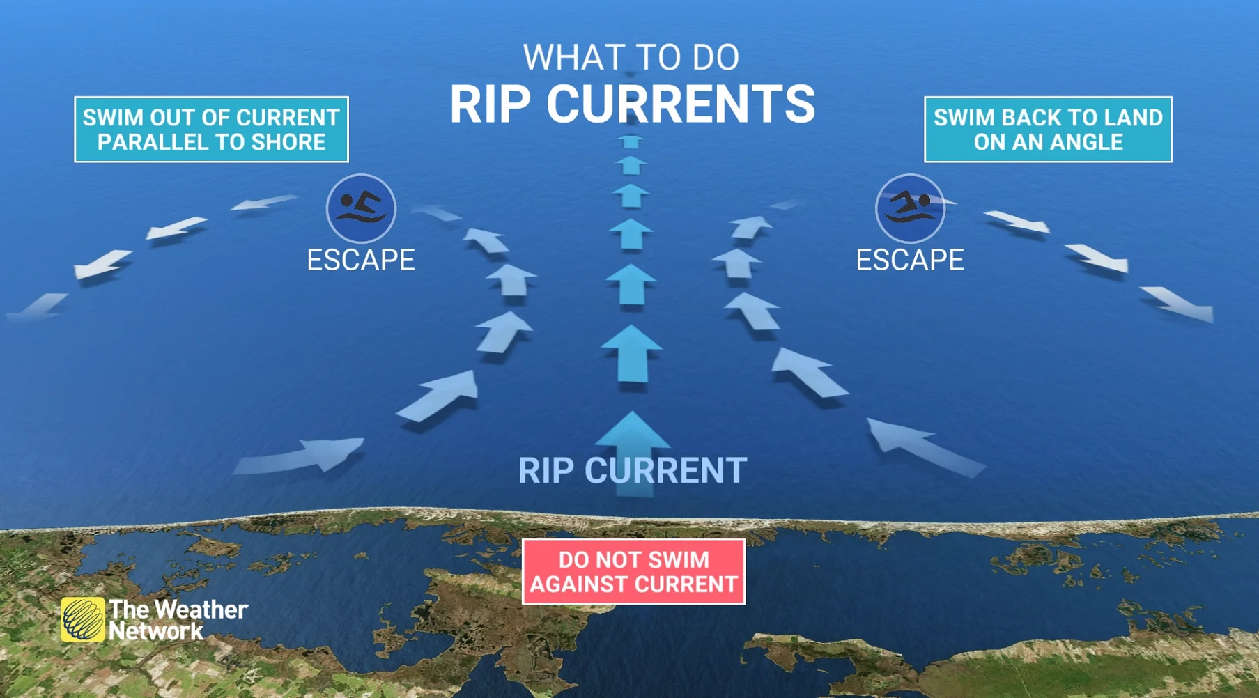
Swells from Hurricane Gabrielle will continue to impact Bermuda, U.S. East Coast, and Atlantic Canada
According to the NHC, swells from Gabrielle will continue to impact Bermuda, the U.S. East Coast from North Carolina northward, and Atlantic Canada in the coming days.
These swells are expected to create life-threatening surf and rip current conditions.

Rip currents pull away from the beach directly out to sea. These deadly hazards can pose a threat to even an experienced swimmer. Stay out of the water if rip currents are possible.
If you’re ever caught in a rip current and you can’t swim, don’t panic. Calmly signal for help and tread water until assistance arrives. Folks experienced in swimming should swim parallel to the beach until out of the rip current, then swim directly back to shore.
Gabrielle is the second major hurricane to form in the Atlantic basin during the 2025 season. It follows Hurricane Erin, which developed last month. Erin reached Category 5 status, becoming the second most intense hurricane globally so far this year.
MUST SEE: What does a hurricane's ‘cone of uncertainty’ mean?
In the wake of Hurricane Gabrielle, forecasters are keeping a close eye on two areas with potential for tropical development in the next seven days.

These systems could contribute to continued activity in the Atlantic basin.