How a typhoon will reinforce temperature flip-flop in Canada

It's a tale of two forecasts across Canada for early October. A recurving typhoon in the Pacific is set to influence Canada's weather, bringing warmth to some, and a chill to others
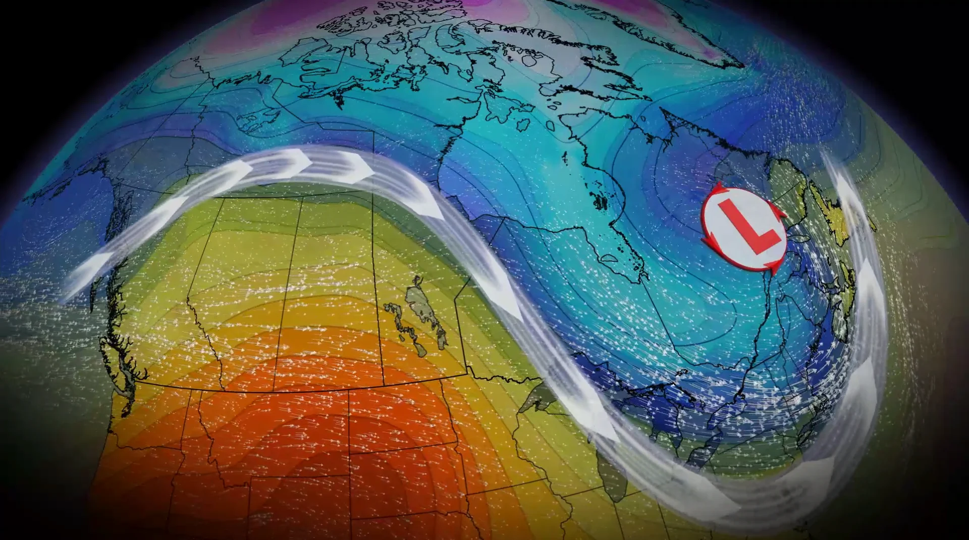
A temperature shift is ongoing in Canada and will continue into next week, with cooler fall conditions expected in the East while the West retains warmer patterns.
Typhoon Choi Wan is going to reinforce that pattern into the middle of the week as the storm injects itself into the jet stream, with the oscillation leading to troughing in the East and ridging in the West.
SEE ALSO: October Outlook: Canada's great fall flip—what to expect this month
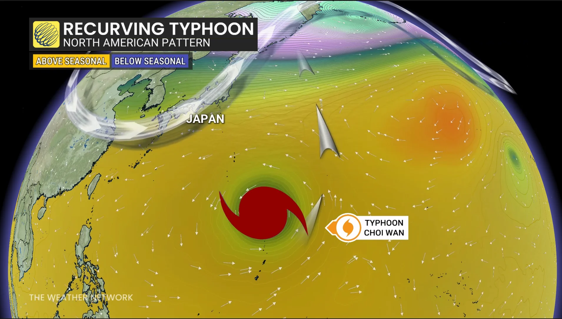
Typhoons that recurve out of the western Pacific Ocean often race toward the Arctic Circle and disrupt the jet stream. These interruptions can have ripple effects that carry for thousands of kilometres downwind.
Dry, warm weather settles in the West
A ridge of high pressure will strengthen and spread north and east across B.C. and the Prairies through this weekend. As a result, dry conditions and above-normal temperatures are expected.
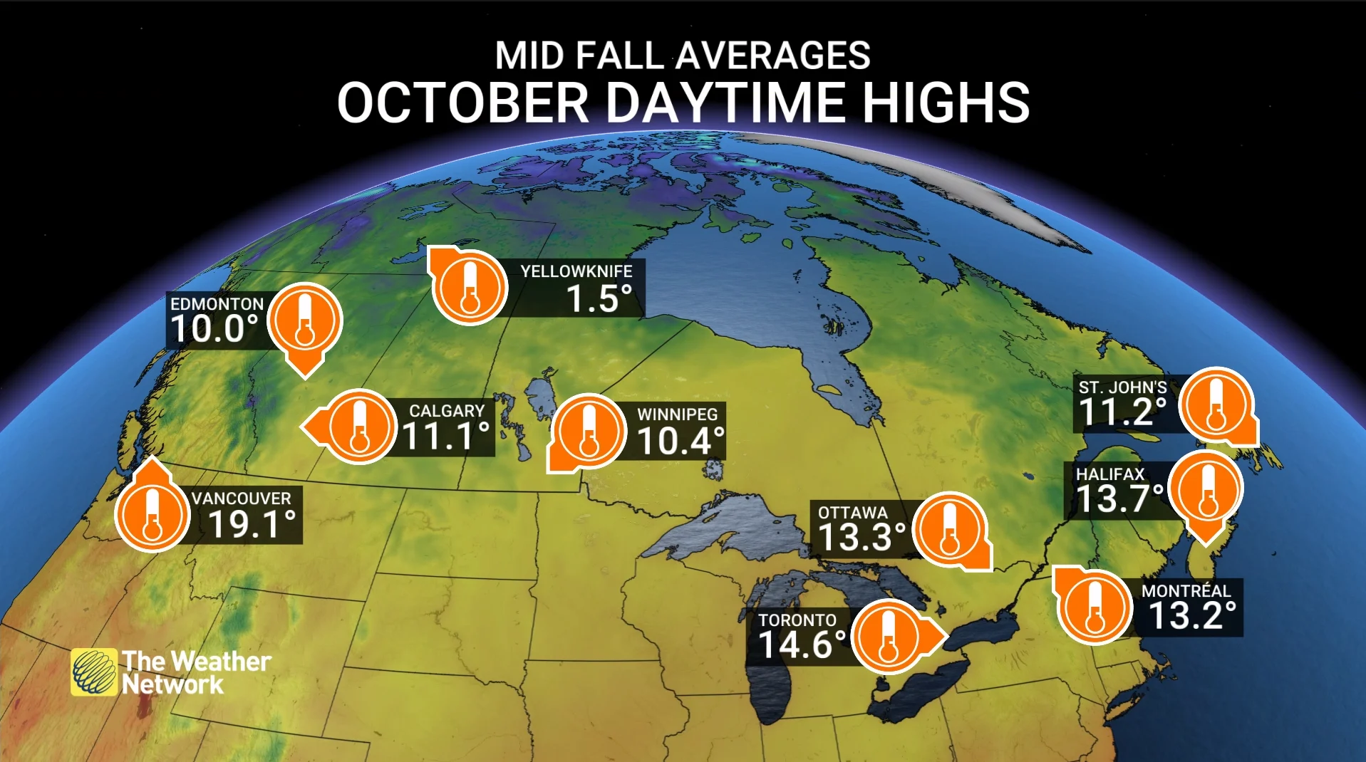
Southwestern Canada's normal daytime highs for early October range in the mid-teens. This weekend, however, a large region will likely tip into the low- to mid-20s.
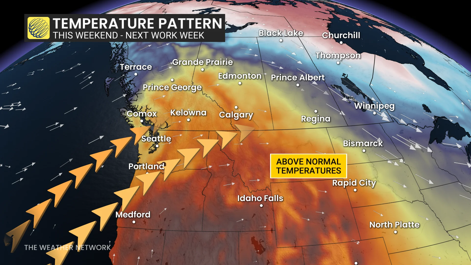
Sunday will see feels-like values in the 20s in B.C.'s Okanagan Valley.
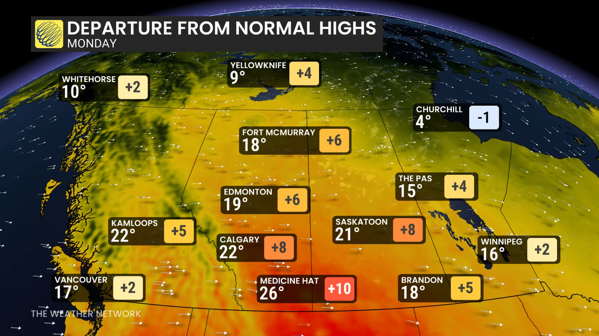
In Alberta, the provincewide warm up begins Sunday but peaks Monday. Impacts will be found in most of Saskatchewan. A daytime high of 19°C is forecast for Edmonton, Alta., with 21°C projected in Saskatoon, Sask.
There will be chances for 26°C or warmer in Lethbridge and Medicine Hat, Alta, and southwestern Saskatchewan.
The warm temperatures may not only extend patio season, but moderate, overnight lows forecast means a reduced frost threat.
Plus, the dry conditions are welcome on the southern Prairies where the fall harvest is still ongoing.
Both outcomes bring good news for the harvest that is less than 60 per cent complete, behind schedule considering that it is typically more than 80 per cent at this time.
Cold, unsettled weather moves into the East
Meanwhile, much cooler weather can be found in the East as a cold front bringing rainfall across Ontario and Quebec is going to open the floodgates of chilly air.
The first round of showers begins across northeastern and southern Ontario through Sunday morning, with a second occurring through Sunday evening for the latter and Quebec.
Rainfall amounts will be the highest in northern Ontario, with less than 5 mm in the south and 5-10 mm in southern Quebec.
The cold front will drop temperatures on the back end with a northwesterly flow through Monday and Tuesday.
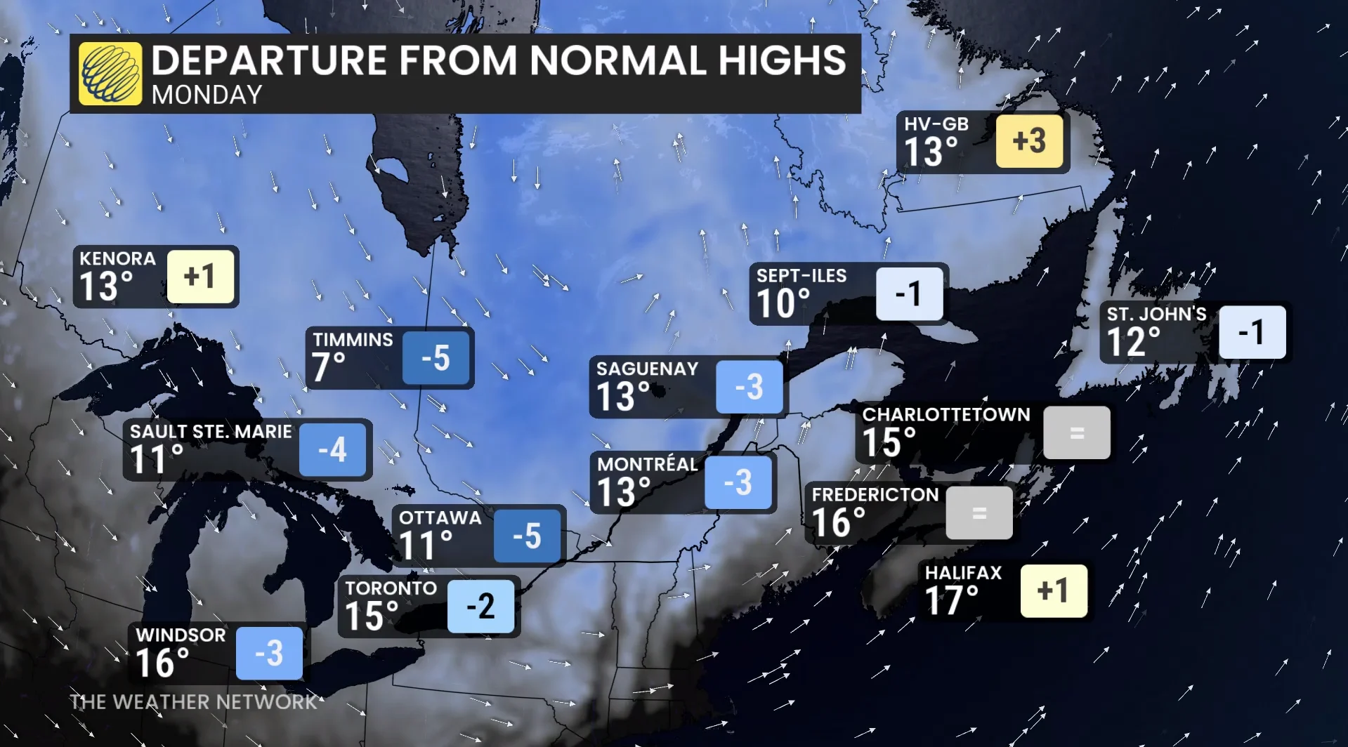
Temperatures will fall 5°C to 10°C below seasonal for this time of year, with Ottawa sitting at a high of 11°C on Monday--its coldest, daytime high since May 13.
Folks can expect widespread freeze and frost conditions through early next week, so people will want to take preventative measures to protect cold-sensitive plants, trees, and crops.
With files from Rhythm Reet, a meteorologist at The Weather Network.