Highway closures begin as second stormy system takes aim at northern Ontario
Back-to-back storms could bring up to 50 cm of snow to parts of northern Ontario this Easter weekend. An icy mix is expected to continue to create hazardous travel on sections of Hwy 11 and Hwy 17
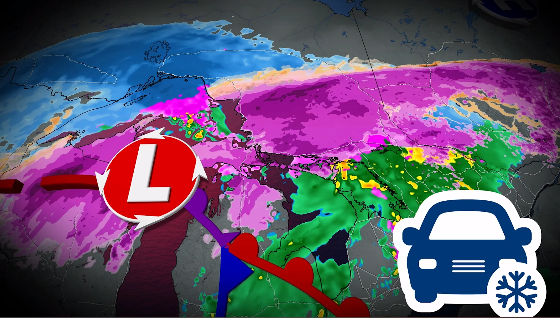
Two Colorado lows will sweep across Ontario this Easter weekend, bringing close to 50 cm of snow to northern regions. Road closures and isolated power outages are possible.
Weather Highlights:
Friday (First Low): Heavy snow (15-30 cm) and freezing rain from Lake Superior to Sudbury
Saturday (Second Low): Additional 10-20 cm of snow, with 6-12 hours of freezing rain from Wawa to Timmins. Road closures likely
Sunday: Snow tapers off by afternoon; regions with ice/rain transition to flurries. Snow totals may exceed 50 cm in northeastern Ontario.
DON'T MISS: Will Canada's April bring a summer preview or a winter rewind?
First system: Heavy snowfall, freezing rain closes highways Friday
Heavy snow fell across northern Ontario Thursday night, with some freezing rain in the mix for parts of northeastern Ontario. Several highway sections closed early Friday morning across the northeast due to the dangerous conditions created by the heavy snow and ice.

Highway conditions will continue to be hazardous across all of northern Ontario, including the northwestern region, throughout the weekend.
Second System: An additional 10-20 cm of snow Saturday through Sunday
A second low will move through Saturday, adding 10-20 cm of snow and several hours of freezing rain (6-12 hours) from Wawa to Timmins. Mild air will push north of Sudbury, bringing icy precipitation, while road closures and power outages remain possible.

RELATED: How Colorado lows and Texas lows affect our weather in Canada
By Sunday afternoon, snow will ease, with areas transitioning from ice and rain to flurries.

By the end of the two systems, parts of northeastern Ontario could receive 30-50+ cm of spring snow!
Below-normal temperatures are expected for most of next week, with a brief warm-up possible mid-week as a strong clipper system moves across northern parts of the region.