Tornadic opportunity on the table for the Prairies with severe storm setup
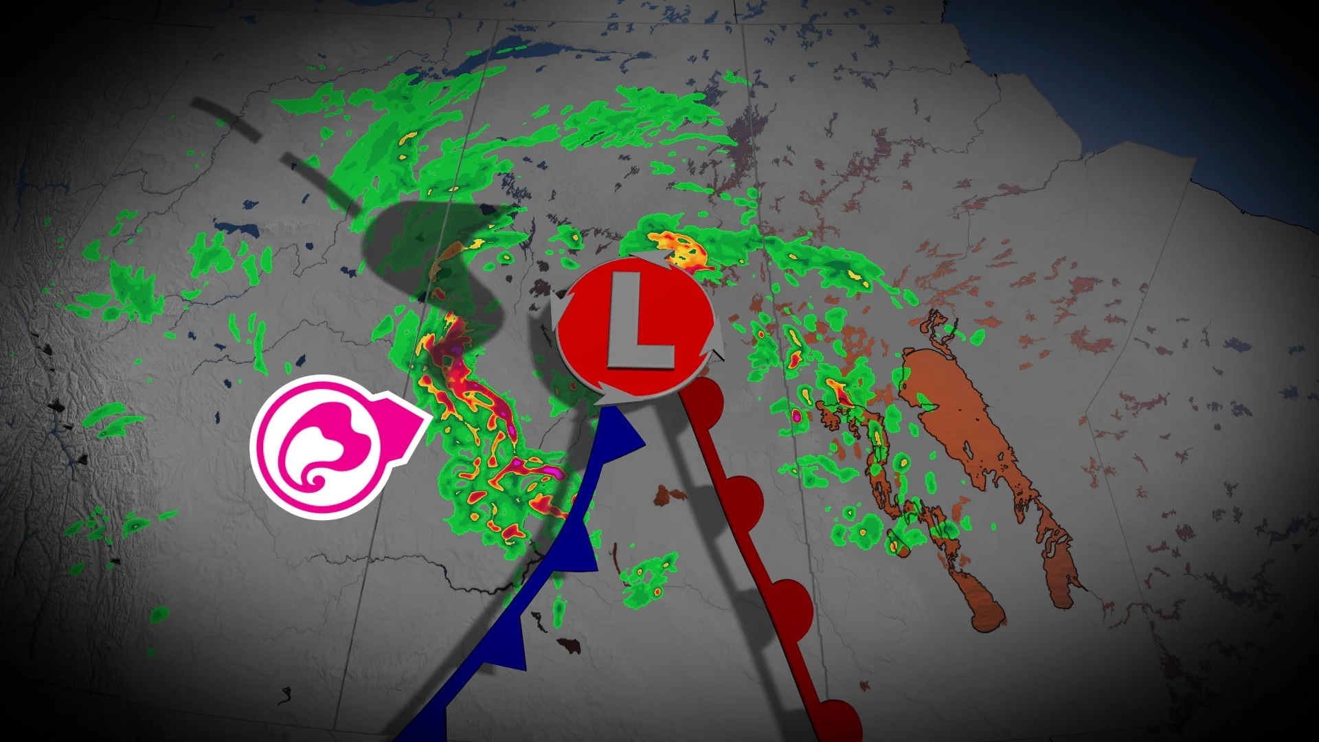
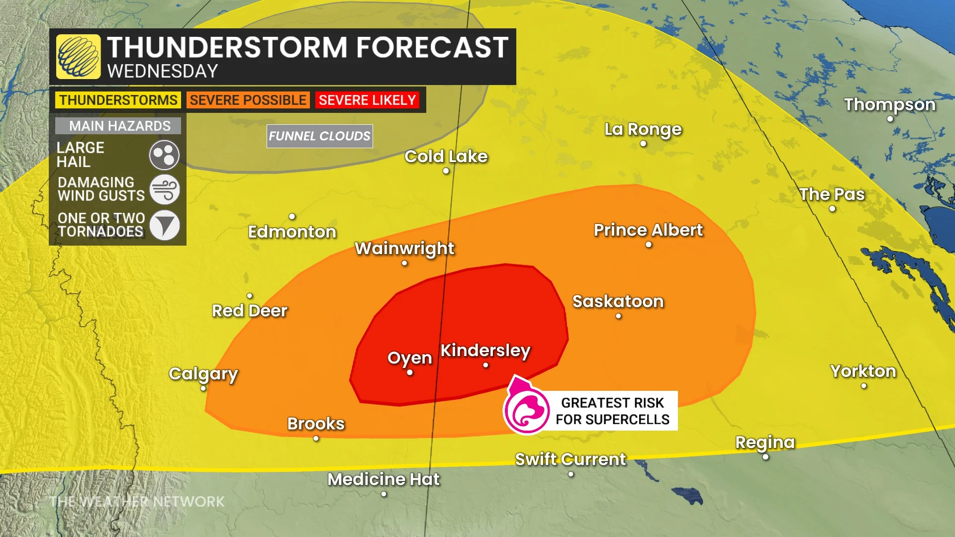
Wednesday will see beneficial rainfall head to the Prairies, but will also feature a favourable environment for severe storms, especially in southern Alberta and Saskatchewan, where the threat for supercells and one or two tornadoes will be present
Western Canada will be seeing a pattern shift this week, with Mother Nature bringing relief to the wildfire-, heat-and dry-stricken regions.
But for the Prairies, the rainfall will be accompanied by a threat for severe weather over multiple days this week. Wednesday will be a day to monitor the skies and forecast closely in southern Alberta and Saskatchewan, especially, with a prime environment for severe storms, large hail, damaging wind gusts and supercells--with one or two tornadoes on the table.
DON'T MISS: Get the latest wildfire news and safety tips to help you stay safe
Northern sections of Alberta could see non-severe storms, with the chance of funnel clouds, on Wednesday.
It'll be important to remain weather-aware, and stay up-to-date on all of the latest watches and warnings as conditions change.
Wednesday: Severe storm risk, but with much-needed rainfall
An upper-level low colliding with a warm ridge of high pressure will create an unstable atmosphere across the Prairies on Wednesday.
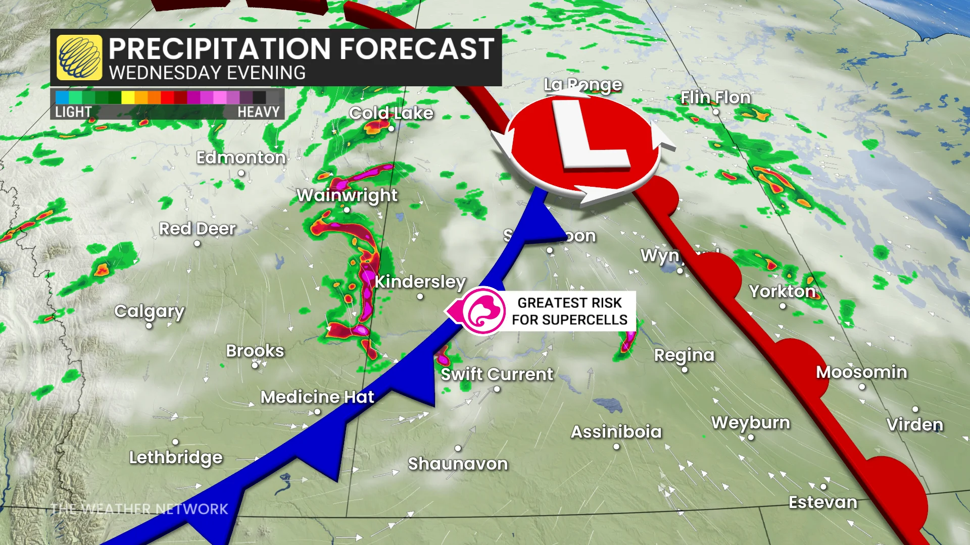
Isolated thunderstorms are expected to develop across northern and central Alberta and Saskatchewan during the afternoon, with a stronger storm potential emerging from areas east of Calgary to Saskatoon by early evening.
Confidence has grown for a supercell or two to develop in Alberta and track east into Saskatchewan. These storms carry the risk of large hail (3-5 cm in size), wind gusts between 90-100 km/h, and the possibility of one or two tornadoes.
There will be the potential for damaging wind gusts up to 90-110 km/h as storms mature and track into Saskatchewan.

DON'T MISS: 2025 is Canada's second-worst wildfire season on record for area burned
By overnight Wednesday, the storm lifts into northern areas, delivering desperately needed rainfall to wildfire-affected regions in Saskatchewan and Manitoba. Rainfall totals could reach 30-50 mm in these zones, continuing into Thursday.
There is also an isolated potential for some large hail to fall through the overnight period, as well.
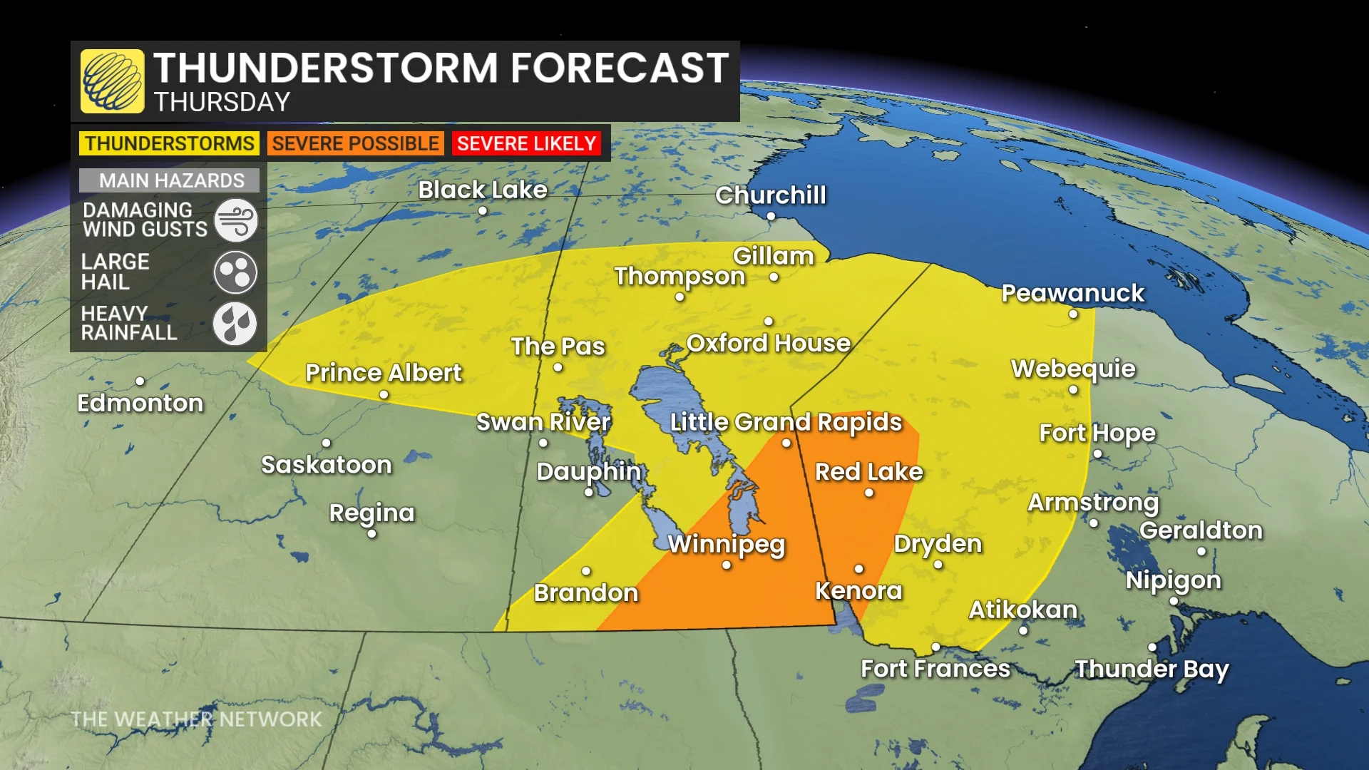
Thursday: Storm risk moves east, Alberta significantly cools
By Thursday, the storm system will shift eastward, bringing a significant cooldown to Alberta, with daytime highs falling below 17°C.
SEE ALSO: Canada’s rain gauge runs dry, cities top weeks without rain

In southern Manitoba and northwestern Ontario, high thunderstorm energy will build through the afternoon. The system’s advancing cold front is expected to trigger potentially severe storms by late afternoon into the evening.
While specific impacts remain uncertain at this time, the environment near Winnipeg and areas to the east appears favourable for severe weather, including the potential for large hail and damaging winds. Further updates will refine specific risks closer to the event.
Beyond, temperatures will be changeable through the weekend. Northern areas will be cooler than normal, but the southern Prairies will end up warmer than normal with a couple rounds of warmer weather surging north of the U.S. border. Warmer-than-normal temperatures will dominate next week.
Be sure to check back for the latest updates across the Prairies