High thunderstorm energy threatens large hail, tornadoes over the Prairies
Prairies to see some much-needed rain in fire zones, but with severe storms also possible in the south mid-week.
Desperately needed rainfall is on its way to wildfire-affected regions of the Prairies this week.
DON'T MISS: Get the latest wildfire news and safety tips to help you stay safe
Meanwhile, some southern sections could face the risk of severe thunderstorms by mid-week. These storms may bring heavy rain, hail, and strong winds to localized areas. Supercell storm types would also increase the risk for large 3 cm-sized hail and possibly one or two tornadoes.
It'll be important to remain weather-aware, and stay up-to-date on all of the latest watches and warnings as conditions change.
Wednesday: Severe storm risk, but with much-needed rainfall
An upper-level low colliding with a warm ridge of high pressure will create an unstable atmosphere across the Prairies on Wednesday.
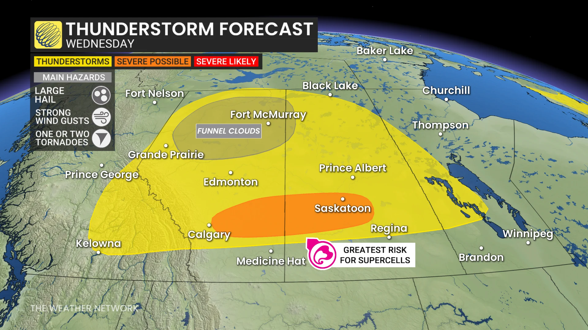
Isolated thunderstorms are expected to develop across northern and central Alberta and Saskatchewan during the afternoon, with a stronger storm potential emerging from areas east of Calgary to Saskatoon by early evening.
There is a possibility of supercell storms forming in Alberta and tracking eastward into Saskatchewan. These storms carry the risk of large hail (up to 3 cm in size), wind gusts between 90-100 km/h, and the possibility of one or two tornadoes.
As the storms mature and move into Saskatchewan, the risk for severe weather remains heightened. Uncertainty in forecast models persists, so updates on the thunderstorm risk should be monitored closely.
DON'T MISS: 2025 is Canada's second-worst wildfire season on record for area burned
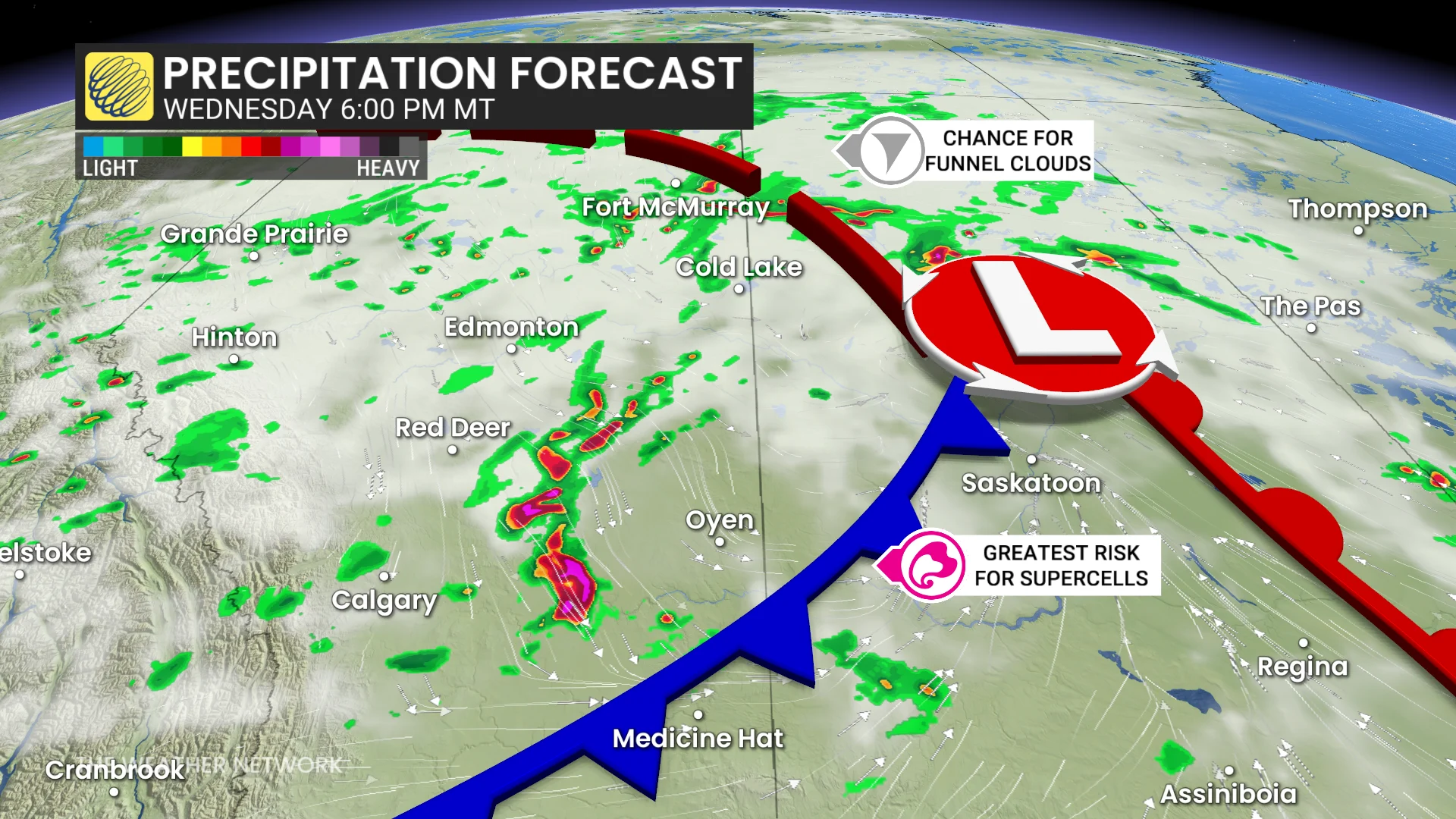
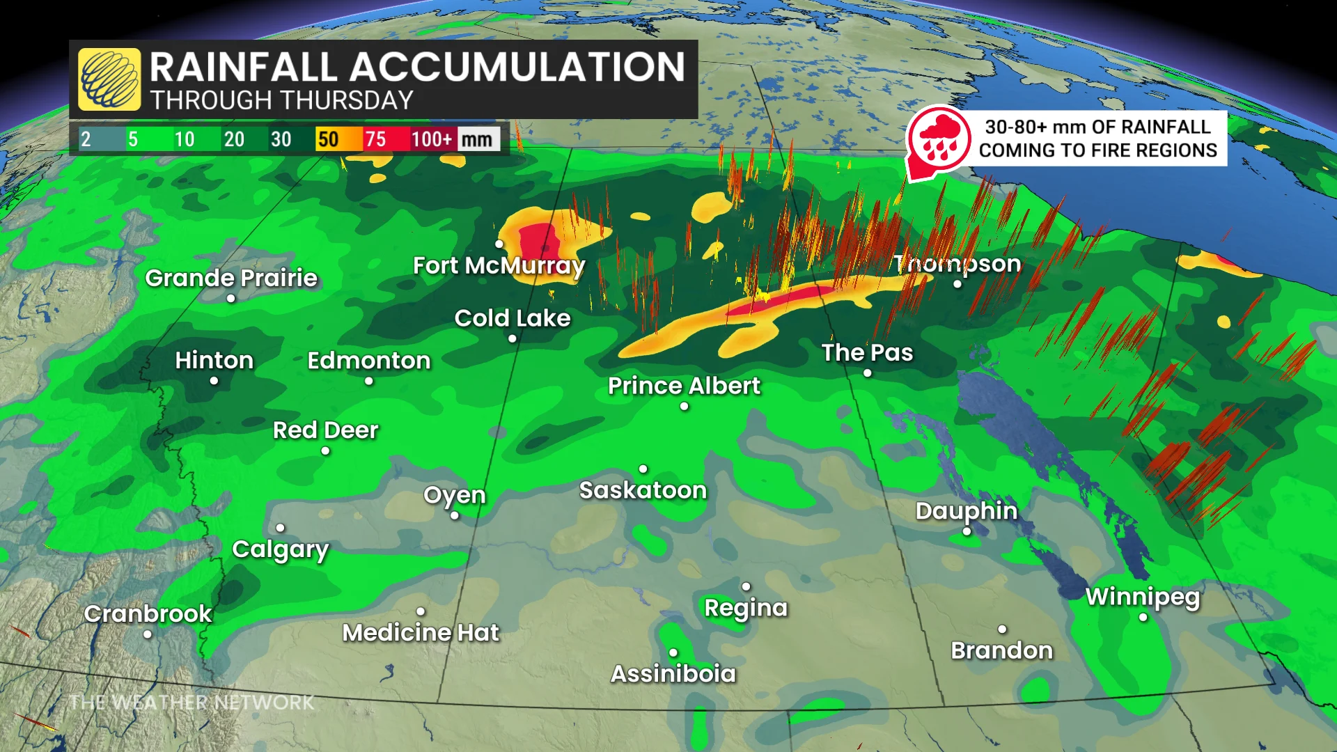
By overnight Wednesday, the storm lifts into northern areas, delivering desperately needed rainfall to wildfire-affected regions in Saskatchewan and Manitoba. Rainfall totals could reach 30-50 mm in these zones, continuing into Thursday.
Thursday: Storm risk moves east, Alberta significantly cools
By Thursday, the storm system will shift eastward, bringing a significant cooldown to Alberta, with daytime highs falling below 17°C.
SEE ALSO: Canada’s rain gauge runs dry, cities top weeks without rain
In southern Manitoba and northwestern Ontario, high thunderstorm energy will build through the afternoon. The system’s advancing cold front is expected to trigger potentially severe storms by late afternoon into the evening.

While specific impacts remain uncertain at this time, the environment near Winnipeg and areas to the east appears favourable for severe weather, including the potential for large hail and strong winds. Further updates will refine specific risks closer to the event.
Be sure to check back for the latest updates across the Prairies