
Heavy, wet snow may slow your weekend travels
Expect a sloppy, snowy system to push through Atlantic Canada this weekend
A cross-country system that’s made a mess of travel from Calgary to Toronto will arrive on the East Coast this weekend with a dollop of heavy, wet snow across the region.
We’ll see a blanket of fresh snow across all four provinces through Sunday. Expect slow travel and reduced visibility during periods of heavier precipitation.
DON’T MISS: A potentially strong El Niño will develop by this summer
Snow arrived in the Maritimes on Saturday
Wet snow moved into the western Maritimes on Saturday morning before pushing east into the eastern half of the region.
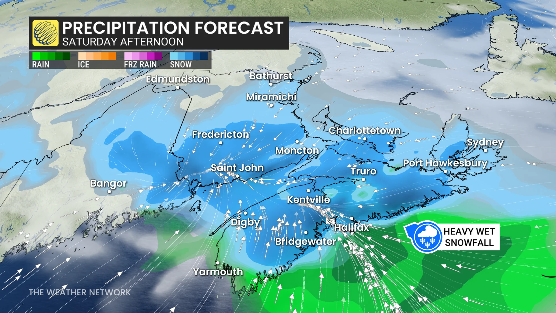
Snow then increased in intensity on Saturday afternoon. Heavy snowfall rates will quickly slicken roads and sidewalks.
The greatest snowfall totals will fall around the Bay of Fundy and across Prince Edward Island, where 10-15 cm is in the forecast by the time snow wraps up Saturday evening.
Lower totals are possible in southern Nova Scotia where borderline temperatures may lead to rain mixing in with the snow.
Heavy snow covers Newfoundland into Sunday
Our system will push flurries into Newfoundland’s southern shores by Saturday evening, with snowfall rates increasing as the precipitation spreads into St. John’s and central Newfoundland through the overnight hours.

Wind gusts of 60-90 km/h will reduce visibility, especially during periods of heavy snowfall.
Widespread snowfall totals of 10-20 cm are in the forecast across central and eastern Newfoundland. Communities on the western shores of the island may see 20-30 cm of snow when you factor in Friday’s precipitation and sea-effect snow expected on Saturday.
Stay with The Weather Network for all the latest on conditions across Atlantic Canada.