Heavy rain and snow: Typhoon remnants set to shake up B.C.'s pattern
Remnants of Typhoon Nakri are heading toward British Columbia, bringing strong winds and heavy rainfall
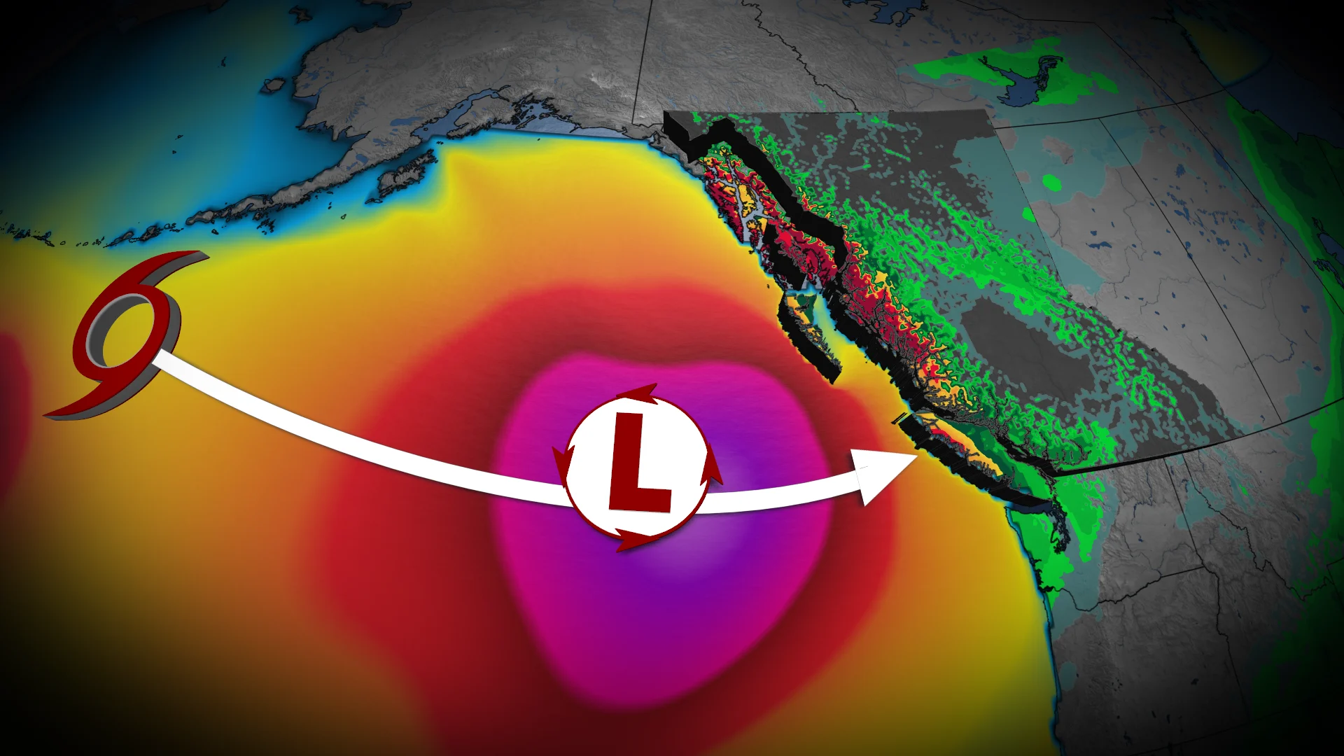
Typhoon Nakri affected Japan’s east coast last weekend. Now, a strong low pressure system over the Aleutian Islands is expanding across Alaska and will help steer Nakri's remnants across the Pacific.
DON'T MISS: What’s the difference between hurricanes, typhoons, and cyclones?
Through Friday, these remnants are expected to intensify along the jet stream, further deepening the trough over the Aleutians. Remnant typhoon energy will sweep into B.C., delivering heavy rain, strong winds, and lowering freezing levels, resulting in significant high-elevation snowfall.
Heavy rain and snow move into B.C. through Saturday
Rain will begin affecting B.C.’s coastline overnight Friday, spreading to the South Coast by Saturday morning. Heavier rainfall will move through the Sunshine Coast by Saturday afternoon.

The system is expected to produce significant high-elevation snow across the coastal mountains through Saturday afternoon, with freezing levels for the South Coast hovering around 1300–1400 m between Saturday and Sunday.
Snow will fall at high altitudes with valley regions transitioning to rain by Saturday evening.

The central coast could see rainfall totals of 75–100 mm, while the Lower Mainland is forecast to receive 15–40 mm.
Gusty winds and rough waters arrive with the system
Windy conditions are also expected with this system.
Gusts of 70–90 km/h are anticipated for the central coast Saturday afternoon into evening. The Strait of Georgia could see gusts of 40–60 km/h, potentially impacting ferry schedules. Showers will persist intermittently into Sunday.
The primary concern remains rough waters heading into the day. Wave heights off the west coast of Vancouver Island are forecast to range from 3–7 m. By Sunday evening, the Strait of Juan de Fuca may experience waves reaching up to 3 m.

Powerful Pacific jet will bring a stormy end to October
This will be the start of a much wetter pattern for the final two weeks of the month.
A powerful Pacific jet will bring a parade of low pressure systems for the rest of October, with above normal precipitation totals likely, including alpine snow. The central coast is expected to bear the brunt of these systems.
Temperatures across most of the province are forecast to remain cooler than seasonal normals through the end of the month.