
Avalanche risk rises in B.C. as heavy mountain snow, rain get underway
Heavy rains and alpine snow is impacting British Columbia's South Coast this week, raising the avalanche danger throughout the region.
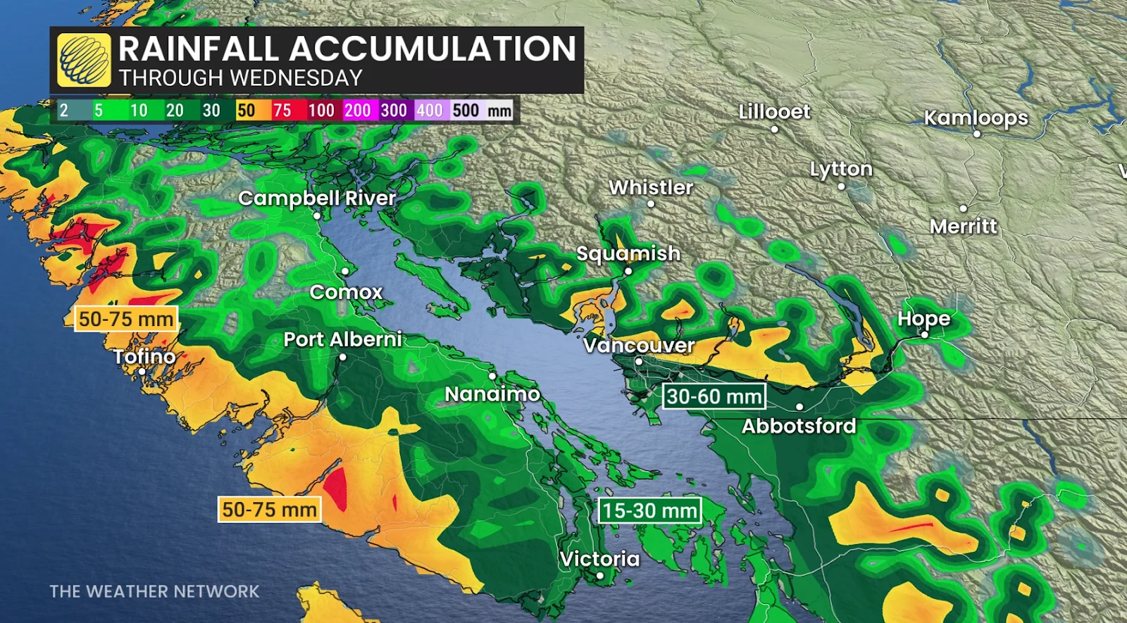
An Alaskan low is bringing heavy rain and snow to B.C. this week, lowering freezing levels and creating challenging wintry conditions in mountain passes and higher elevations.
DON'T MISS: January outlook: Winter hits pause in Canada before striking back
Significant snowfall is expected in alpine areas, with the potential for low-elevation snow later in the week, as well.
Snow threat creeps into the Lower Mainland Wednesday
On Wednesday, another wave of moisture moving south from the Gulf of Alaska will slip along the coast and bring another 10-20 mm of rain to the Lower Mainland.
RELATED: Why B.C.'s Coquihalla Highway is a danger in the fall and winter
By Wednesday night, temperatures near the freezing mark may allow a transition to a wintry mix or snow for some lower-elevation communities.
Heavy snow raises avalanche danger
In all, between 20-40+ cm of snow is forecast for Cypress and Grouse Mountain in the North Shore Mountains, with 10+ cm of snow forecast for Big White and Silver Star.

Avalanche Canada raised the avalanche danger rating across much of the region, including the South Coast, Vancouver Island range, and parts of the Rocky Mountains, due to the heavy snowfall, blustery winds, and warming temperatures making the snowpacks unstable.
WATCH: January cold hits pause before winter stages a comeback
Be sure to check back for the latest weather updates across B.C.