Heat wave breaks with major cool down in Ontario, and rounds of rain on tap
Ontario’s heat wave is coming to an end as a major cooldown sweeps in, bringing more comfortable temperatures, but with rounds of rain through the region
Ontario's first heat wave of the summer, which brought record-breaking heat and humidity, will end this week as cooler temperatures and widespread rain arrive.
DON'T MISS: The Weather Network's exclusive summer 2025 forecast
By Thursday, much of the province will feel an abrupt temperature drop following highs earlier in the week that reached the mid to high 30s. The relief from the heat, however, comes with rounds of rain that will likely persist into Saturday for many areas.
First round of rain hits southern Ontario Thursday as temperatures take a significant tumble
Rain will begin early Thursday morning in the Nickel Belt, spreading into central Ontario by midday, and eastern Ontario by the afternoon.
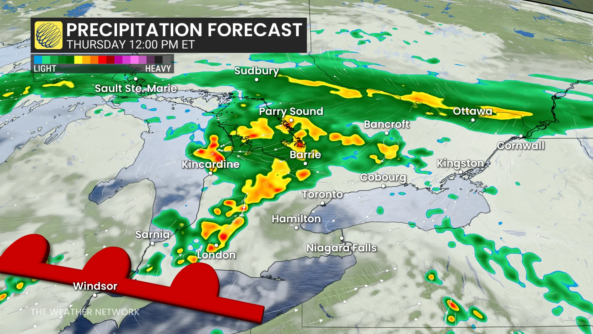
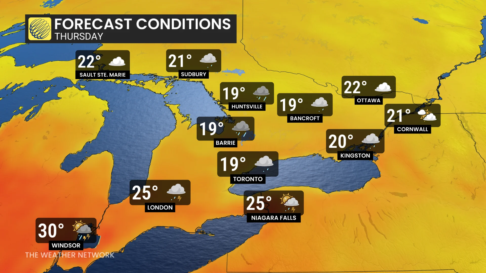
Southwestern Ontario will experience a mix of dry conditions and passing showers, while remaining quite warm.
Temperatures across the Greater Toronto Area (GTA), central, and eastern Ontario will hover around 19-20°C. This will feel like a significant drop compared to the 30°C highs earlier in the week, which, with the humidex, made conditions feel closer to the mid-40s.
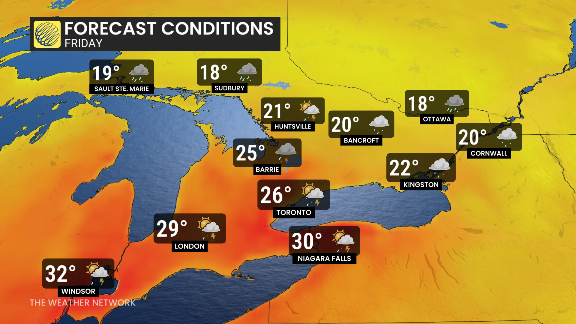
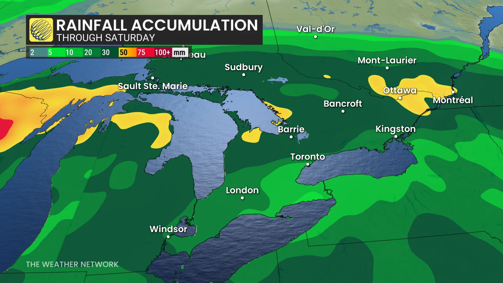
More rain hits Friday and Saturday, but with some uncertainty
Friday will see two rounds of precipitation. The first will become scattered overnight into early Friday, followed by a second round moving in late overnight into Friday morning, particularly affecting southwestern Ontario and the GTA. This time frame is expected to be one of the wettest for these regions, with additional rain possible later in the day.
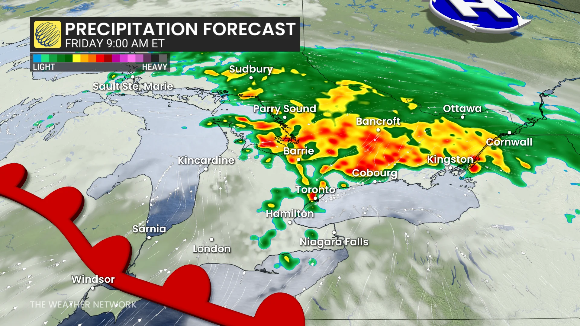
Central and eastern Ontario will continue to see steady rainfall, with temperatures remaining below 20°C.
Rain is expected to taper off in central and eastern Ontario by Saturday morning, though scattered showers could continue across the east through the afternoon and evening.
Temperatures will slowly recover, reaching the low to mid-20s by Saturday afternoon.
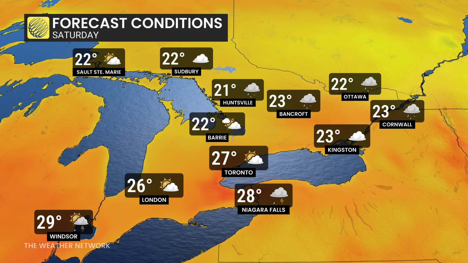
There is still uncertainty regarding the exact timing of the heaviest rain and when it will clear, particularly for eastern Ontario, where precipitation may persist into Saturday afternoon.
Early July looking cooler than normal
Monday will bring back hot and humid weather across the region. Showers and thunderstorms are forecast to develop ahead of a cold front, which is expected to move through overnight Monday, and into Tuesday for Canada Day.
SEE ALSO: No fireworks: Check out this pet-friendly Canada Day celebration in Toronto
The first few days of July will feel cooler, with temperatures near or slightly below seasonal averages and notably lower humidity levels.