
Heat set to break across Atlantic Canada, but at a stormy cost
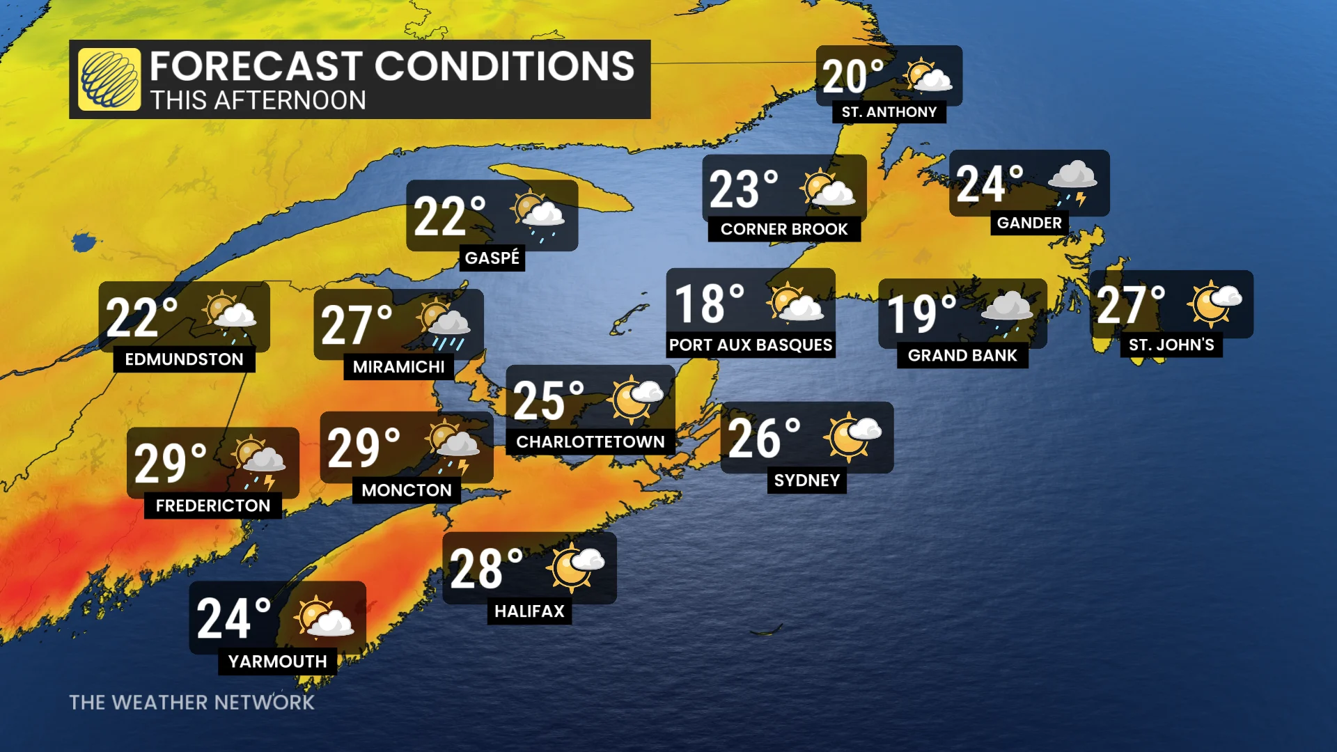
The heat and humidity over Atlantic Canada will help to fuel thunderstorms in the region on Wednesday.
Cooler temperatures are finally on the way to Atlantic Canada this week, but some folks may feel it move in with a rumble or two.
An area of low pressure along a frontal boundary will harness the heat and humidity that have been building over the East Coast to trigger some stormy weather on Wednesday.

While the storm risk isn't widespread and is expected to stay non-severe, the rain and thunder could still disrupt plans for folks hoping to spend time outdoors.
SEE ALSO: Ottawa announces toll cuts, fare freezes to boost Atlantic Canada travel
Another low-pressure system was hot on the heels of Tuesday's low, bringing another round of storms to parts of New Brunswick and Newfoundland on Wednesday.
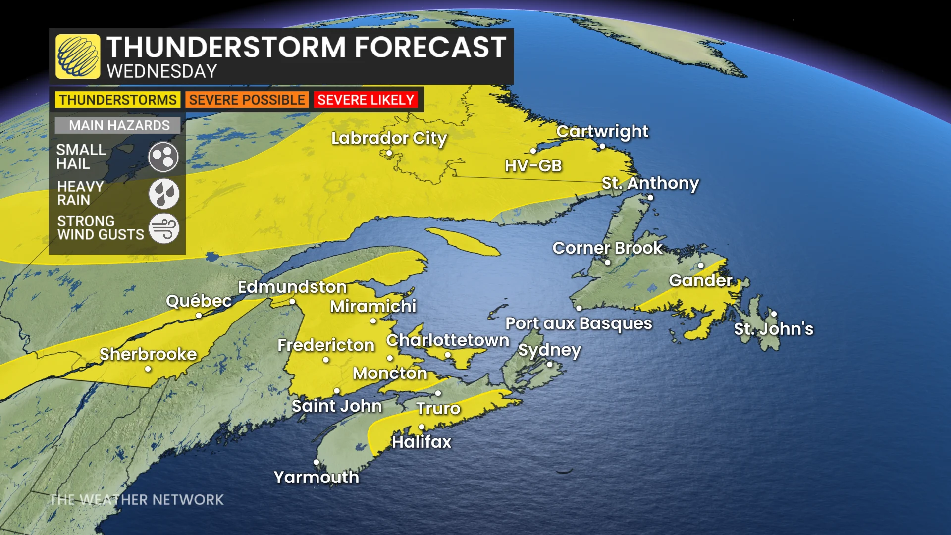
Temperatures in the upper 20s, and even a couple in the 30s, along with high humidity, will give some of these storms a better chance at producing heavy rainfall.
The good news is that the heat will finally begin to break on Thursday. Friday will feature much cooler temperatures than we've seen all week, but we may see some isolated showers graze the Maritime provinces heading into the weekend.
Stay with The Weather Network for more information and updates on your weather across Atlantic Canada.