Hazardous travel possible as snowsqualls develop on Sunday
Snowsqualls could produce 30+ cm of snow in parts of southern Ontario through Sunday
It’s the heart of winter and the weather is certainly playing the role.
Snowsqualls are expected to sweep through portions of southern Ontario on Sunday and Monday. Some areas could see more than 30 cm of snow to end the weekend.
That’s not the only hazard. Dangerously cold temperatures are in the forecast across Ontario as frigid Arctic air descends on the region by next weekend. Northern parts of the province could approach -40°C.
DON’T MISS: Second half of January looking much colder across Canada
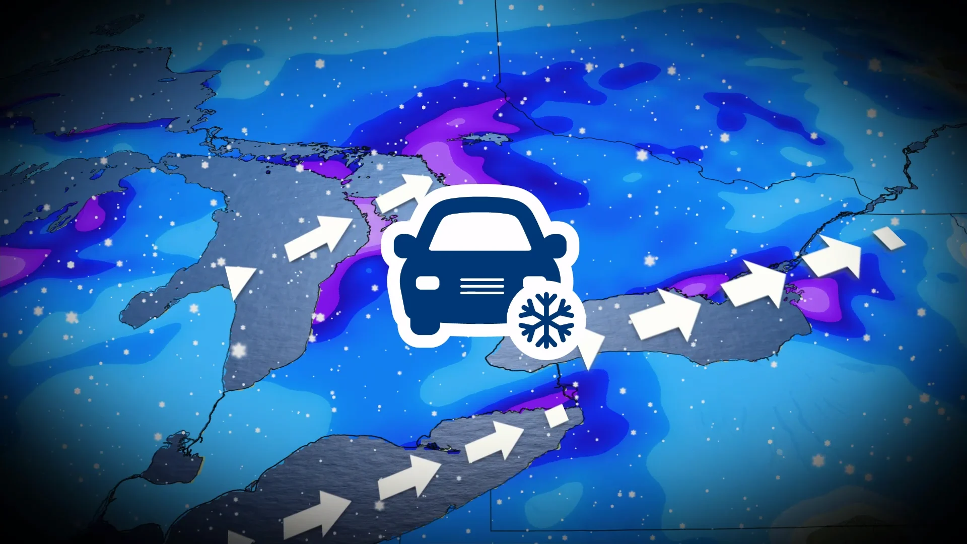
Snowsqualls threaten travel in southern Ontario
Southwesterly winds blowing across the Great Lakes during the day Sunday will give rise to snowsqualls along the Bruce Peninsula, Georgian Bay, as well as the Niagara Peninsula and the northern shores of Lake Ontario.

A system arriving Sunday night into Monday will bring widespread light snow to the region. Lake enhancement is likely, leading to potentially hazardous driving conditions in spots.
Kingston to Cobourg along the 401, including Prince Edward County, will see 10-20+ cm of snow and reduced visibility from the band of snow expected to develop here.
The Bruce Peninsula and the shores of Georgian Bay will also see a sustained snowsquall drape across the region, potentially producing up to 30 cm of accumulation in spots.

Another band of lake-effect snow will spread over the north shore of Lake Erie toward Niagara Falls and Welland, where localized totals of 10-20 cm are possible.
By Monday evening, more traditional bands of lake-effect snow will develop as west-northwesterly winds sweep across the snowbelt communities.
Dangerously cold temperatures likely next weekend
A slug of truly frigid air is likely to arrive in the Great Lakes region by next weekend.

Daytime highs could struggle to warm past the minus teens on Saturday for much of Ontario. Temperatures are likely to remain below seasonal for the remainder of January.
How cold could it get? Temperatures may reach -40°C for pockets of northern Ontario during the worst of the cold snap, with widespread temperatures as low as -30°C in northeastern Ontario.