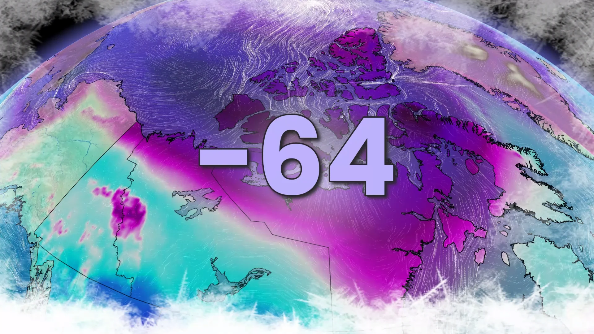
Feels like -64: Harshest cold wave in decades hits Canada
Polar vortex plunges parts of Canada into extreme cold, frostbite risk persists
The polar vortex continues to grip parts of the Northwest Territories and Nunavut with extreme cold, bringing the harshest conditions seen in decades, even by northern standards.
DON'T MISS: Canada’s 2025-26 winter report card revealed. How did your region pass?
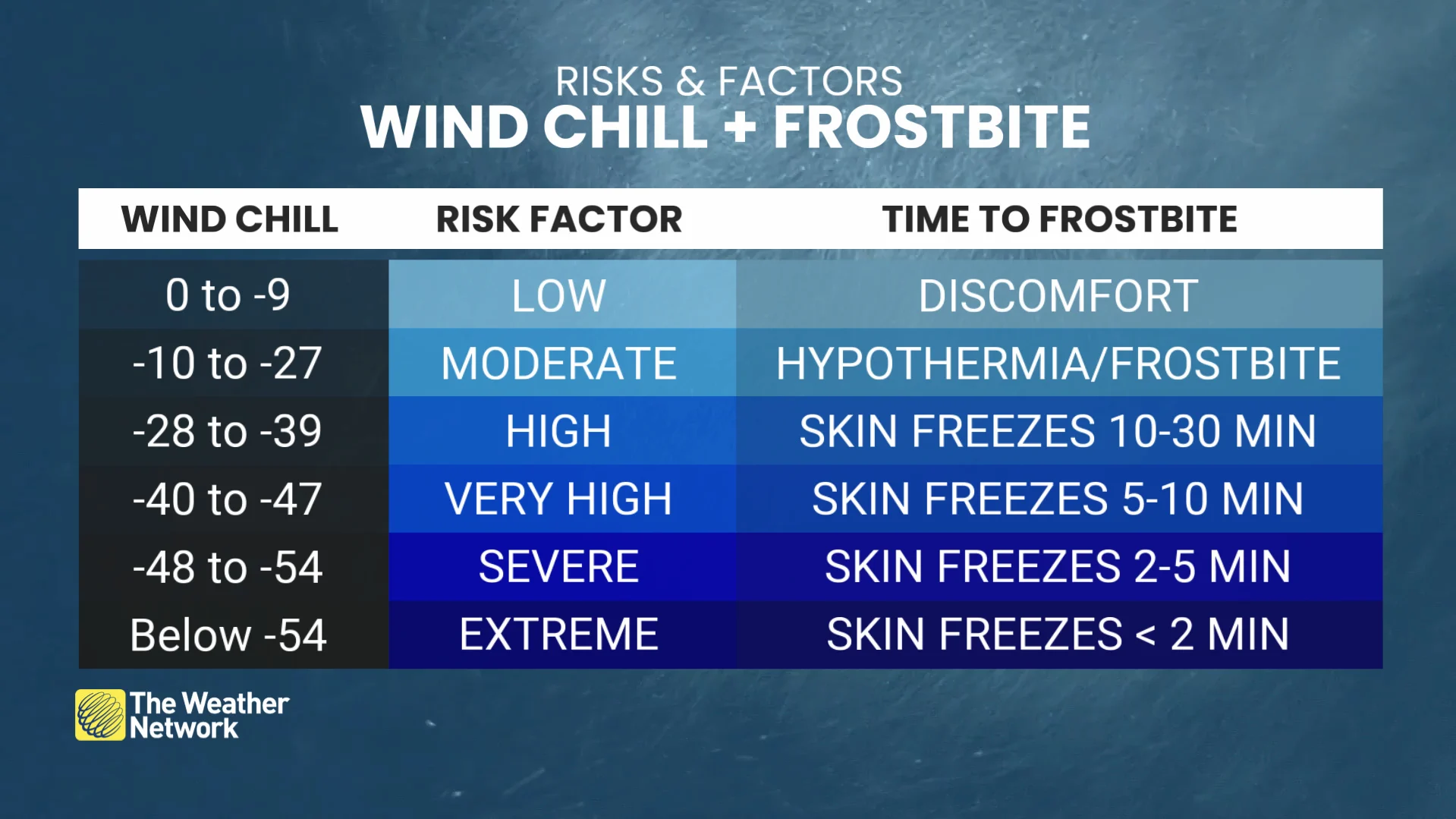
Temperatures in the -40s and wind chills between -50 and -60 are forecast to persist through the weekend, posing serious risks to exposed skin, with frostbite developing in minutes.
Sachs Harbour, NWT, issued a boil water advisory after frozen water intake at the local treatment plant earlier this week.
Cambridge Bay reported a staggering wind chill of -64 on February 10, the coldest felt there since February 26, 2003 (-67).

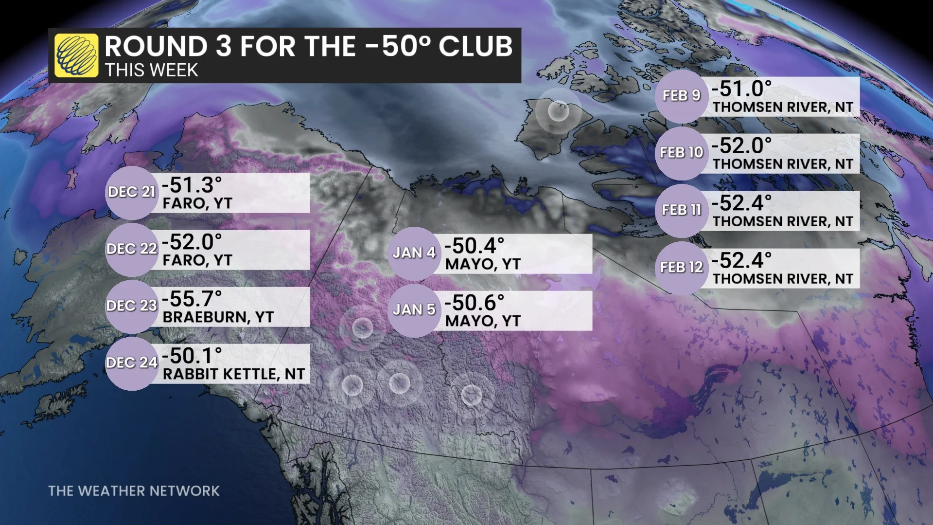
Thomsen River endured three consecutive days with highs at or below -50°C, a first since records began in 1997.
RELATED: Cold-related emergencies: Essential tips for staying safe in cold temperatures
This marks the third and longest extreme cold event below -50°C in Northern Canada this winter, with similar conditions recorded in Yukon and southwestern NWT in late December and early January.

The cold is expected to ease slightly early next week as it shifts further north; however, temperatures are still expected to remain below seasonal.
DON'T MISS: Can cold weather trigger an allergic reaction? Here's what experts say
Residents are urged to take precautions for the extreme cold.