From hail to humidity: B.C. faces stormy stretch before weekend warm-up
A low-pressure system is bringing widespread thunderstorm activity to B.C., with the possibility of hail, strong winds and funnel clouds
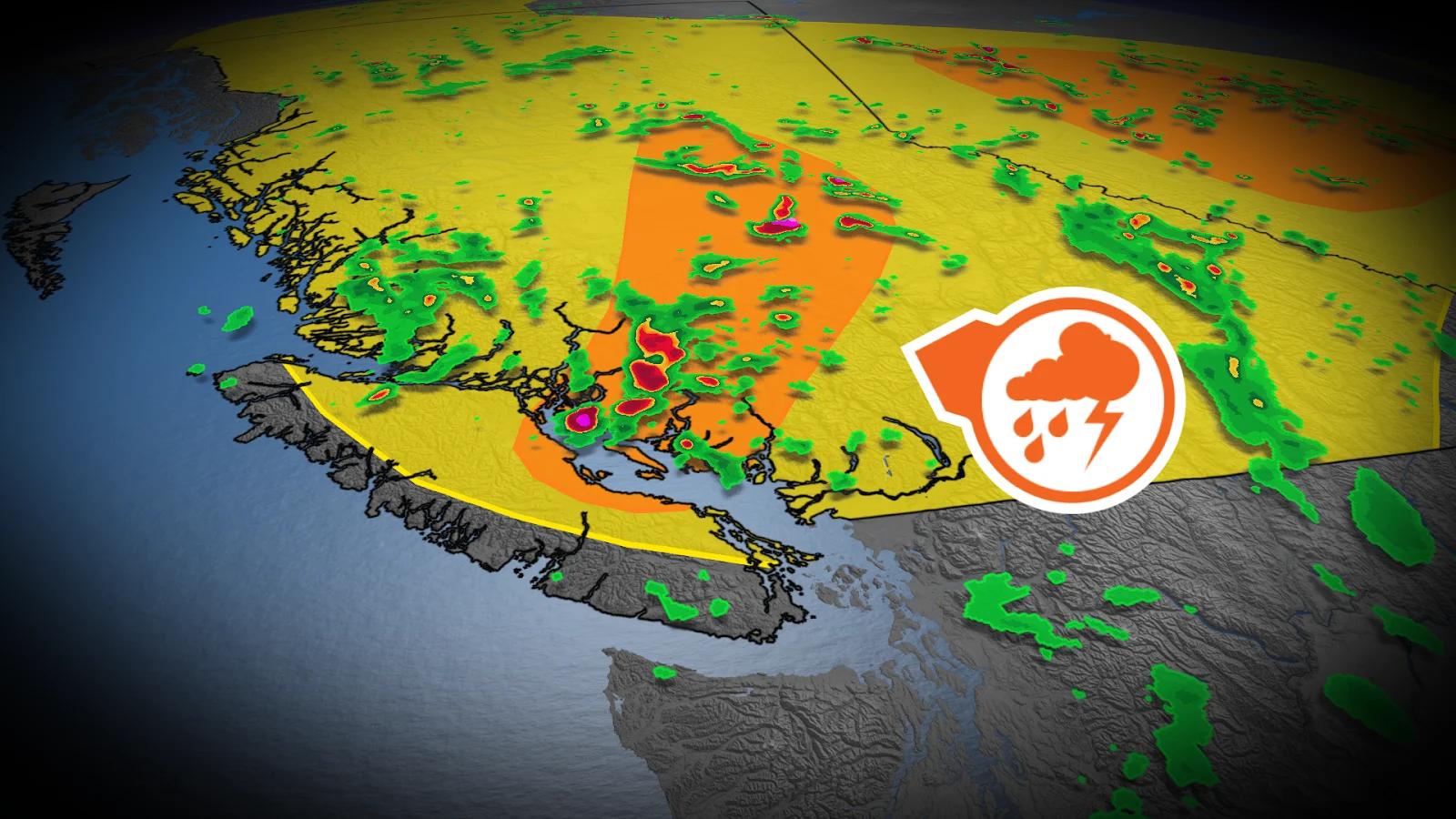
A low-pressure system approaching the B.C. coast is expected to produce thunderstorms across the province on Wednesday, with a few potentially severe storms in a swath from Comox to Prince George.
Forecasters warn that hail, strong winds and lightning are possible along the cold front, with active weather continuing into the evening.
RELATED: How does hail get so big?
Storms target central B.C. as cooler air sinks
While non-severe thunderstorms are expected to be more widespread, the highest risk of severe activity will be found on Vancouver Island and in the Interior, particularly along the advancing front.
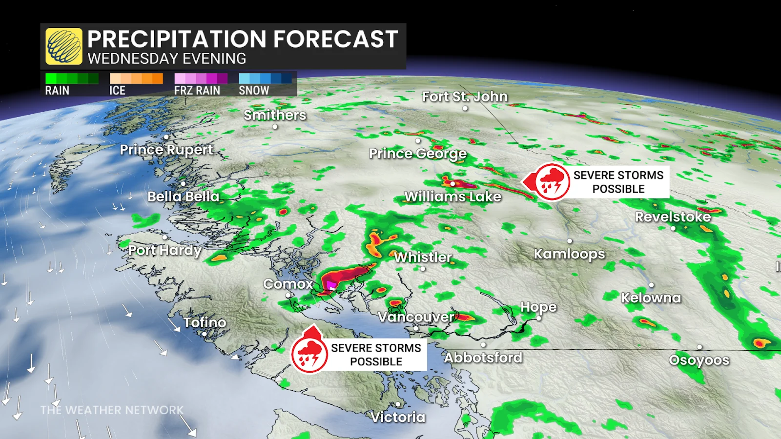
Some of the most severe storms may produce two-centimetre hail, lightning, strong wind gusts and heavy rains, particularly in higher elevations.
Chillier air aloft is also being drawn in behind the system, increasing instability, particularly over the Strait of Georgia, where funnel clouds or a waterspout is possible.
Conditions heading into the weekend
Storms may linger into Thursday for parts of the Interior, but warmer, more humid weather is expected by Friday, with dry conditions likely through the weekend.

DON'T MISS: From drips to disasters: How to flood-proof your home
WATCH BELOW: If your hair suddenly stands straight up, you should take cover
Stay with The Weather Network for all the latest on conditions across British Columbia.