Flood warnings as potent Pineapple Express rains reach B.C.
Prepare for flooding in vulnerable areas as another potent atmospheric river washes into British Columbia to start the new week
A robust atmospheric river washing into the West Coast will revive the risk for flooding throughout southwestern British Columbia over the next couple of days.
Several days of heavy rainfall are in the forecast for most areas, which will exacerbate flooding on waterways already swollen by the recent precipitation.
Gusty winds will also pose the risk for power outages and travel disruptions.
DON'T MISS: What’s a Pineapple Express? Diving into this robust atmospheric river
Pineapple Express arrives on the West Coast
This latest event is a particularly robust type of atmospheric river known as a Pineapple Express, as the plume of moisture originated in tropical latitudes around Hawaii where they grow pineapples.
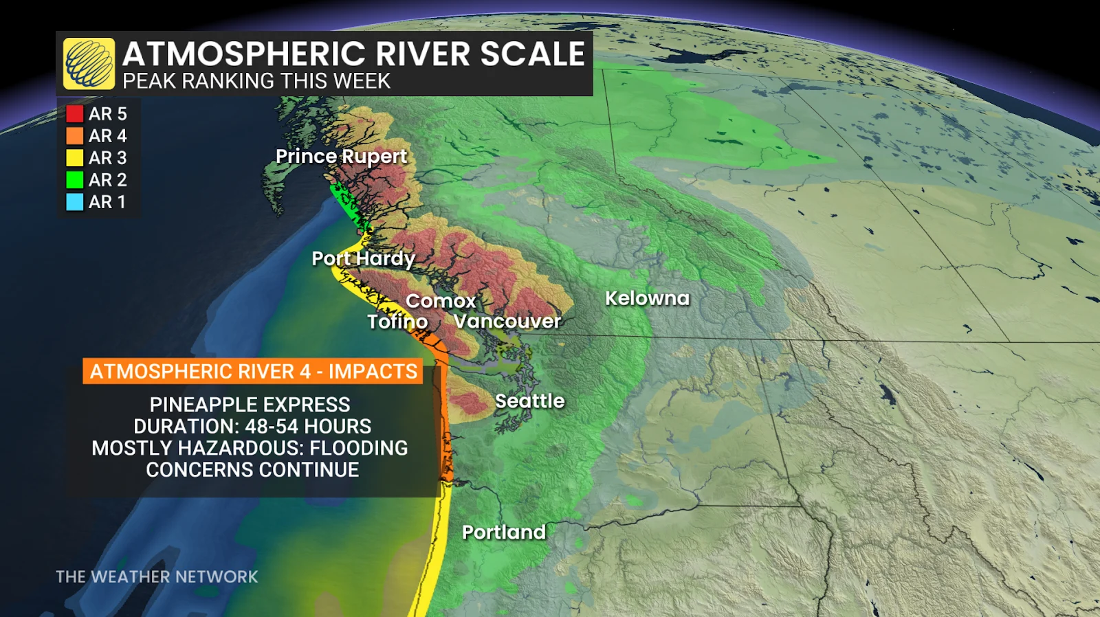
Folks throughout southern B.C. can expect two pulses of heavy rainfall: one arriving Sunday night and lasting into Monday, with an additional round on Tuesday.
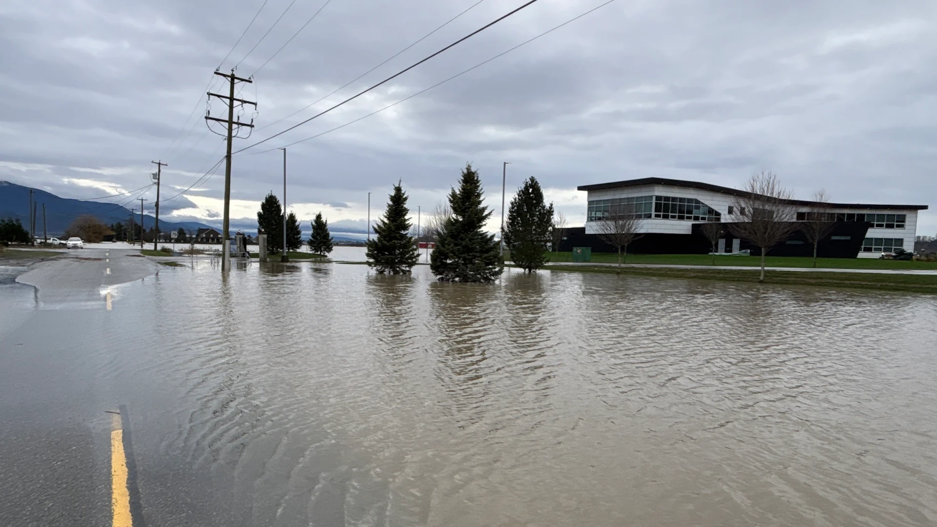
This will be a high-impact weather event with additional flooding likely. Waterways are already swollen from the region’s recent atmospheric river events.
Flood warnings are in effect for the Sumas River and Chilliwack River. Flood watches are in place for the Lower Fraser tributaries, as well as the Kingcome River and Englishman River. High streamflow advisories are in effect across the B.C. Coast, Vancouver Island, and Haida Gwaii.
The heaviest rainfall rates will arrive overnight Sunday through the pre-dawn hours Monday, with rates as high as 10-15 mm per hour possible. Rumbles of thunder are possible during this period.
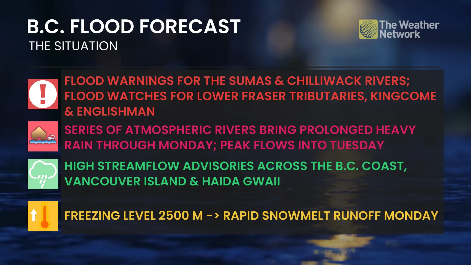
Snowmelt from rising freezing levels will also contribute to runoff, further exacerbating the flood risk on Monday.
We’re on track to see storm totals of 80-100+ mm in the Fraser Valley and Coast Mountains through Monday. The highest amounts across lower elevations are forecast for the northeast sections of Metro Vancouver.
Locally, more than 200 mm of rain is possible in the North Shore mountains and western Vancouver Island.

A second round of moisture on Tuesday will bring additional rainfall, but not as much as we’ll have seen on Monday. This round will see cold air aloft produce heavy alpine snow, which will reduce the amount of runoff.
Wind threat builds with potential power outages
Gusty winds and saturated soils will increase the risk for tree damage and power outages through Monday evening. Delays and cancellations are possible for both ferries and flights across the region.
Winds will increase as a centre of low pressure approaches Haida Gwaii on Sunday evening.
RELATED: How to stay safe during a power outage
Southeasterly gales will develop in the Strait of Georgia and offshore Greater Victoria on Sunday night, increasing the power outage threat for exposed coastal sections and the Gulf Islands.
We’ll see winds out of the southwest up to 80 km/h across Greater Victoria through Monday afternoon, increasing the risk for wind-related impacts in this area.
Strong winds will continue and push inland toward the Fraser Valley through Monday afternoon and evening, with local southwesterly gusts up to 90 km/h possible.
As the low lifts into Alberta, damaging wind gusts up to 80 km/h will also be possible in the southern Interior.