Flood, avalanche concerns rise in B.C. as atmospheric river brings deluge
A multi-day atmospheric river event will bring B.C. the potential for flooding and an elevated avalanche threat as freezing levels soar and the hefty rainfall brings snowmelt
This coming week will begin on a wet, soggy note across British Columbia as a slug of moisture associated with an atmospheric river continues to bring heavy rain.
The latest atmospheric will be a pineapple express, a potent type of atmospheric river that transports moisture straight from the region around Hawaii.
DON’T MISS: What’s a Pineapple Express? Diving into this robust atmospheric river
Water will likely pool on roads and in low-lying areas. Some travel delays are possible. Landslides may occur in vulnerable areas such as steep slopes, deforested areas or recent burn scars.
As well, dangerous avalanche conditions are anticipated as heavy rain and fluctuating freezing levels could destabilize the snowpack. An elevated flood risk will also exist in steep terrain and regions with poor drainage.
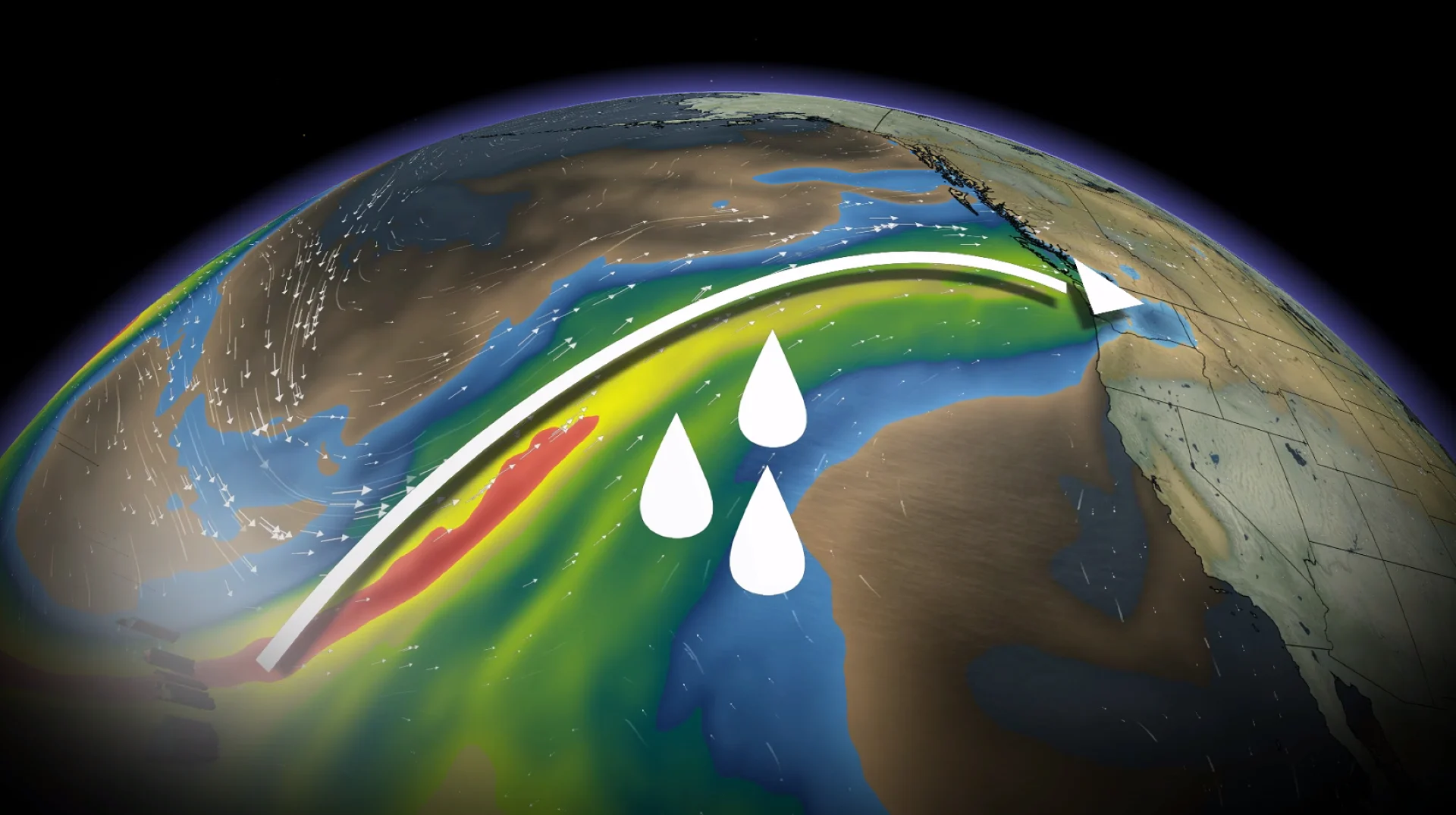
Atmospheric river aims for the West Coast
The atmospheric river model guidance indicates this event will be a AR-2 to AR-3, with a moderate to high impact.
We’ll see multiple waves of moisture linger along the coast this weekend as frontal systems target the South Coast. By Sunday night, the most potent moisture is expected to move ashore.

Heavy rainfall is expected across Vancouver Island, the South Coast, and Coast Mountains.
Rainfall forecast (through Tuesday morning)
Tofino: 150-200 mm
Port Alberni: Approximately 100 mm
Nanaimo: 20-40 mm
Victoria: 15-30 mm
Downtown Vancouver: 50-75 mm
Abbotsford: 75-100 mm
North Vancouver: 100+ mm
Squamish: Approximately 100 mm
Flood watches issued: Northern and western Vancouver Island, Sunshine Coast, Howe Sound and North Shore Mountains
High streamflows issued: Central, eastern and southern Vancouver Island, Haida Gwaii, North Coast, Central Coast, South Coast, and Lower Fraser tributaries (Pemberton, Fraser Valley North, Metro Vancouver).
Mid-elevation snowmelt is concerning as rivers may reach five- to 10-year flow levels in flood watch areas.

Slower-than-normal Monday morning commute across the Lower Mainland as frequent ponding, pooling, and localized flooding will occur as the heaviest rain moves in.
Freezing levels are expected to rise rapidly to 2,000 metres or higher by Sunday, followed by a peak later Tuesday at values locally near 3,000 metres above sea level near the North Shore Mountains.
The last time we had such warm air aloft was January 2009, when Vancouver International Airport and the lowest elevation were shrouded in fog for days on end, creating magnificent pictures from higher terrain.
This is an average freezing level for the summer months: 3,000-3,500 metres.

The warm-up will allow rain to reach well into the alpine regions and accelerate snowmelt throughout the mountains.
Freezing levels are forecast to surge this week to exceptionally high values for January, approaching or exceeding historical records for the Pacific Northwest.
Dangerous avalanche conditions are expected as heavy rain and fluctuating freezing levels could destabilize the snowpack. An elevated flood risk will also exist in steep terrain and regions with poor drainage.
Stay with The Weather Network for all the latest on conditions across British Columbia.