Severe storms fire up in Saskatchewan, prompting tornado warnings
A severe thunderstorm capable of producing a tornado has been detected in southern Saskatchewan. Residents in the affected region should be in their shelters.
A tornado warning has been issued in southern Saskatchewan as meteorologists with Environment and Climate Change Canada (ECCC) are tracking a thunderstorm that is potentially producing a tornado.
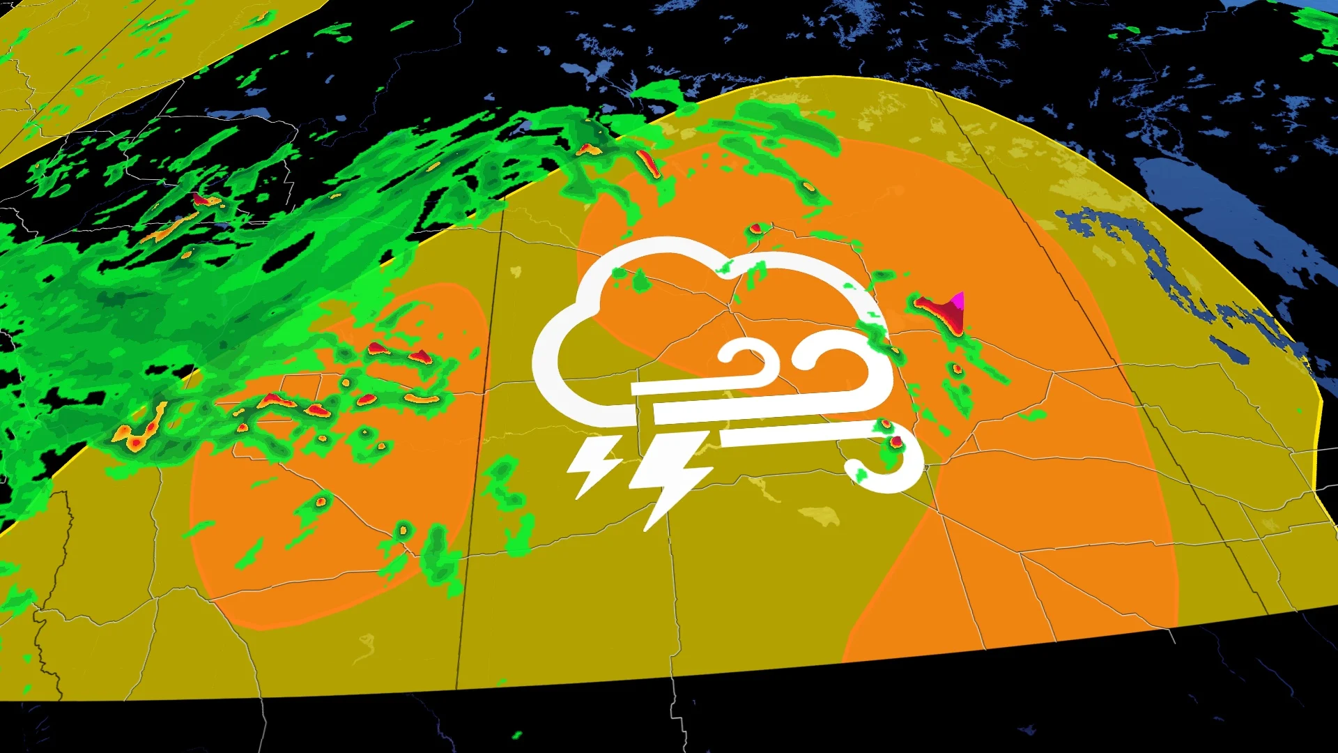
In addition to potentially producing a tornado and intense winds, large hail and locally intense rainfall are possible. See below for the details.
Current tornado warnings
R.M. of Orkney including Yorkton Springside and Ebenezer
5:19 PM CST: Environment Canada meteorologists are tracking a severe thunderstorm that is possibly producing a tornado. Damaging winds, large hail and locally intense rainfall are also possible.
The severe thunderstorm is located 10 km southwest of Sprinside and is moving to the northeast at 60 km/h.

This is a dangerous and potentially life-threatening situation.
Take cover immediately, if threatening weather approaches. If you hear a roaring sound or see a funnel cloud, swirling debris near the ground, flying debris, or any threatening weather approaching, take shelter immediately.
Go indoors to a room on the lowest floor, away from outside walls and windows, such as a basement, bathroom, stairwell or interior closet. Leave mobile homes, vehicles, tents, trailers and other temporary or free-standing shelter, and move to a strong building if you can. As a last resort, lie in a low spot and protect your head from flying debris.
Thunderstorm threat covers southern Alberta and Saskatchewan, with landspout tornado risk
In Alberta, quickly developing storms in the afternoon and early evening on Monday could lead to the development of funnel clouds, or even a landspout tornado.
Southern Saskatchewan will see a line of storms develop in Montana and move in, expected to generate strong wind gusts, which can cause damage along the line of storms. The timing is projected in the late evening and through the overnight on Monday.
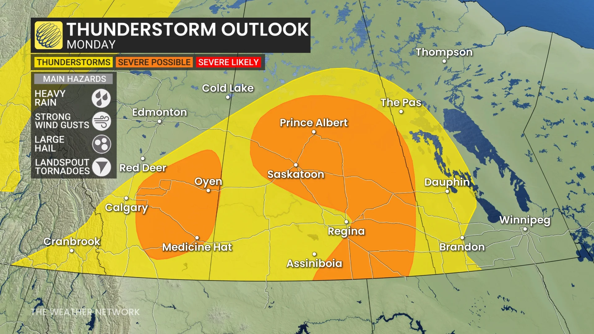
Central areas of Saskatchewan will see strong wind gusts and large hail as the greatest threat for severe storms.
WATCH: Late-season snow collides with summer-like heat in Manitoba
You can expect persistent rainfall west of the QE2 throughout through much of the day on Monday, before gradually easing as Tuesday morning hits.
Significant totals are expected, with between 20 to 30 mm forecast for Calgary, and higher towards Red Deer and Hinton. Localized totals could reach between 30-50 mm into Tuesday.

This could be accompanied by both embedded and isolated thunderstorms in Alberta, which would bump up rainfall totals, as well.
The greater chance for severe thunderstorms will span across central Saskatchewan later Monday, especially for areas north and west of Saskatoon. In addition to the rain, strong wind gusts and large hail are risks with storms that develop.
Thumbnail courtesy of Christian King, taken in Cremona, Alta.
Be sure to check back for the latest weather updates across the Prairies.