
Favourable environment for severe weather in southern Saskatchewan
Folks in southern Saskatchewan, especially, will need to stay alert for potential watches and warnings in their area on Sunday as the ingredients are in place for severe weather to develop
Sunday will be another day to monitor the skies and forecast closely in southern Saskatchewan, with a prime environment for severe weather.
The same trough that prompted tornado watches in Alberta Saturday evening will move east and could set off storms Sunday afternoon and evening, bringing the threat for large hail, strong winds and heavy rain.
DON'T MISS: Get the latest wildfire news and safety tips to help you stay safe
Parts of Alberta and Manitoba could see thunderstorms, as well, but should remain below warning criteria.
It'll be important to remain weather-aware, and stay up-to-date on all of the latest watches and warnings as conditions change.
Sunday: Severe storm risk shifts eastward on the Prairies
The same trough moves closer to the Saskatchewan-Manitoba border, with another corridor of severe thunderstorms popping up for southern areas of the former on Sunday.

The greatest risk for severe weather will extend through Regina, and southeast towards Weyburn and Estvan. Any storms that approach severe limits could produce strong wind gusts, large hail, and heavy rainfall.
DON'T MISS: 2025 is Canada's second-worst wildfire season on record for area burned
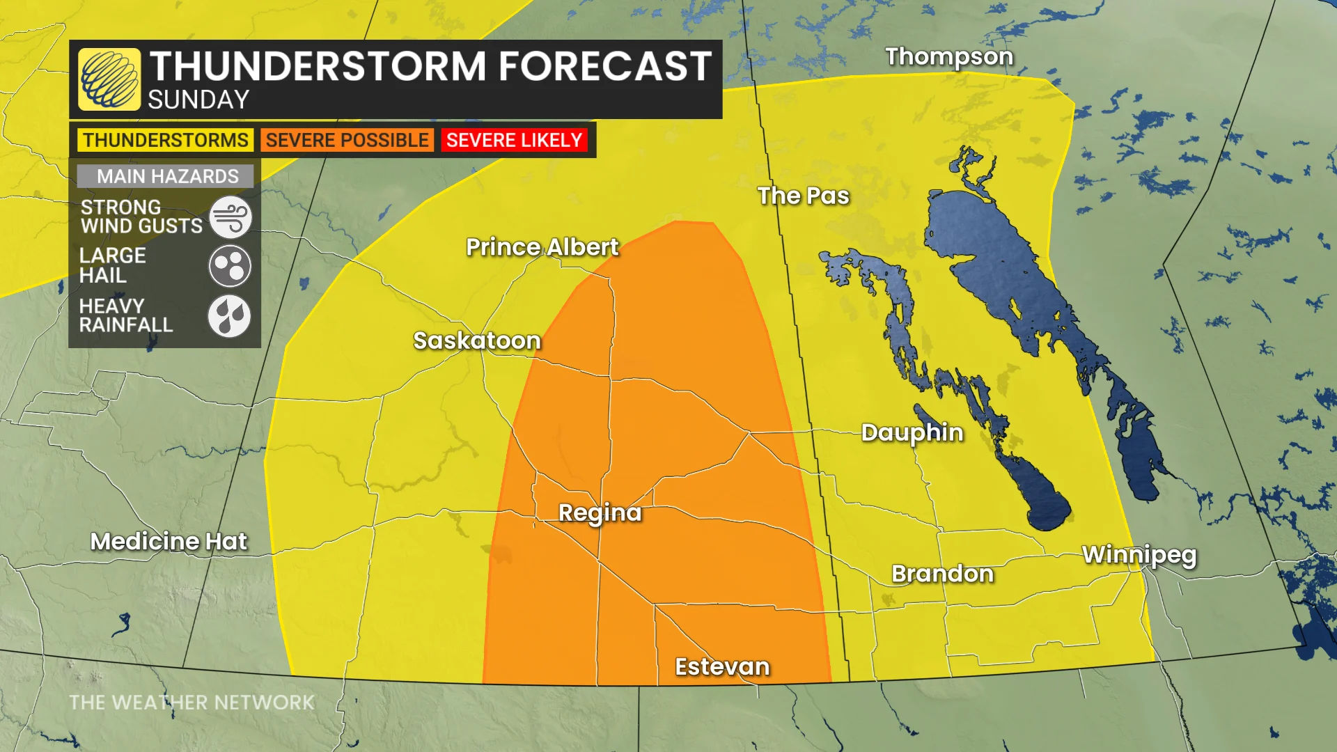
Given the amount of moisture in the atmosphere, watch for localized flooding beneath the heavier downpours.
Remember, never try to drive across a flooded roadway. It’s impossible to tell how deep the water is until it’s too late, and it takes a small amount of moving water for a vehicle to lose traction with the roadway.

Northern and central areas of the Prairies will be much cooler than seasonal through the weekend while warmer conditions will be found across southern areas. The warmth will expand north and dominate most of next week.
However, a shot of much cooler weather will spread across the region late next week and eastern areas will be cooler than normal for next weekend--with highs in the teens across Manitoba and mid-20s to lower 30s returns to Alberta. Warmer-than-normal temperatures are expected to dominate during the final week of August.
Stay with The Weather Network for all the latest on conditions across the region.