September chill takes a bite out of Ontario's warmth after winds and rain
Ontario’s late-summer warmth is being swept away as strong winds and soaking rain usher in a September chill, dropping temperatures to well below-seasona values
September is well known for its contrasting conditions in Canada, with B.C. undergoing extreme heat this week while southern Ontario gets a sneak preview of autumn as a cooldown and a bout of rain and gusty winds push in.
After a bout of rainfall on Thursday, the south can expect temperatures to take a noticeable dip heading into the weekend, including some chilly mornings.
DON'T MISS: September’s back-to-school tug of war: Summer heat meets fall chill
Be sure to stay weather-aware for late-week rain impacts and prepare for changing conditions later in the week, as well.
Pattern interruption brings heavy rain through Thursday
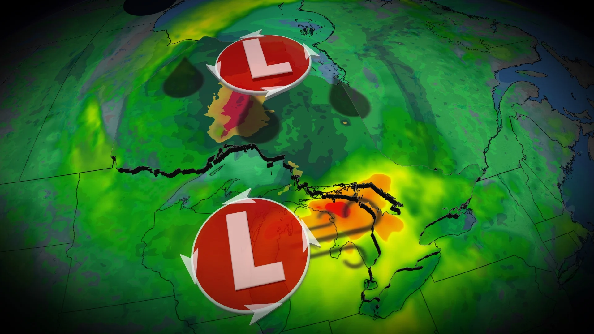
A system over northeastern Ontario is pushing a cold front through southern and eastern Ontario this week. Rainfall is expected to spread from Lake Huron into the Greater Toronto Area (GTA) Thursday morning, reaching the Ottawa Valley by evening.
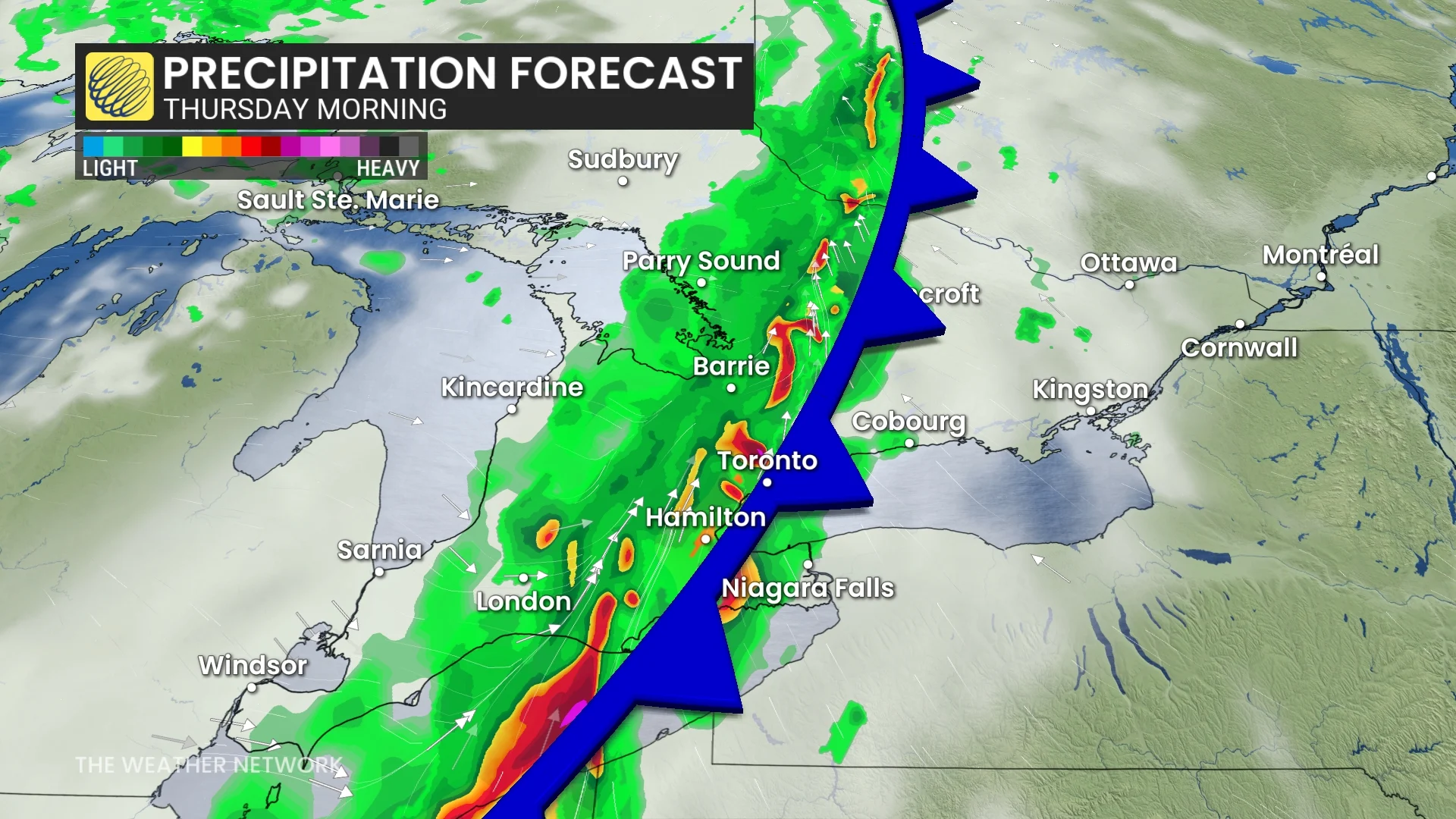
Rain could bring heavy downpours and isolated rumbles of thunder. Northern Ontario may see 50-75 mm of rain, while southern Ontario is forecast to pick up 10-20 mm due to fast-moving showers. Rainfall in any given area in the south is likely to last no longer than three or four hours.
Model projections suggest the rain will affect the GTA during Thursday's morning commute and shift into the Ottawa Valley by the afternoon.

Drivers are advised to plan for potential disruptions during the Thursday morning commute in the GTA and monitor for updates on local rainfall amounts and storm activity.
Gusty winds pick up on Friday
Meanwhile, a strong, low-pressure system over northeastern Ontario steers a secondary Prairies low. The second low will draw into Ontario heading into Friday.
That will bring a secondary round of heavy rainfall across northeastern Ontario.

However, the bigger threat will be the winds across northeastern and southern Ontario. Gusts up to 90 km/h can be expected across the shorelines of Georgian Bay. Southern ontario gusts are expected to be 50-80 km/h.
DON'T MISS: A typical September sends Canada heat, frost, hurricanes, and snow
But, fortunately, with the southerly flow, the temperatures will climbing to seasonal values.

Autumnal chill hits in time for the weekend
A large, upper-level low will pull a cold air mass from the north across the province later this week.
By the weekend, daytime highs in the GTA are expected to settle in the mid-to-high teens, accompanied by chilly morning temperatures. These readings will be a few degrees below the seasonal average for early September.

Looking ahead, temperatures are forecast to gradually climb back to seasonal averages by the second week of September.
WATCH: Canada, what kind of weather is typical in September?
Be sure to check back for the latest weather updates across Ontario.