
Experts predict an above-average 2025 Atlantic hurricane season
We could see more tropical storms and hurricanes than normal this year. Coastal residents should closely monitor forecasts this hurricane season
Experts with Colorado State University (CSU) expect an above-average Atlantic hurricane season this year, the group announced on Thursday.
While forecast confidence is lower than normal due to several factors at play, all the signs this spring are pointing toward favourable conditions for more tropical storms and hurricanes than a typical season would produce.
Coastal residents across Canada’s East Coast and throughout the Atlantic basin should always be prepared in case a storm threatens the region. No matter how many storms form in a season, it only takes one storm making landfall to threaten life and property.
DON'T MISS: Deep U.S. cuts may affect Canadian hurricane forecasts this summer
A potentially active hurricane season ahead
Forecasters with CSU called for 17 named storms across the Atlantic basin this hurricane season, which runs from June 1 through November 30.

Nine of those named storms could grow into hurricanes, and four of those hurricanes could intensify into major Category 3 storms or stronger.
An average Atlantic hurricane season would see 14 named storms, seven hurricanes, and three major hurricanes.
DON'T MISS: What to pack in your emergency kit
Warm waters, lack of El Niño are driving factors
Forecasters cited several factors behind their prediction of more named storms than usual.
We’re likely going to see ENSO-Neutral conditions across the Pacific Ocean during the heart of this year’s Atlantic hurricane season, which means neither El Niño nor La Niña will be present to affect tropical cyclone activity. This generally favours storm activity across the Atlantic.

MUST SEE: What happens when El Niño and La Niña disappear?
Key portions of the Atlantic Ocean are also experiencing warmer-than-normal ocean temperatures.
“A warm Atlantic favors an above-average season, since a hurricane’s fuel source is warm ocean water,” CSU explained in their forecast. The experts added: “Additionally, a warm Atlantic leads to lower atmospheric pressure and a more unstable atmosphere. Both conditions favor hurricane formation.”
The anticipated increase in hurricane activity throughout the Atlantic basin this season could lead to greater chances of landfalling storms across the U.S. and Caribbean.
The team at CSU gave a one-in-four chance of a major hurricane landfall on the U.S. East Coast, a one-in-three chance of a major hurricane hitting the U.S. Gulf Coast, and better-than-even odds of a powerful storm making landfall somewhere in the Caribbean.
Several names retired after the 2024 season
We’re in an active era for hurricanes across the Atlantic Ocean. Four of the basin’s past five hurricane seasons came in above average. Last year saw 18 named storms, 11 hurricanes, and five major hurricanes.
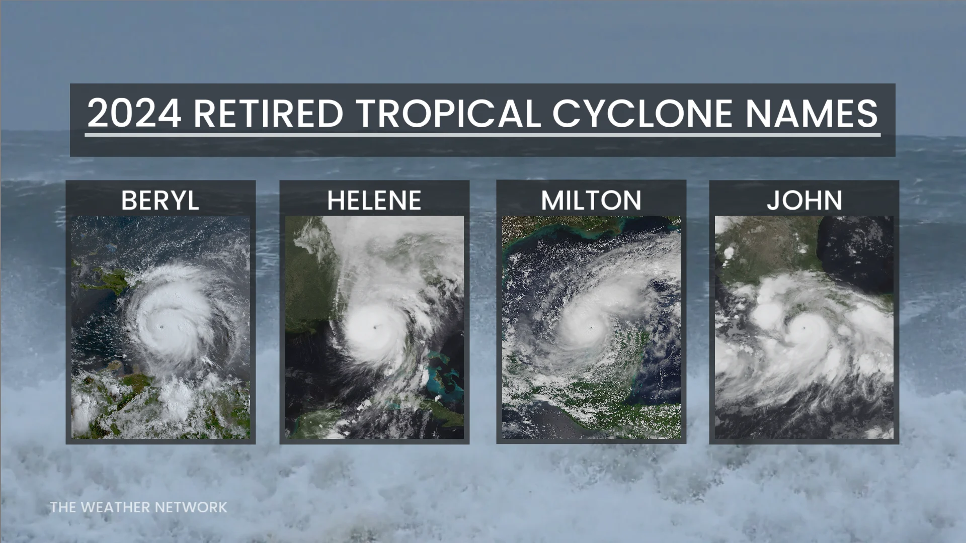
Three of those storms—Beryl, Helene, and Milton—were deadly and destructive enough to warrant retirement of their names.
Hurricane Beryl was the earliest Category 5 storm on record. Hurricane Helene killed hundreds of people in the U.S. when it unleashed catastrophic flooding in North Carolina and Tennessee. Hurricane Milton was one of the strongest Atlantic hurricanes ever recorded.
These names will be replaced with Brianna, Holly, and Miguel when last year’s list is reused in 2030.
Forecasters also retired one storm name from the eastern Pacific. Hurricane John killed several dozen people in western Mexico in September 2024. This name will be replaced by Jake during the 2030 eastern Pacific hurricane season.