Expect disruptions: Buffet of winter weather bombards Atlantic Canada
A winter storm will bring Atlantic Canada a buffet of impactful precipitation through Thursday, with every type on the table. Folks can expect numerous disruptions and delays
It's that time of the year for messy, wintry weather as we get closer to spring.
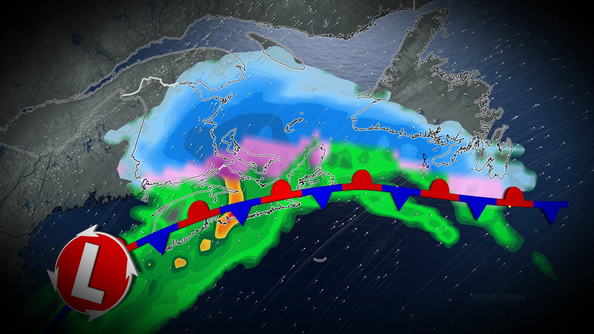
Eastern Canada is being dealt a significant blow from the mess as a potent system is bringing Ontario, Quebec and Atlantic Canada a mix of rain, freezing rain, ice pellets and heavy snow. Atlantic Canada's impacts are underway and will continue through Thursday.
Parts of the region could face up to eight hours of freezing rain or ice pellets, while other locales face 20-40 cm of snowfall.
RELATED: Staying safe during a power outage
Expect slippery and hazardous travel or walking conditions. Ice buildup on trees and utility infrastructure may cause damage or outages.
Plan ahead in case schools or scheduled activities are cancelled. Consider adjusting travel plans to avoid the most adverse conditions.
Through Thursday: Winter storm bringing buffet of precipitation
A messy, wintry mix is forecast in New Brunswick on Wednesday, with snow and ice pellets having filled in across the province in the afternoon.

Precipitation rates pick up around the evening commuting hour, with heavy snow in the north and ice pellets in the south and central regions of the province.
Overnight, the ice pellets will lift north. Freezing rain takes its place for Fredericton and communities north of the city through Thursday morning.
Rainfall is forecast for Nova Scotia, southern New Brunswick and P.E.I. at this time.

On Thursday afternoon, rainfall takes over across the southern Maritimes, but it could change to wet snow by the evening.
Central and western Newfoundland starts out with seeing widespread snow Thursday morning, then changing to ice and/or freezing rain by the afternoon and rain by the evening.

Heavy snow: Highest impact will be western Newfoundland, with 30-40 cm. Northern New Brunswick could see 20-30 cm.
Ice pellets: Highest impact will be central New Brunswick. Over 3 cm of ice accretion is possible for the hardest hit regions north of Fredericton.
Freezing rain: Highest impact will be central New Brunswick. Up to 8 hours of icing is possible.
Rain: Highest impact will be southern Nova Scotia and southern Newfoundland. 10-30 mm and localized flooding possible.

Accumulations of ice may create slippery and hazardous travel or walking conditions. Ice buildup on trees and utility infrastructure may cause damage or outages.
Plan ahead in case schools or scheduled activities are cancelled. Consider adjusting travel plans to avoid the most adverse conditions.
The exact totals of ice pellets and freezing rain are uncertain. There is good confidence that New Brunswick and P.E.I. will see the highest freezing rain and ice pellet impacts. There is good confidence for a rain event in Nova Scotia.

Some timing and precipitation types may change leading up to the event, depending on how the storm tracks.
Stay with The Weather Network for more information and updates on your weather across Atlantic Canada.