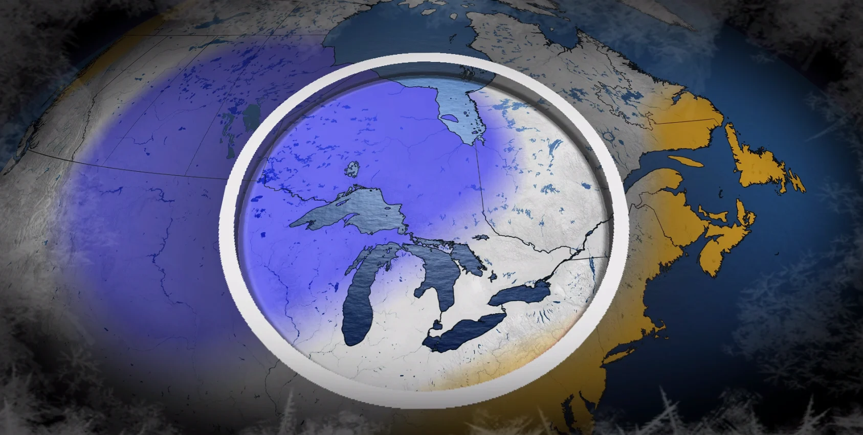
Frigid divide splits Eastern Canada in your winter sneak peek
A busy winter is in store for Eastern Canada this season
Frosty mornings are here to stay and the countdown is on for the first flakes of the season. What could this winter have in store for Ontario, Quebec, and Atlantic Canada?
This could be an active season across the region as factors like La Niña, unusual ocean warmth, and the jet stream team up to influence your winter conditions.
DON’T MISS: Canada’s winter sneak peek holds an abrupt transition to winter
Pacific waters may hold the key to your winter ahead
Water temperatures thousands of kilometres away could exert a significant influence on this winter’s weather across the eastern half of Canada.

Forecasters recently declared the arrival of a weak La Niña around the equator in the eastern Pacific Ocean. These cooler-than-normal waters can affect patterns across the country. A weak event may have a more subdued impact on our conditions this season.
But it’s something closer to home that may hold the key to our winter patterns. We dove into autumn with exceptionally warm water temperatures across much of the northern Pacific Ocean.
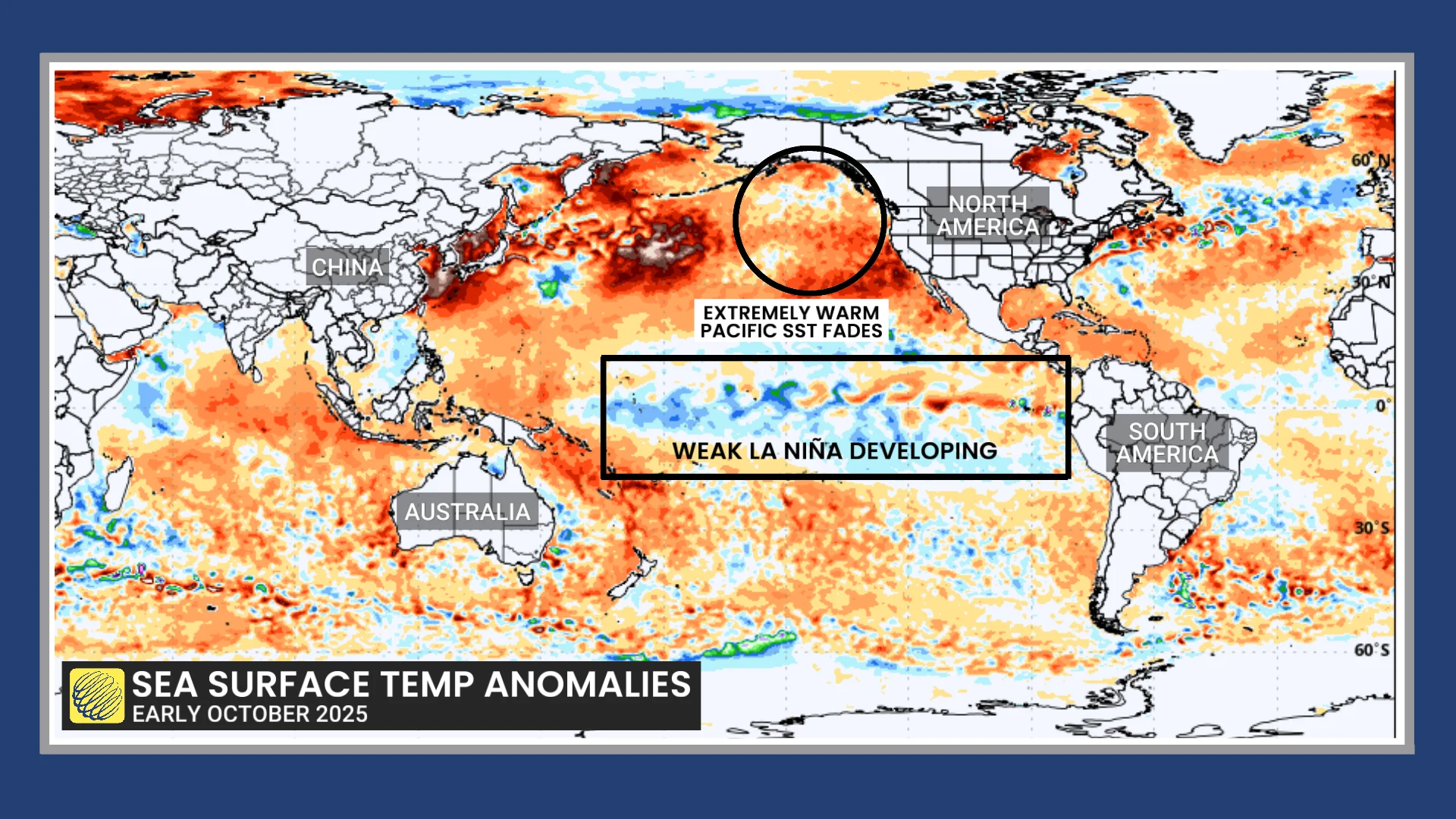
If these waters remain toastier than normal, upper-level winds could respond by setting up a block over the northeastern Pacific that allows cold air to plunge across much of Canada. Bursts of mild air would also sweep across southern Canada at times.
However, water temperatures off the coasts of Alaska and British Columbia started cooling to begin October. If this trend persists, cold air could settle back over Western Canada instead.
Looking ahead to Eastern Canada’s winter temperatures
Given that basic setup, here’s what we may have in store this season across Ontario, Quebec, and Atlantic Canada.

Forecasters see an abrupt transition to winter throughout Canada during November. This shift could allow below-seasonal temperatures to spread over much of Ontario and Quebec, with near-normal temperatures favoured across Windsor, Toronto, Ottawa, and Montreal.
Heading into the heart of the winter months, the temperature breakdown may reflect an active storm track over the region.
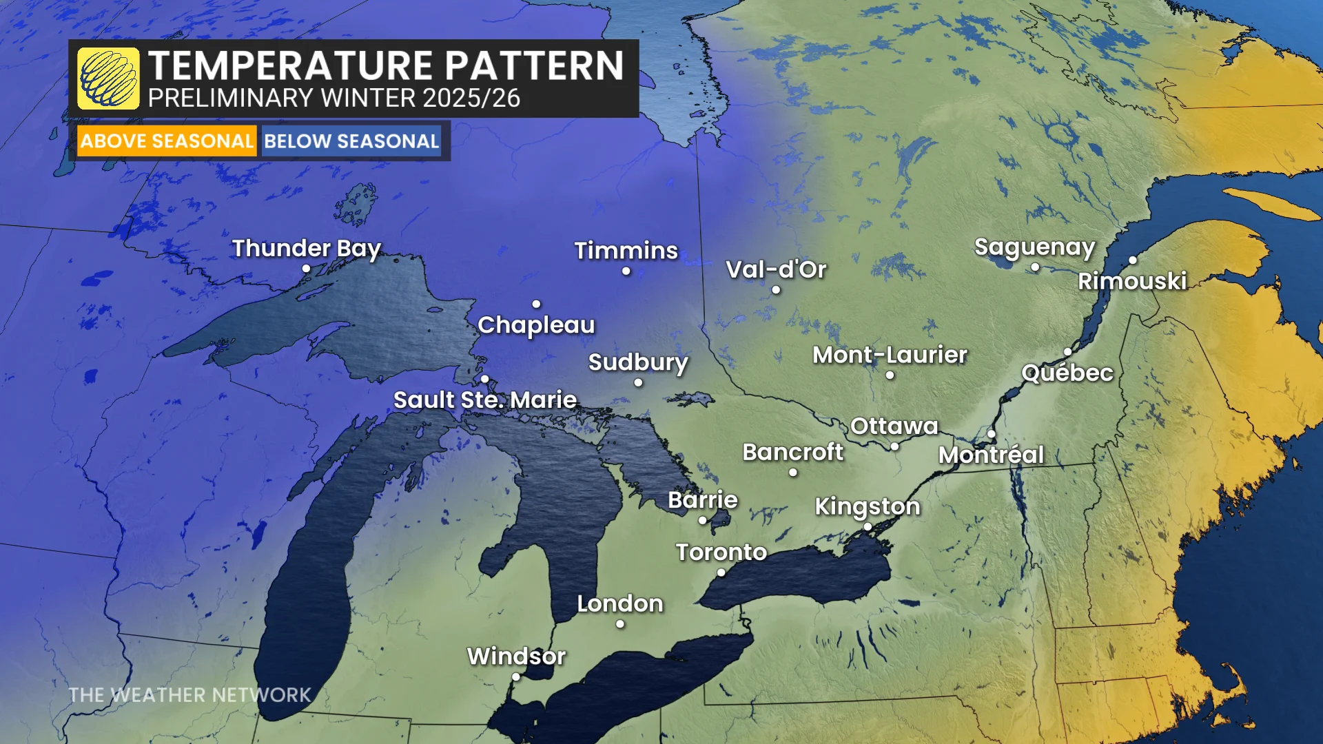
Near-seasonal temperatures look to persist across southern Ontario and much of Quebec, with the cooler-than-normal air pulling west. This westward trend may continue if waters in the northern Pacific continue cooling in the weeks ahead.
Meanwhile, above-seasonal temperatures are favoured over much of Atlantic Canada. Warmer-than-normal temperatures are still fairly cold during the winter, of course, so high-impact winter weather is still in the cards for the region.
A healthy lake-effect snow season is possible
Cold air moving over the warm lakes during late autumn and early winter is the classic recipe for lake-effect snow around the Great Lakes.
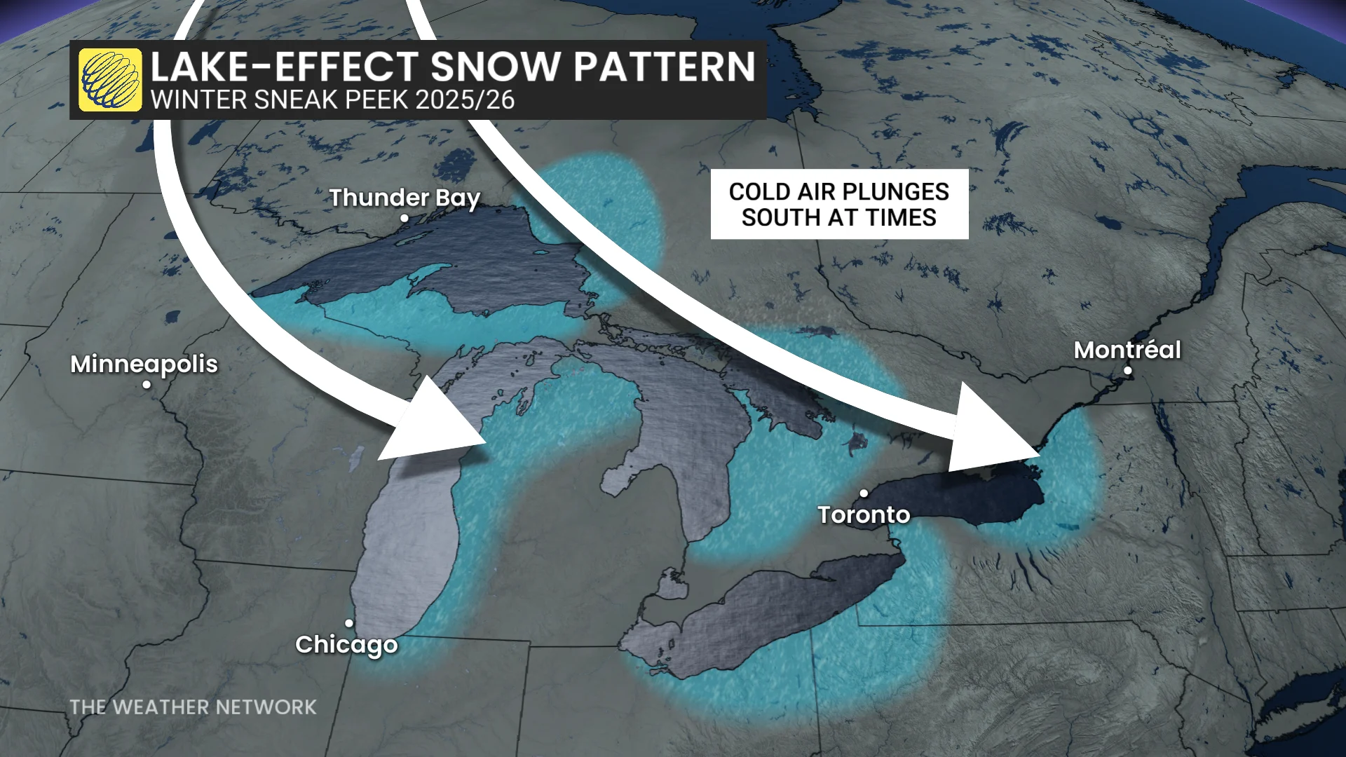
Bursts of chilly temperatures may allow bands of lake-effect snow to thrive in the traditional snowbelt communities downwind from Lake Superior, Lake Huron, and Georgian Bay—though hopefully not to the extreme extent some areas saw last year.
Communities outside of the snowbelts are nearing their first snows, as well.
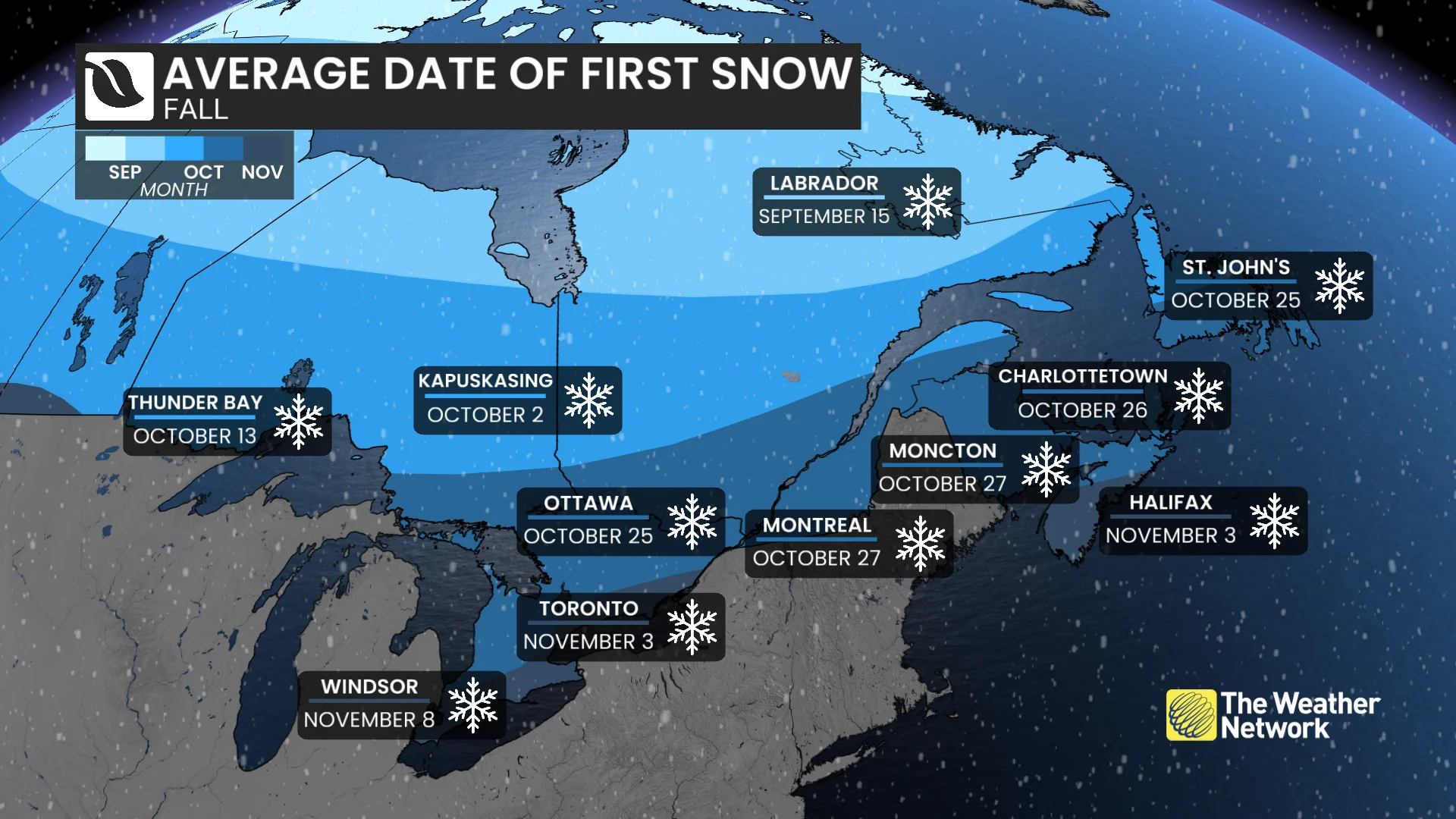
On average, the first snow of the season falls during the final week of October in Ottawa, Montreal, Moncton, and St. John’s. Folks in Toronto, Windsor, and Halifax average their first snowfall in the opening days of November.
January is typically the snowiest month of the year for most cities in Eastern Canada.
Start preparing for winter weather while temperatures are still comfortable, and stay tuned for the full winter forecast coming out on Nov. 26.