B.C. heat event brings more intense temperatures. When will it ease?
After Lytton, B.C., nearly hit the 40-degree mark on Sunday, what's next for B.C. this week? Could we see another community usurp Lytton's reading to claim Canada's hottest value of 2025 so far?
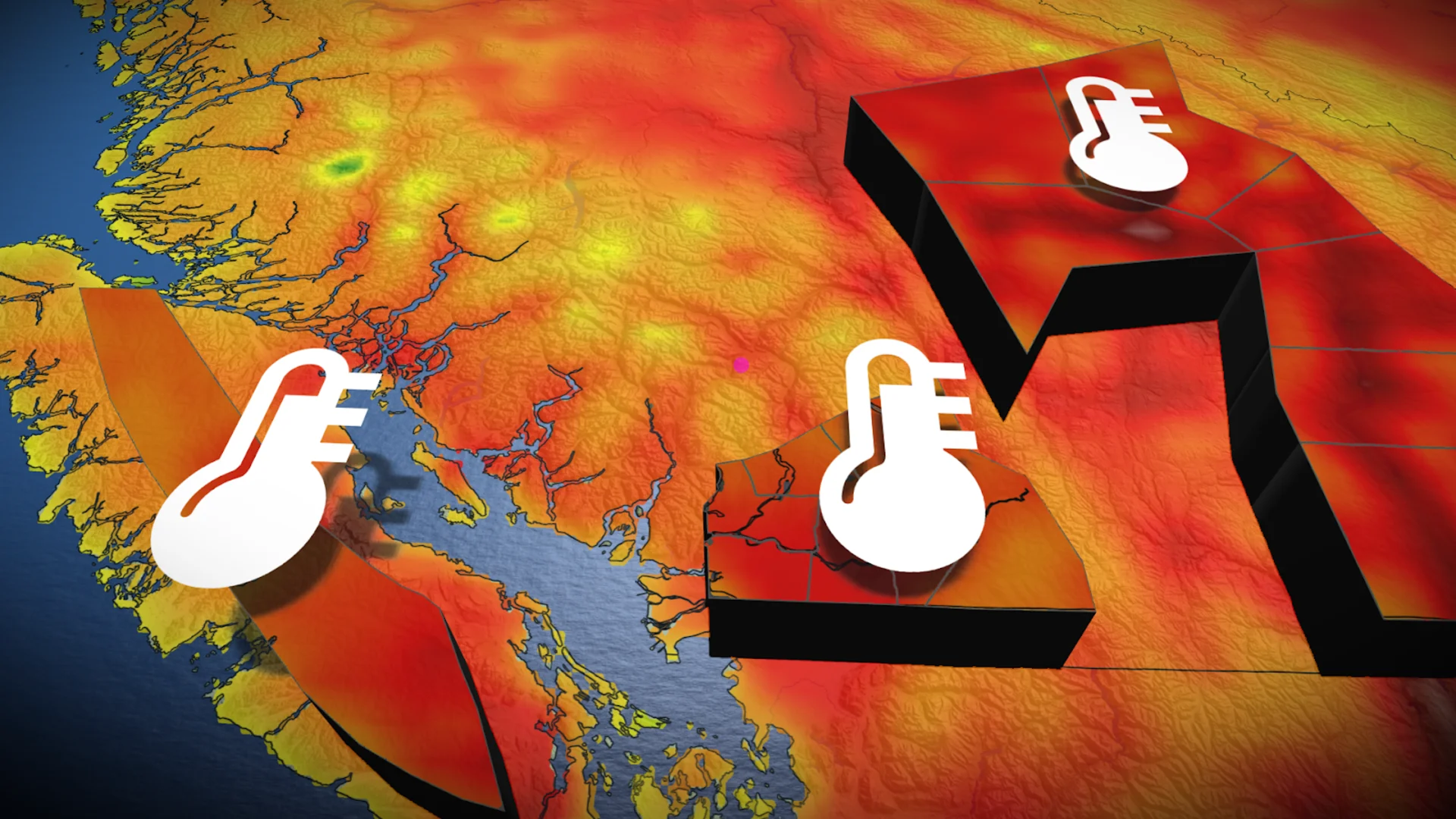
The early-season heat event continues to impact B.C., although temperatures are beginning to cool along the coast. The heat has been fuelled by a ridge of high pressure bringing dry, sunny conditions to the South Coast and Interior.
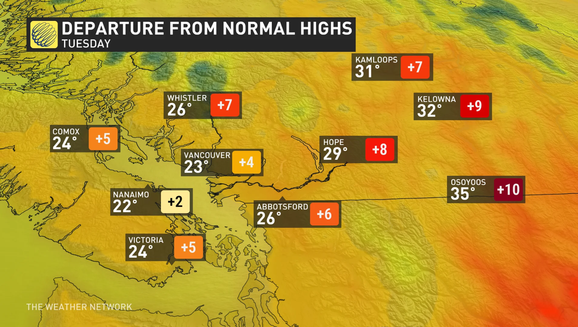
Special weather statements are in place, with daytime highs reaching the mid-to-upper 30s--more than 10°C above seasonal averages.
DON'T MISS: The Weather Network's exclusive summer 2025 forecast
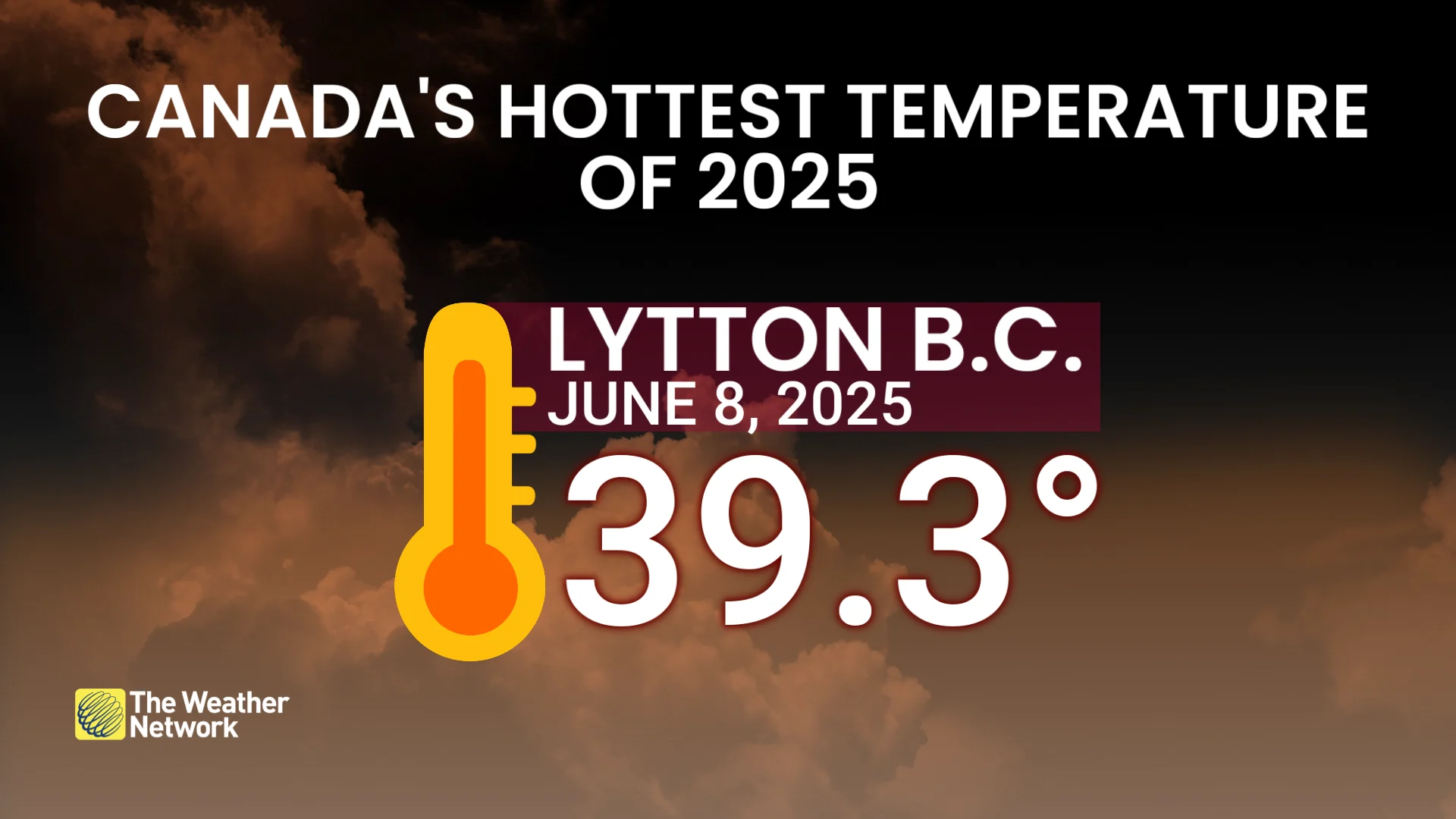
Following Lytton's scorching 39.3°C on Sunday, making way for the country's hottest temperature this year so far, more high heat was recorded on Monday.
Monday saw inland Vancouver Island record temperatures close to 30°C in Port Alberni, while Osoyoos climbed to 37.4°C--more than 10°C above normal. Castlegar climbed to 36°C, while Lytton reached 36.9°C.
On Tuesday, the ridge of high pressure begins to flatten, lowering temperatures a little bit across the province.
Be sure to stay up-to-date on any new alerts or advisories during this heat event, and take necessary precautions as temperatures remain significantly above seasonal.
Relief from the heat arrives for some on Wednesday
On Sunday, Lytton reached a scorching 39.3°C, marking the warmest temperature recorded in Canada so far this year. This surpasses the previous national high of 37.8°C recorded in Emerson, Man. on May 11.
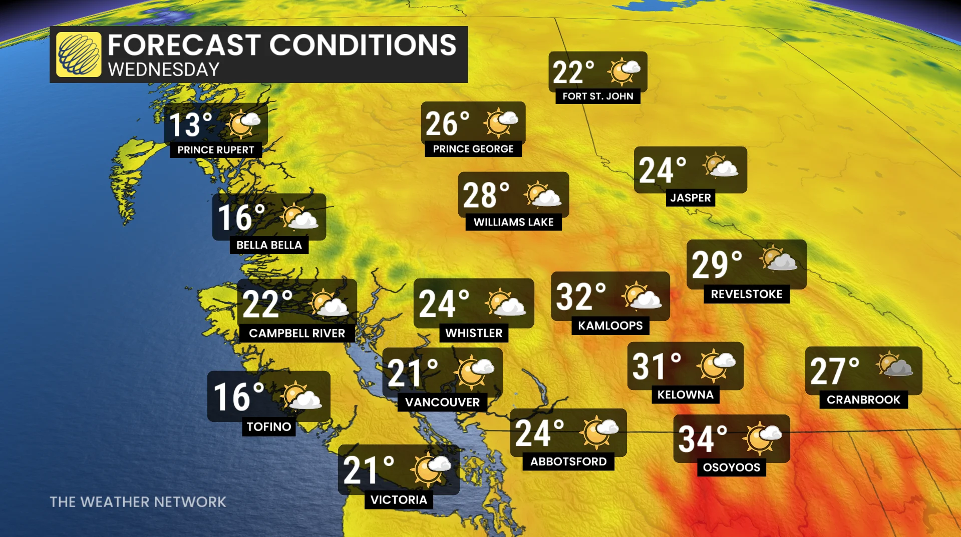
By Wednesday, temperatures are back to seasonal along coastal sections of the province--near the 20-degree mark, while the temperatures in the Interior fall into the low 30s.
RELATED: A new season, a new pattern: What's in store for Canada this June?
Thursday will see increasing clouds as an upper trough arrives, keeping things at or slightly below seasonal along the coast, also dropping temperatures within a couple of degrees of seasonal for the Interior.
Rain desperately needed
June has started on a dry note across B.C.'s South Coast, with no measurable rainfall recorded so far. The last notable precipitation occurred on May 31:
Vancouver (YVR): 10.2 mm
Victoria (YYJ): 7.8 mm
Kamloops: 5.3 mm
This marks the driest start to June since 2023, with high pressure dominating the region’s weather patterns.
DON'T MISS: Get the latest wildfire news and safety tips to help you stay safe
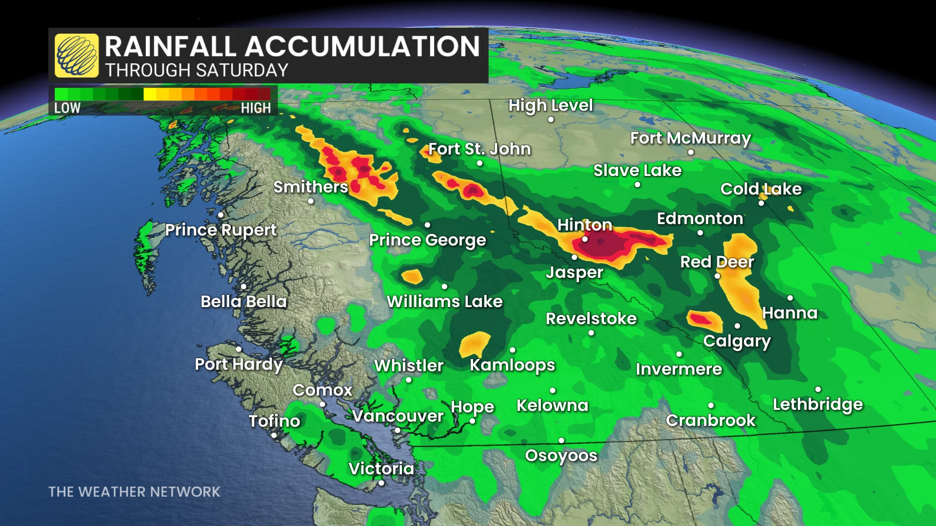
Some rainfall is forecast on Thursday, but it’ll come with a risk of scattered thunderstorms inland.
There is a chance of shower activity for the South Coast, but nothing prolonged or widespread is currently forecast over the next seven days. Higher amounts look to target the Caribou and northeastern sections of the province.
The ongoing heat and lack of rainfall have led to heightened fire risk across affected areas. Residents are urged to stay informed on local fire danger ratings and adhere to any fire restrictions or advisories in place.
Stay with The Weather Network for all the latest on conditions across B.C.