Parts of Ontario to see some heat, rain reprieve but comes with storm risk
Some rain relief on the horizon across parts of southern and eastern Ontario amid a prolonged dry August stretch
Parts of Ontario will finally see some relief to the tinder-dry conditions accompanying the current heat wave on Tuesday.
Not every area will see rain, unfortunately, as the much-needed precipitation will be hit and miss--accompanied by isolated thunderstorms. The rain will needed, especially in the areas seeing wildfires or are facing a heightened threat. Some the storms could bring torrential rainfall, so localized flooding is a concern.
DON'T MISS: Get the latest wildfire news and safety tips to help you stay safe
The heat will relent somewhat, but will still be warm on Wednesday as temperatures cool slightly with the passage of a system.
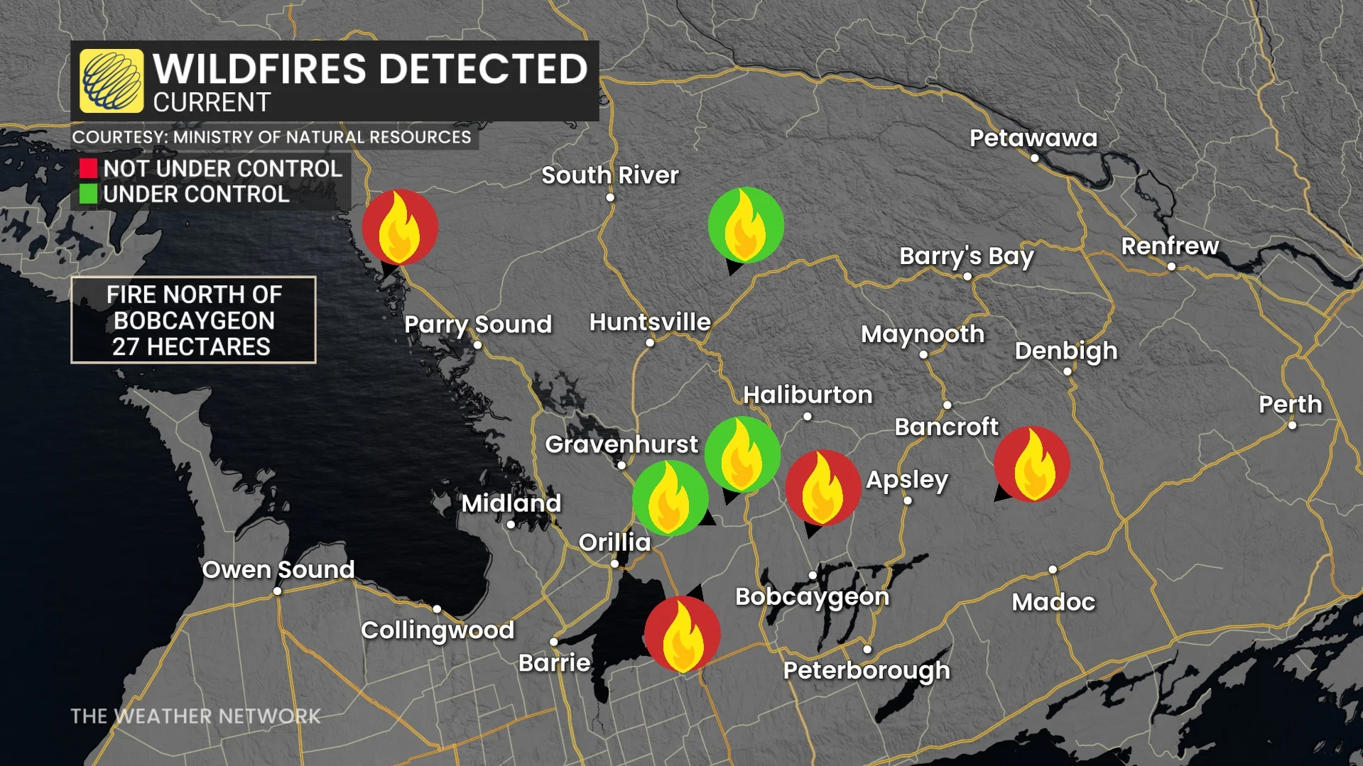
Fire danger ratings have climbed to extreme levels in several regions, with multiple fires igniting over the weekend in Kawartha Lakes and Bobcaygeon.
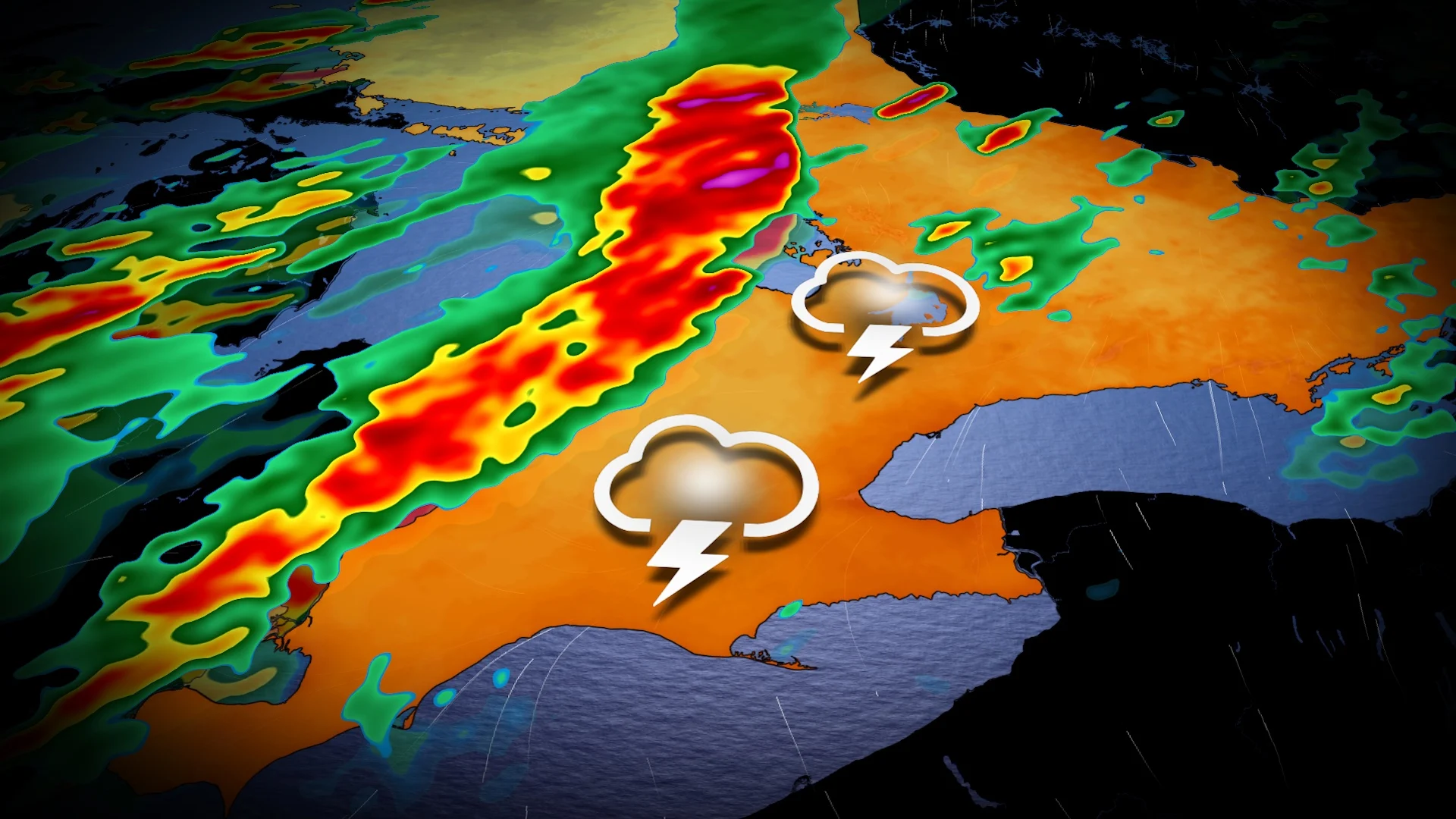
Hit-or-miss rainfall chances with storms on Tuesday
On Tuesday afternoon, weak instability will trigger isolated thunderstorms across southern Ontario, including the Greater Toronto Area (GTA), by the mid-afternoon.
Some of these storms may deliver scattered, hit-or-miss rainfall to fire-affected regions like the Kawarthas.
With high humidity and moisture in the atmosphere, torrential rainfall and localized flooding are threats under these storms, along with the chance of gusty winds.

Rainfall totals may exceed 30 mm in the heaviest downpours, while others could remain dry.
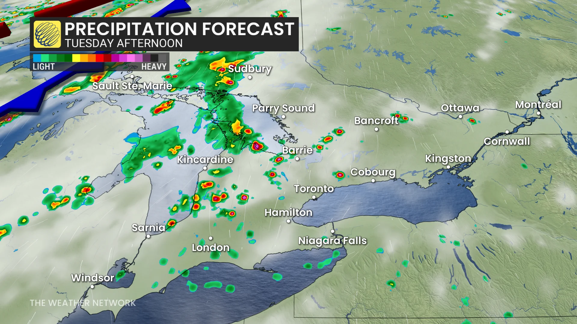
More widespread rainfall on Wednesday as temperatures 'cool' slightly
A cold front is set to arrive late Tuesday into Wednesday, delivering some much-needed rainfall.
Thunderstorm activity is forecast from Windsor to Toronto, and possibly Ottawa, Tuesday overnight into Wednesday morning.

Accumulations of 5-10+ mm are expected, enough to be the first rainfall several cities have seen all month so far.
DON'T MISS: Summer in Canada steams ahead in August, with a few hints of fall
Temperatures will be more comfortable on Wednesday, but still seasonably warm. High-20 daytime highs are forecast Thursday and Friday. However, humidity will still have most feeling in the 30s.

While rain chances remain minimal in the extended outlook, additional showers are possible this weekend.
Be sure to check back for the latest weather updates across Ontario.