
Days of wet weather hit Ontario, risk of severe thunderstorms
The first full day of fall brings a classic autumn feel to southern Ontario, featuring the potential for thunderstorms alongside much-needed rain. By Thursday, winds are expected to strengthen significantly as a weather system moves through
Warm and humid conditions will persist through Thursday across southern Ontario, but with intermittent showers and thunderstorms mixed with sunny intervals.
A slow-moving weather system is expected to trigger thunderstorms, including the potential for severe storms, on Tuesday. A more organized round of rain and thunderstorms is anticipated Wednesday evening into Wednesday night, potentially lingering into Thursday morning.
MUST SEE: Ontario's fall colours hang in the balance: Brilliant or browning?
By Friday, drier conditions are expected with increased sunshine, though there remains a slight chance of isolated showers.
It is important to remain weather-aware, and stay up-to-date on all of the latest watches and warnings as conditions change.
Severe thunderstorm risk across parts of southern Ontario Tuesday
A slow-moving weather boundary is forecast to trigger thunderstorms across southern Ontario on Tuesday, with the potential for some to become severe. Thunderstorm activity is expected to peak during the late afternoon as instability builds.
Pop-up thunderstorms could develop over Bancroft, the Greater Toronto Area (GTA), and southwestern regions in the late afternoon through the evening. Commuters may face disruptions during the evening rush hour due to heavy rain and localized flooding, especially along Highway 400 and the 401 corridor.

Severe thunderstorms are a possibility for areas including Windsor, London, and regions north of the GTA. The main risks associated with these storms include heavy downpours, strong winds, and small hail.
There remains significant uncertainty regarding the severity of these storms. Timing will be critical: if storms develop later in the evening, their intensity may be reduced.
Storm risk continues through Wednesday and Thursday, heavy rain likely
The weather remains unsettled across Ontario on Wednesday, with weak atmospheric forcing potentially triggering isolated pop-up thunderstorms. These storms are expected to be mostly non-severe and highly localized.

By Thursday, a low pressure system advancing northward from the United States is expected to bring more widespread impacts.
DON’T MISS: More dangerous than snow: Why driving in the rain can be a bigger hazard
Heavy rain and embedded thunderstorms could develop, with rainfall amounts potentially reaching 30–50 mm in spots. However, the precise location of the heaviest rainfall remains uncertain.
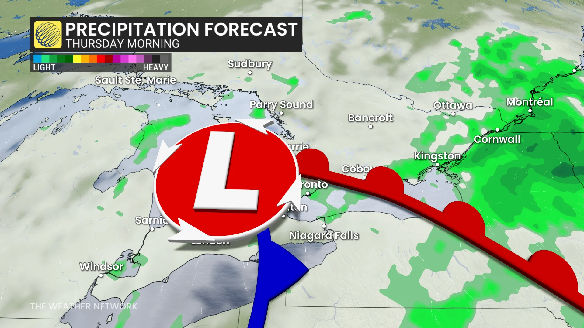
Current projections suggest the highest rainfall amounts could favour eastern Ontario, from Peterborough to Ottawa, but this depends on the system's final track.
Elevated precipitable water vapour (PWAT) levels may lead to higher rainfall rates and totals where thunderstorms occur.

Forecast models continue to show uncertainty surrounding the timing, track, and intensity of this system. There is also a possibility that the heaviest rainfall may remain stateside.
First weekend of fall will be a pleasant one
After several days of rain and thunderstorms, a pleasant fall weekend with calmer weather is anticipated. Saturday will bring mostly sunny skies and warm temperatures, ranging from the low to mid-20s, accompanied by gusty winds. Clouds will increase into the afternoon, bringing a chance of passing showers later in the day, mainly in areas near cottage country.
Sunday is expected to be mostly sunny and slightly cooler, with temperatures a few degrees above seasonal norms, despite the drop.
Visit our Complete Guide to Fall 2025 for an in depth look at the Fall Forecast, tips to plan for it and much more!
Looking ahead into next week, warmer-than-normal temperatures are expected to persist. A drier pattern is forecast to take hold, with abundant sunshine anticipated through at least midweek.
Stay with The Weather Network for all the latest on conditions across Ontario.