Plan ahead: Strong gusts return, threatening outages; snow to follow
Windy Wednesday ahead for Ontario with thunderstorm risk, wet snow, and a significant weekend cooldown
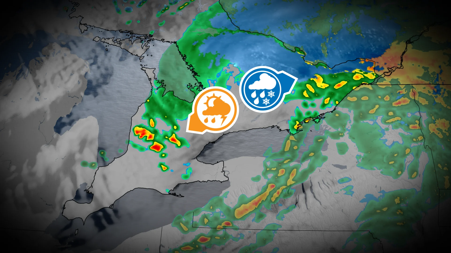
An active storm track will bring various weather conditions across Ontario this week, with multiple storm systems delivering wind, rain, and a potential wintry mix by the weekend.
Folks should prepare in advance for potential power outages and take some time to secure loose items, as wind gusts could reach over 70 km/h in some areas on Wednesday evening.
DON'T MISS: Canada’s November features extended fall, but winter lurks on the sidelines
Days of rain, wind, and even some November thunderstorms
The first system arrives Wednesday, bringing light rain to the Greater Toronto Area (GTA) through the morning and afternoon. Heavier rainfall and possible thunderstorms are expected in areas near Kitchener by late afternoon and evening, accompanied by gusty winds of 60-70+ km/h, especially along Lake Huron, Lake Ontario, and Lake Erie shorelines.

Lake-effect showers could develop overnight near Barrie, with brief, wet snowflakes possible in the Dundalk Highlands.

Ottawa will see rain Wednesday morning, becoming heavier by the afternoon, with a chance of wet snowflakes into the evening, though no accumulation is expected.

Closely watching for wintry weekend impacts
The second system, a fast-moving Prairie clipper, will impact the province on Friday.
A cold front will bring rainfall from west to east, affecting the GTA by Friday afternoon. Northeastern Ontario could see some wet snowfall as temperatures dip.
DON'T MISS: Snowy surprises can blanket Canada during a typical November
Heading into the weekend, a significant cooldown is anticipated, with highs sitting around 5-6°C on Saturday and Sunday.

We are monitoring a potential third system on Sunday that might bring wintry weather, but its track remains uncertain at this time.
Signs of lake-effect snow ahead of a mid-November warm up
Chilly weather is anticipated early next week, bringing the potential for significant lake-effect snow in traditional snowbelt regions. However, temperatures are forecast to rebound later in the week, with above-seasonal temperatures likely by mid-November and into the latter half of the month.
WATCH: Will intense lake-effect snow result from warmer Great Lakes?
Be sure to check back for the latest weather updates across Ontario.