Blizzard and flash freeze as dangerous storm moves across the Prairies
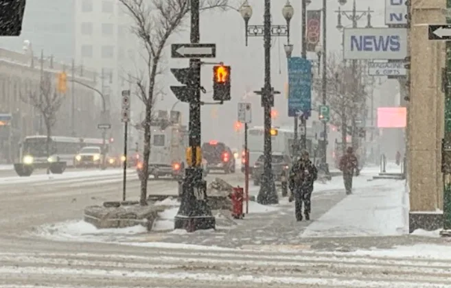
Winter storm and blizzard warnings cover parts of the Prairies as a dangerous and disruptive storm sweeps through on Wednesday and Thursday. Travel may become near impossible due to near-zero visibility
A powerful storm will move across the Prairies starting Wednesday and continuing into Thursday, bringing significant impacts. Widespread road closures are expected due to blizzard conditions, creating hazardous travel and life-threatening situations. A flash freeze could also affect parts of the region.
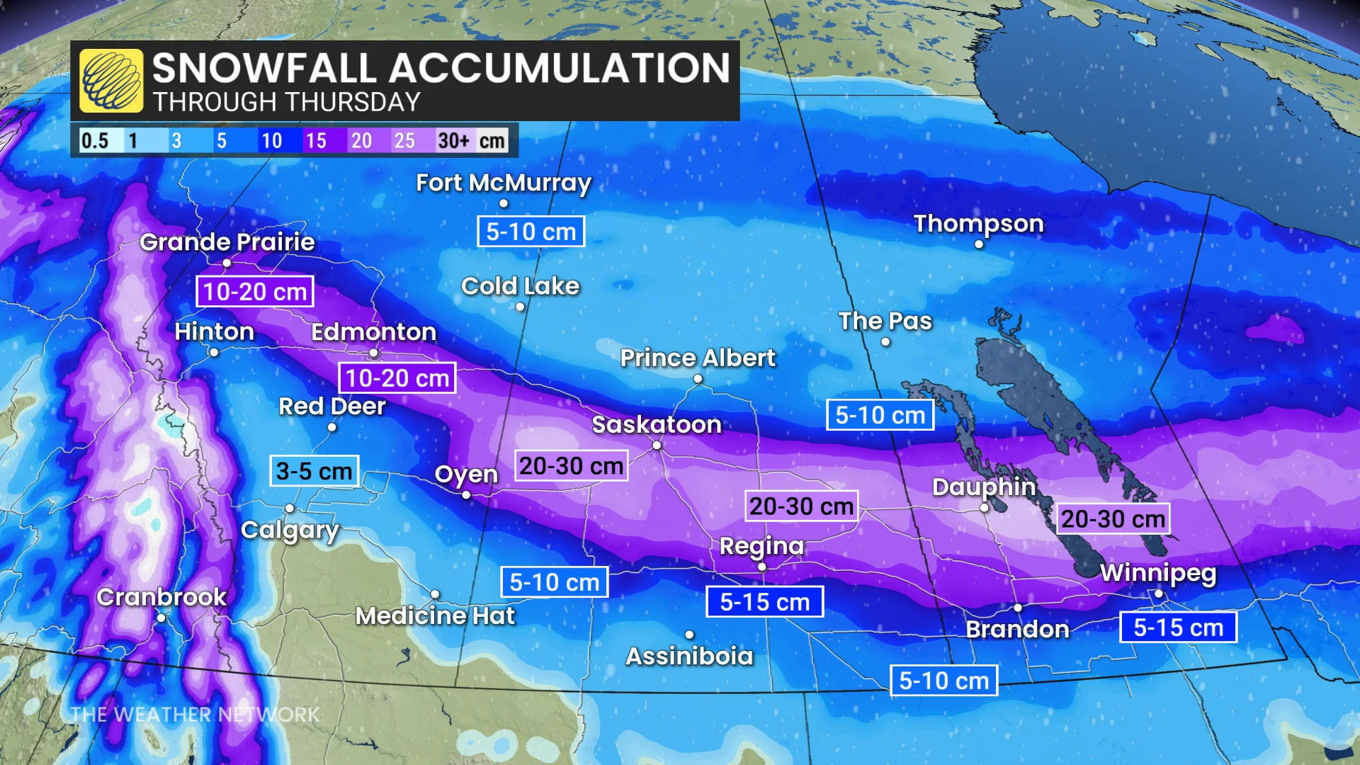
The system will intensify east of the Rockies on Wednesday, with 15-30 cm of snow forecast across central Alberta, including Edmonton, and through south-central Saskatchewan and Manitoba, impacting major cities like Regina, Brandon and Winnipeg.
DON'T MISS: What turns a snowstorm into a raging blizzard?
Blizzard conditions with whiteouts and dangerous wind chills are likely as wind gusts reach 60-80+ km/h. Drivers are urged to prepare for quickly changing and deteriorating travel conditions, and to adjust any plans accordingly.
Widespread warnings in effect for dangerous winter storm Wednesday and Thursday
A strong Alberta clipper will quickly track across the Prairies on Wednesday, affecting all three provinces with snow, wind, and potential blizzard conditions.

Between 15–30 cm of snow is possible in central Alberta and southern Saskatchewan, including Edmonton, Saskatoon, Regina and major corridors like the Yellowhead Highway. Stretches of highway are not recommended for travel from the Alberta border to central Saskatchewan. As of 8:30 a.m. on Wednesday, a significant portion of the Trans-Canada Highway between Swift Current and Caronport was fully closed.
Snow timing:
Snow began in central Alberta, including Edmonton, early Wednesday, and is expected to taper off by evening. Winds gusting 40–60 km/h will reduce visibility and create slick roads, impacting the morning commute.
Snow will intensify over southern Saskatchewan into the afternoon with peak snowfall rates of 2–3 cm per hour.
Wind gusts of 40–60 km/h will cause blowing snow, with heavier impacts along major highways by evening.
Southern Manitoba will see snow by Wednesday afternoon, becoming heavy by evening. Winds of 60-80 km/h are expected, creating whiteouts along major routes.
Highway 1 from Brandon to Winnipeg could see 10-20 cm of snow, with up to 30 cm for the Interlake region.
Though snow tapers by Thursday morning, wind gusts up to 70 km/h will persist, resulting in blowing snow and difficult travel during the morning commute.

Consider postponing travel with truck-tipping winds in southern Alberta forecast, and dangerous winter driving for central Alberta and southern Saskatchewan.
Winter storm watches, wind, blizzard warnings are in effect. Travel could become dangerous, with blizzard conditions likely in southern Saskatchewan from Wednesday evening to early Thursday.
SEE ALSO: ECCC launches new colour-coded Canadian weather alerts
A second clipper arrives in Manitoba on Friday, bringing less moisture but still delivering 5-10 cm of snow along Highway 1 (Brandon to Winnipeg) and 10-15 cm in the Interlake region.
WATCH: Heavy snow and plummeting temperatures for Manitoba and northern Ontario
Flash freeze threat with wild temperature swing
Southern parts of the Prairies will experience dramatic temperature swings this week. On Wednesday, temperatures will rise well above freezing, with some areas reaching double digits, while regions north of the Arctic boundary will stay in the minus teens and 20s. A flash freeze is expected Wednesday night as Arctic air pushes south again, and temperatures are set to drop sharply by 10-20°C in some areas.
DON’T MISS: La Niña to continue into 2026, leaving thumbprint on winter weather
Another brief warm-up is forecast for late Thursday, followed by a return to colder conditions. Areas near the U.S. border will continue to see highly variable temperatures into next week.
WATCH: Extreme winds flip tractor-trailers and ignite wildfire in Alberta
Stay with The Weather Network for the latest on conditions across the Prairies.