15-30+cm: Major winter storm will move east on the Prairies with more snow
A sprawling winter storm that has led to multiple collisions and road closures in parts of Alberta will continue to batter parts of Saskatchewan and Manitoba with similar results into Thursday
A powerful winter storm moving across the Prairies will continue eastward on Thursday, with Manitoba lined up to see worsening conditions, after bringing significant travel and flight impacts to parts of Alberta and Saskatchewan on Wednesday.
The storm caused travelling nightmares across parts of Alberta and Saskatchewan, with a major pileup reported in the former, prompting a closure of Highway 2 between Calgary and Airdrie.
RELATED: Calgary airport forced to pause flight operations as major storm hits Alberta
Through Thursday, the system is forecast to bring 15-35 cm of snow to southern Saskatchewan and Manitoba, impacting major cities like Regina, Brandon and Winnipeg. All major routes will be impacted with near zero visibility, so travel is not recommended.
Blizzard conditions with whiteouts and dangerous wind chills are likely as wind gusts reach 60-80+ km/h.
Conditions improve in Saskatchewan on Thursday morning
On Wednesday, in and south of Calgary, Alta, multiple collisions occurred, prompting a closure of Highway 2 between Calgary and Airdrie. Also, flights in and out of Calgary International Airport were put on hold temporarily during the severe blizzard conditions. The flights have since resumed.
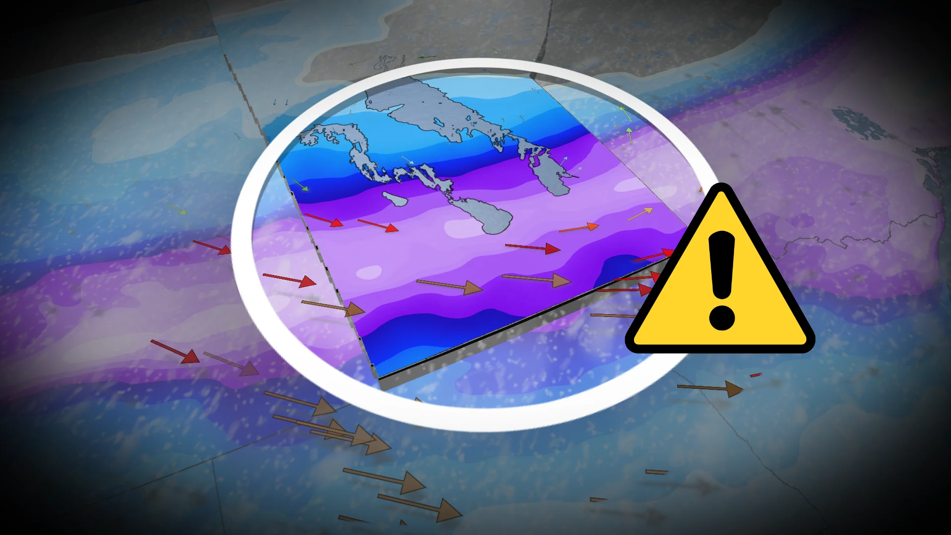
Meanwhile, the strong Alberta clipper continues to move through Saskatchewan and Manitoba, bringing low visibility and significant travel disruptions.
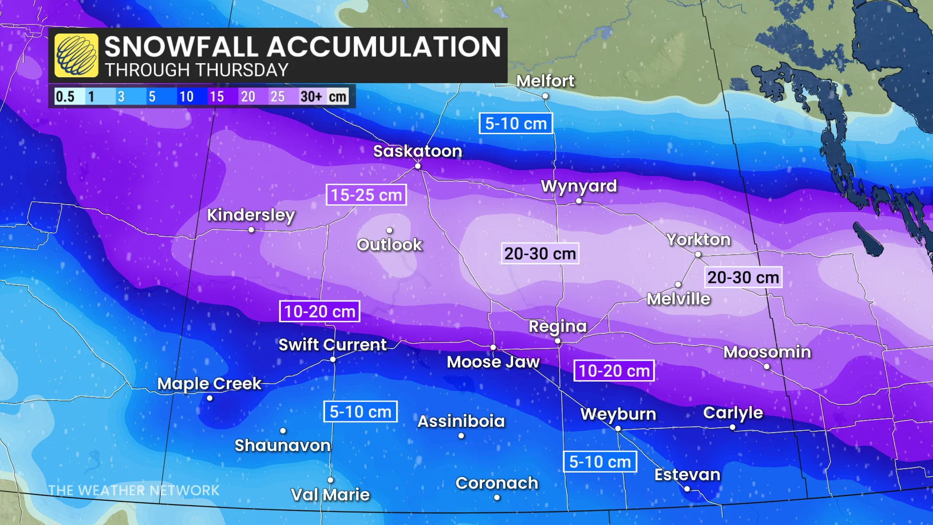
Between 20–30 cm of snow is possible in southern Saskatchewan, between Saskatoon and Regina, and on major corridors like the Yellowhead Highway. Stretches of highway are not recommended for travel.
Conditions will improve Thursday morning in Saskatchewan.
WATCH: Blizzard warnings continue for Manitoba as heavy snow falls
Manitoba to see blizzard conditions through Thursday morning
15-35 cm of snow is forecast in southern Manitoba, including Brandon, Winnipeg, Dauphin and Gimli. Conditions worsened late Wednesday, and persist through Thursday morning, travel is not recommended during this time.

Expect strong, 60-80 km/h winds, and when combined with high snowfall rates, will lead to impossible travel as visibility will be near zero. In fact, blizzard conditions with zero visibility and whiteouts are likely across all major routes.
Southern Manitoba, including Winnipeg, is in a blizzard warning. Travel will be dangerous and likely impossible due to near-zero visibility. There may be a significant impact on rush-hour traffic. Avoid all travel if possible.

A second clipper reaches Manitoba, with less moisture, but will bring another 5-10 cm for Highway 1 (Brandon to Winnipeg) and 10-15 cm for the Interlake region.
Very cold temperatures will follow this storm as Arctic air wraps in behind it.
SEE ALSO: ECCC launches new colour-coded Canadian weather alerts
WATCH: Whiteout conditions hit southern Saskatchewan
Stay with The Weather Network for the latest on conditions across the Prairies.