Snow and ice to disrupt Boxing Day travel in southern Ontario
Snow, ice pellets and freezing rain are anticipated Friday as a powerful storm moves through the region, creating possible travel delays and isolated power outages.
Flexible plans are in the works for Boxing Day on Friday, as an impactful wintry mix is expected to move into southern Ontario.
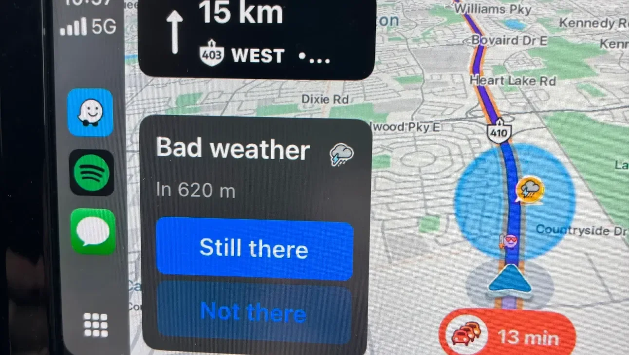
A messy temperature divide will allow snow, ice pellets and prolonged freezing rain to accumulate. Travel issues are possible and residents are urged to keep an eye on highway conditions before leaving.
DON’T MISS: Freezing rain and ice pellets are dangerous winter hazards
Wintry mix threatens snow and ice in southern Ontario
A large, moisture-laden low-pressure system is headed into the Great Lakes region on Friday, causing a surge of precipitation across Ontario.
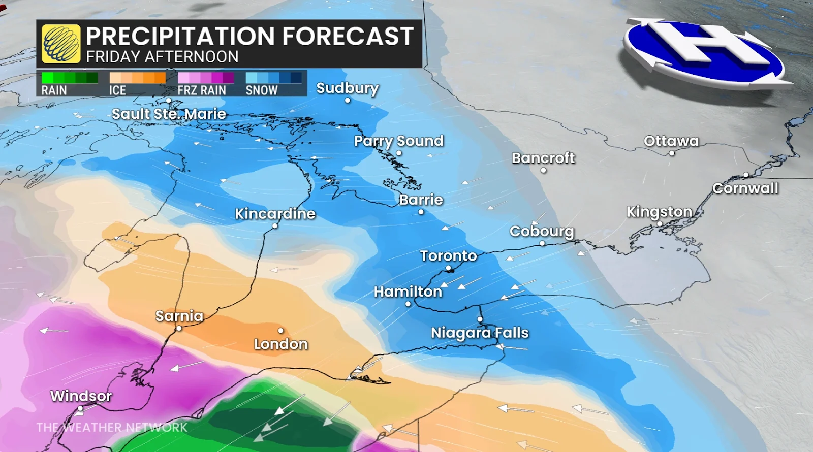
Northern Ontario is anticipated to experience an all-snow event, with accumulations ranging from 5 to 20 cm, heaviest between Thunder Bay and Wawa. Snow is expected to remain the most common precipitation type in the north.
Farther south, a complex system will form as mild, moist air moves aloft and collides with a cold surface high. Cold air near the ground will stay dense and trapped, while a layer of above-zero air will rise several kilometres overhead.
The thickness and location of that warm layer will determine whether communities receive snow, ice pellets, or freezing rain.
Even though temperatures at ground level will be at or below freezing, the warm layer aloft will transform the system into an icy mix in many places.
Temperature differences as small as 0.5°C can alter the outcome, so exact precipitation types and totals remain uncertain.

Snow: Residents in northern Ontario, cottage country and parts of eastern Ontario can expect 5 to 20 cm of snow throughout the system.
Snow could fall late Friday afternoon in Niagara, Toronto, Oshawa and Barrie, with 5 to 15 cm expected. A period of ice pellets may mix in during the evening, limiting snowfall totals as the storm moves out Saturday morning.

RELATED: A winter storm’s track can make or break your forecast
Ice pellets: Ice pellets are most likely to accumulate north of a line connecting Windsor, London, Hamilton, Kitchener and Goderich. Ice pellets or freezing rain could fall in areas such as London and Simcoe County, with 5 to 15 mm of ice accumulating in some places.
They form when snowflakes partly melt and then refreeze before hitting the ground. Those living there should remove accumulations as soon as it is safe to do so, as pellets may quickly turn into a solid layer of ice.
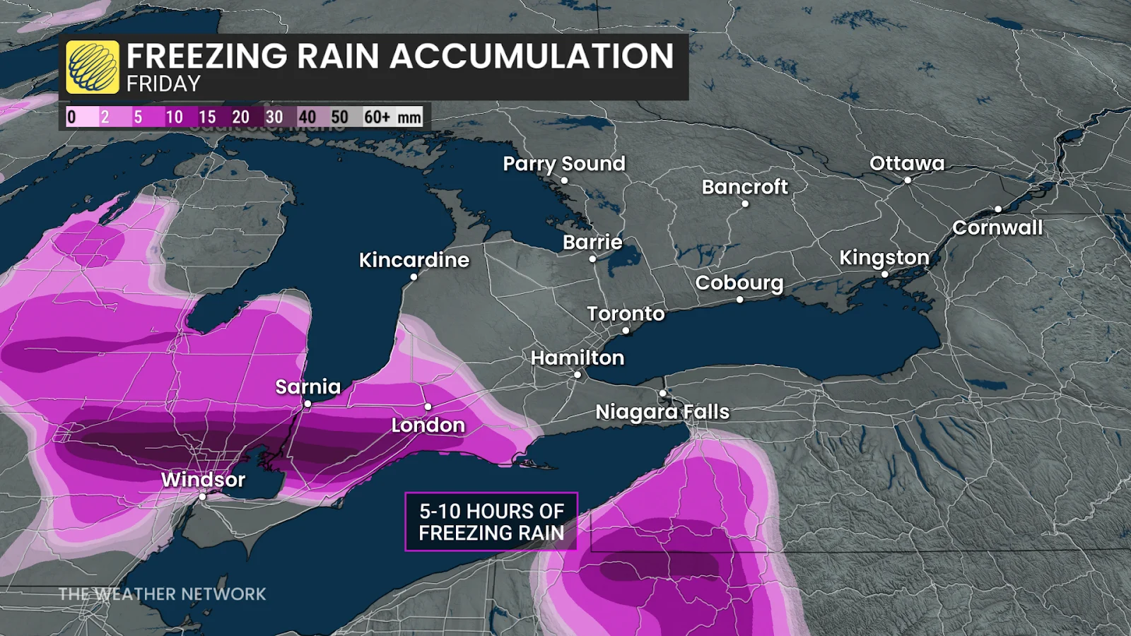
Freezing rain: Periods of freezing rain and drizzle are expected around Windsor, with the greatest risk extending into Chatham. Prolonged freezing rain over several hours may cause slick roads and sidewalks, as well as isolated power outages due to ice buildup.
Even a thin layer of ice can cause hazardous driving conditions, especially on untreated roads and bridges.
Stay with The Weather Network for all the latest on conditions across Ontario.