
Dangerous nocturnal storms likely in Manitoba, northwest Ontario
Stay weather aware as you wind down and head to bed on Friday night
A volatile setup for severe thunderstorms will develop across portions of southern Manitoba and northwestern Ontario on Friday evening and continue through the overnight hours.
Widespread storm activity is expected late Friday night into early Saturday morning, including the risk for one or two tornadoes.
Nocturnal thunderstorms are particularly dangerous because folks tend to tune out the weather as they wind down for the evening and head to bed. It’s advisable to keep your phone nearby through the overnight hours as warnings are likely.
DON'T MISS: Tornado warning safety: Here’s what you should do
Severe storms expected Friday night into Saturday morning
All the ingredients needed for severe thunderstorms are present and abundant across southern Manitoba and northwestern Ontario on Friday night.
A low-pressure system is moving into the region from the northern U.S. Plains. High thunderstorm energy that arrived during the day will linger after dark. Strong wind shear will help organize thunderstorms and push them beyond severe limits.
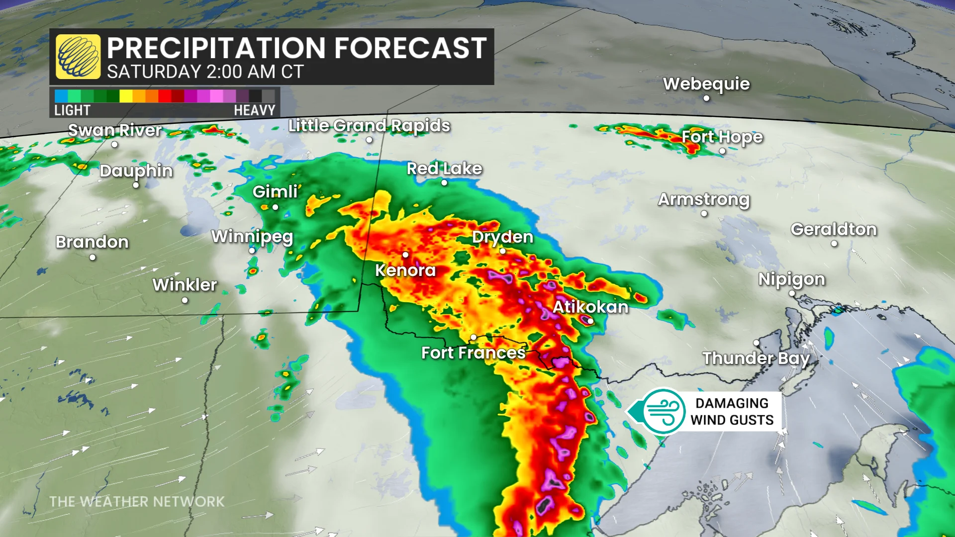
Given these very favourable conditions, a large line of severe thunderstorms may form stateside by 8:00 p.m. Friday and continue after dark. This line is forecast to track along the international border overnight, moving toward Thunder Bay by early Saturday morning.
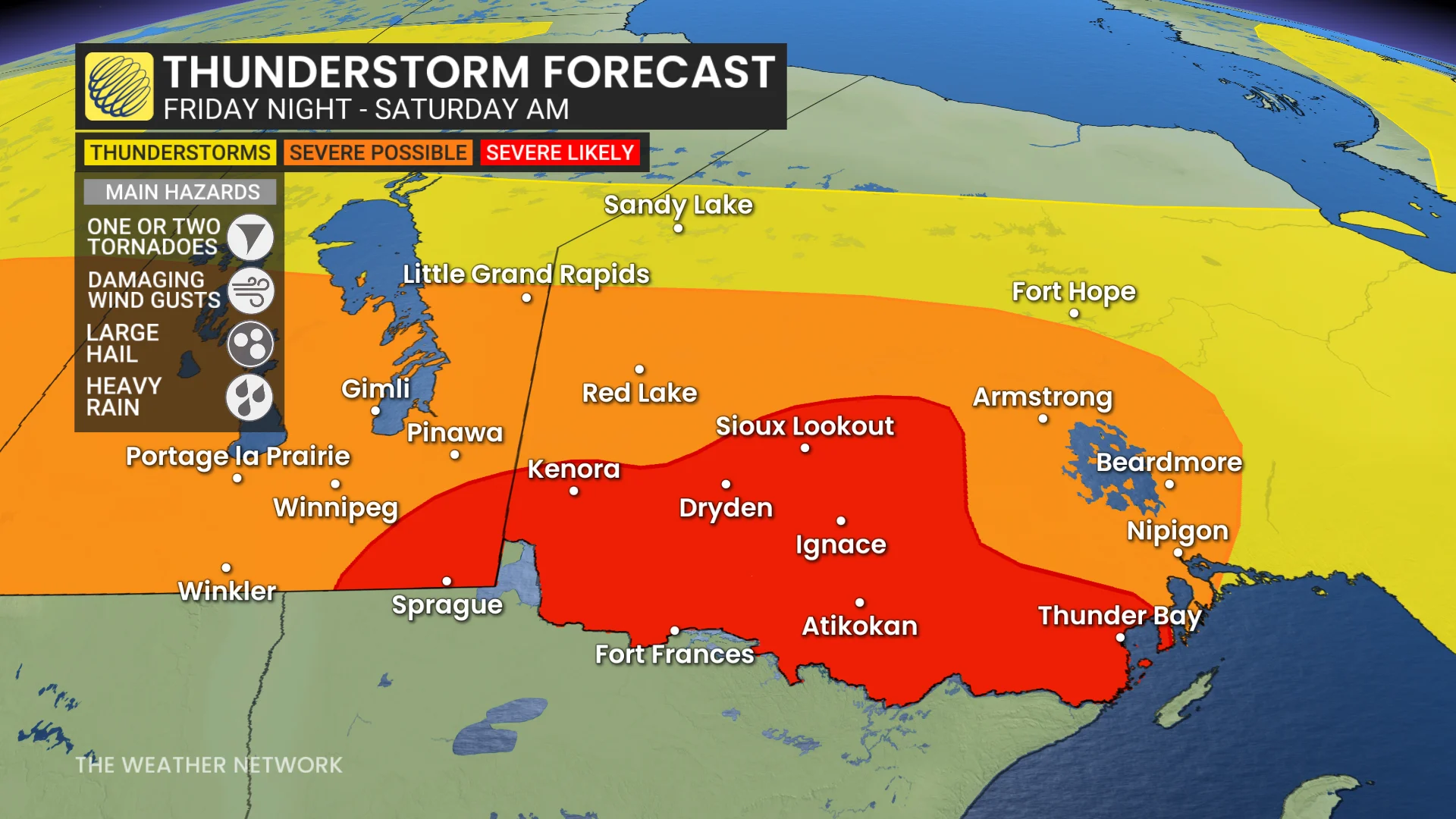
Communities within the highest risk zone include Thunder Bay, Fort Frances, Dryden, Kenora, Ignace, and Atikokan.
Damaging winds greater than 100 km/h are possible, along with embedded rotation that could produce one or two tornadoes. Large hail, heavy downpours, and frequent lightning are also expected.
Stay with The Weather Network for all the latest on conditions across the region.