Damaging storms threaten to close the week in Sask., Man., NW Ont.
An unstable environment across the Prairies and northwestern Ontario will bring another chance for severe thunderstorms on Thursday and Friday.
A multi-day threat of severe thunderstorms will continue for parts of Saskatchewan, Manitoba and northwestern Ontario on Thursday and Friday.
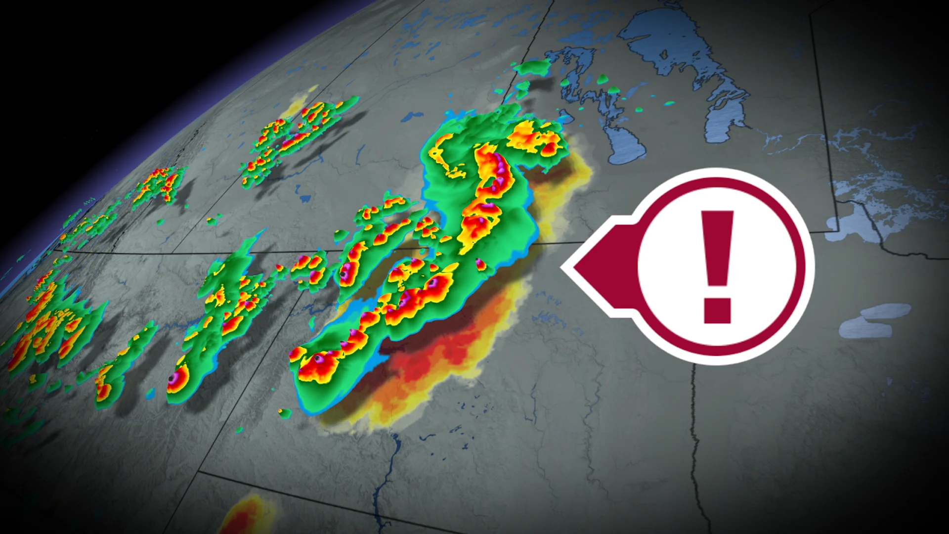
The setup, which yielded tornado warnings Wednesday evening in southern Manitoba and northwestern Ontario, includes several moving parts. A slow-moving low and moisture from the U.S. will create a volatile environment through Friday.
SEE ALSO: Heat and storms linger as August starts Canada's slide out of summer
Large hail, heavy downpours and damaging wind gusts are hazards to look out for on Thursday and Friday. We could also see some severe supercell storms develop, raising the risk of one or two tornadoes.
Similar storm conditions are developing in Alberta, where a stalled system is causing several rounds of severe weather this week.
Thursday: Supercell threat along the international border
By Thursday, the storm threat will have shifted west into parts of Saskatchewan and southern Manitoba.
An active boundary that runs across the region could trigger severe storms north and west of Saskatoon, Sask. Forecasters are also keeping an eye on the Canada-US border for a possible cluster of severe supercell storms Thursday afternoon--but that will depend on how close the boundary is to the border.
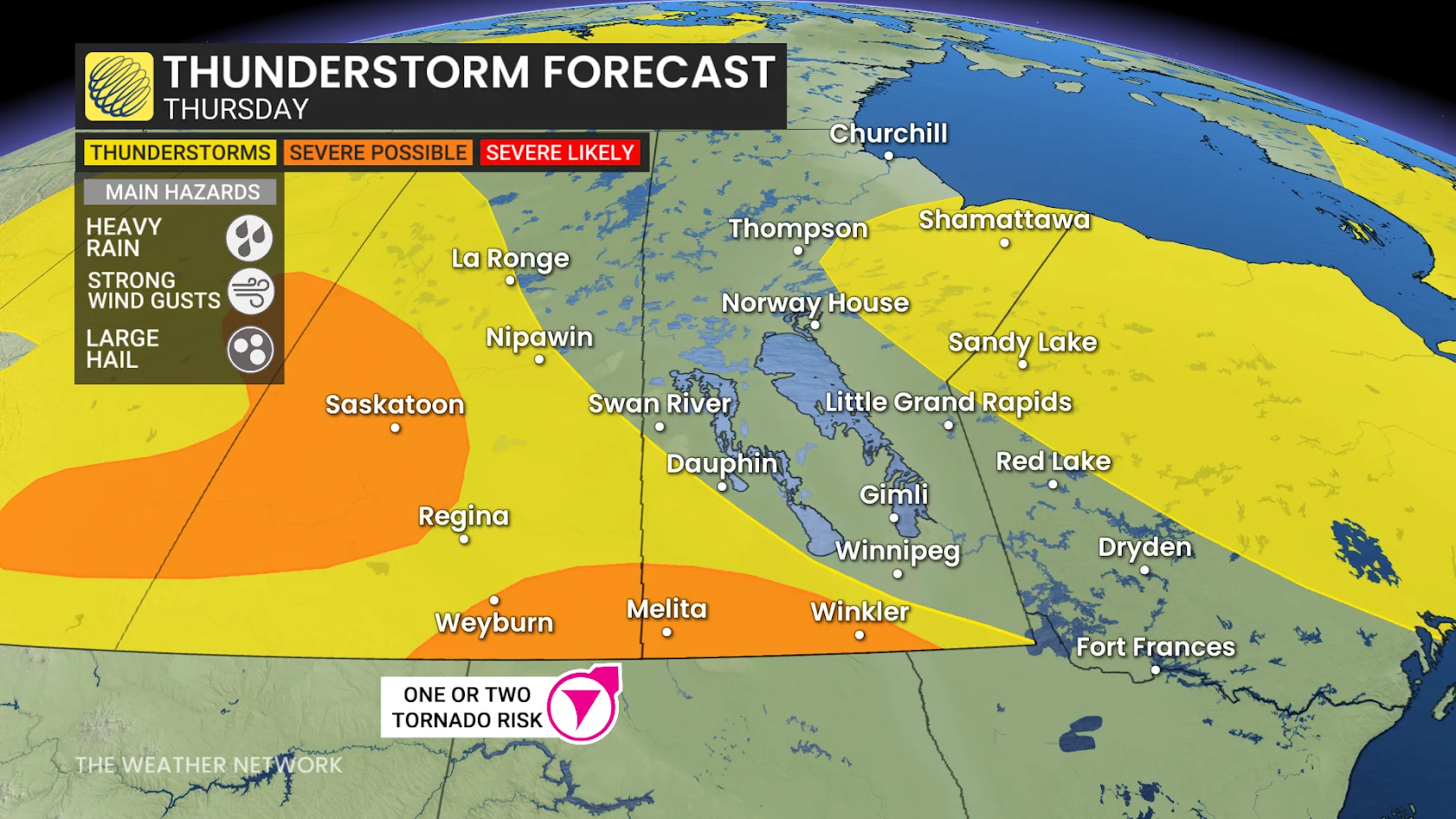
Any supercell storms that develop could bring 2-3 cm hail, 90+ km/h winds, and a tornado or two. It is possible, though, however, for the storms to remain stateside.
DON'T MISS: Are your tomatoes struggling to ripen? Blame the heat!
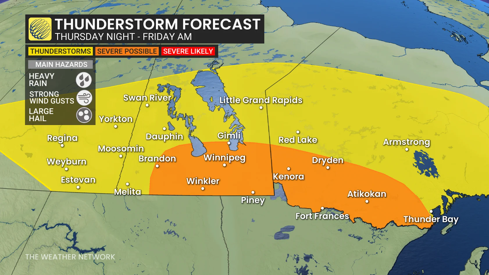
Into the evening hours, the storms are forecast to organize into a mesoscale convective system (MCS)--a long-living line of storms that can produce damaging winds.

The tornado threat will continue in southern Saskatchewan and Manitoba Thursday evening with these organized storms.
The line of thunderstorms are expected to move along the Manitoba/US border and into northwestern Ontario. Municipalities, including Winnipeg, will be at risk of damaging winds up to 100 km/h.
Friday: Storm threat expands into northwestern Ontario
Forecasters are looking at a high-impact environment for severe weather in northwestern Ontario on Friday morning--although how high-impact and severe will be determined by the speed of the MCS travelling across the eastern Prairies. If the cluster of storms are moving slowly, we will see less severe weather as the energy in the atmosphere is used up. On the other hand, if the storms are moving fast, we'll see more energy present in the atmosphere to sustain their severity.

Later Friday, a moisture-rich airmass moving in from the US northern Plains, as well as a high amount of thunderstorm energy in the atmosphere, will help to fuel a new environment capable of favouring strong supercell storms. With this, forecasters are also looking at a possible tornado threat.
RELATED: Canada's tornado count far behind schedule this year
Storms are expected to develop in North Dakota and move northward through the evening hours. The storms may reach Manitoba closer to dark, which would somewhat limit their severity. Although if the storms move in any earlier, we could see an increase in severity.
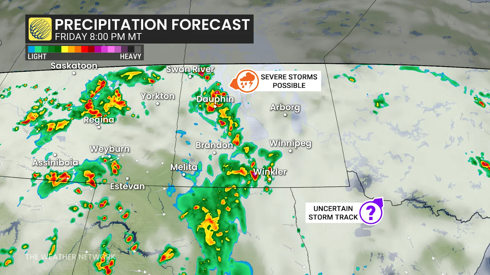
Meanwhile, in southern Saskatchewan, a dying low will trigger another round of thunderstorms throughout the day Friday, with some reaching severe criteria.
Stay with The Weather Network for all the latest on conditions across the Prairies and northwestern Ontario.