Snow lovers in B.C. will get ample opportunities of winter weather

An incoming blast of snowfall is phenomenal news for ski resorts along the B.C. South Coast, which looks to enter one of the snowiest periods of the entire season
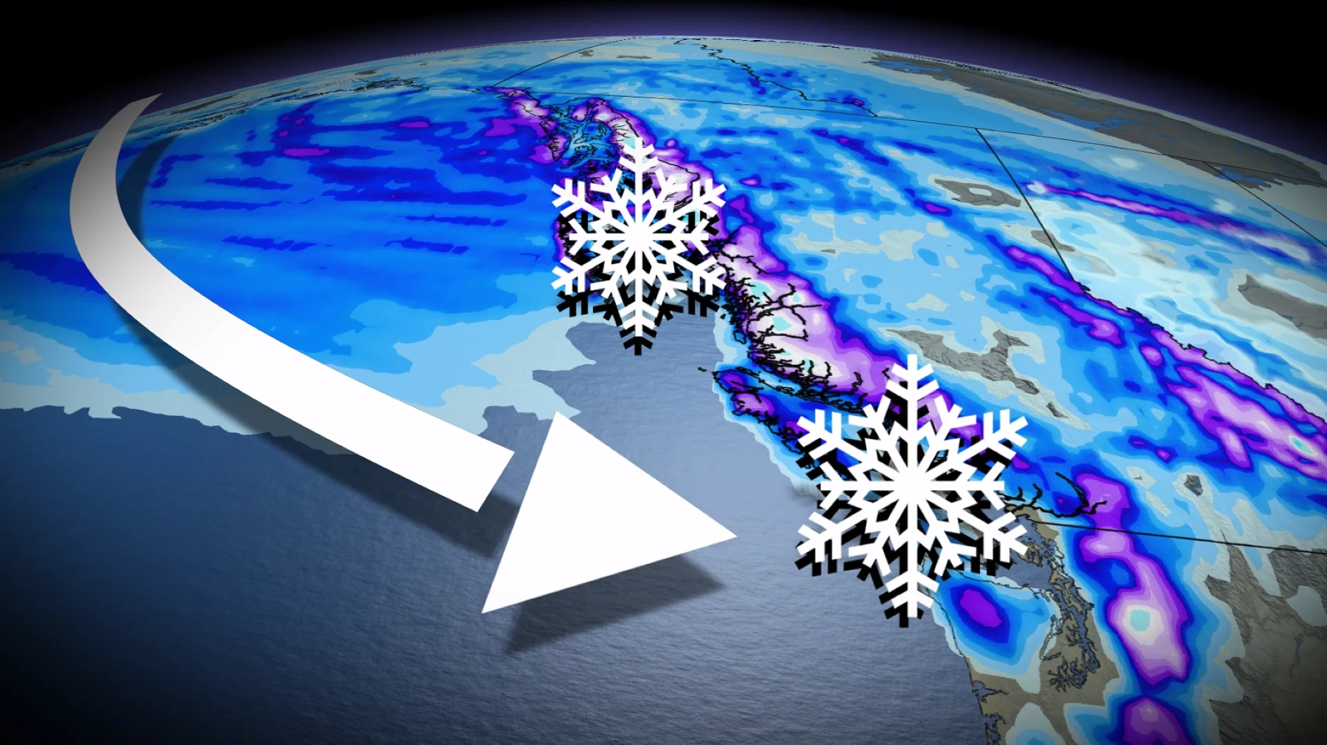
A rare pattern that will bring widespread snowfall across the Gulf of Alaska over the Pacific Ocean will also threaten lower-elevation snow along the British Columbia coast this week.
It’s now been over a year since Vancouver airport (YVR) recorded accumulating snowfall, dating back to Feb. 8, 2025.
RELATED: Five avalanche deaths in B.C. this season. Will we see more in March?
An anomalously cold air mass over eastern Siberia and Alaska has begun to migrate across the Gulf of Alaska, and this cold air will continue to interact with Pacific moisture over the week ahead.

It is phenomenal news for ski resorts along the South Coast, which look to enter one of the snowiest periods of the entire season!
Monday
Snow-showers are forecast from Haida Gwaii and Prince Rupert, towards southern locations like northern Vancouver Island, as this cool, unstable air migrates towards the coast, producing wet snow for some.
Locally, 5-15 cm of snowfall is possible, with higher amounts tending to favour regions above 200 metres in elevation.

Even some locations in Greater Victoria, including the West Shore and the Malahat, have the potential for a few cm of snowfall through Monday night.
Tuesday and Wednesday
This is where things get more interesting for the South Coast.

The same weak low continues to swirl northwest of Haida Gwaii, but temperatures aloft continue to gradually cool just a few hundred metres above sea level.
Higher elevations of Metro Vancouver can expect 5-10 cm of snowfall above 200 metres in elevation, including inland sections of Vancouver Island (Highway 4), and the Sunshine Coast. Regions in the Fraser Valley can also expect accumulating snowfall.
Computer models also highlight Tofino as receiving snowfall as well, which is a rarity at any time of year, and particularly noteworthy in March.

Snowfall amounts will be highly localized, with some locations receiving little-to-no snowfall, but heavier convective bursts of snow could lead to accumulations close to 10 cm.
By Wednesday, temperatures warm aloft across the South Coast, nudging the freezing level back to around 600 metres above sea level.

Late week
More chilly below seasonal air makes its way across the South Coast by Thursday night into Friday, meaning another brush of lower-elevation snow will be once again possible.
Mountain totals equal massive
Over the course of the week, forecasting snowfall across Vancouver Island and the Coast Mountains will be more than 100 cm in some cases.

Avalanche risk will fluctuate, but considerable to high will be the norm over the next week.
Stay tuned to The Weather Network for the latest forecast updates for B.C.